Browse / United States / Tennessee / Luttrell
Luttrell
Tennesseetown

Luttrell
Total population
1,158
Median home value
$154,000
Bachelor's+
Median income
$41,742
Demographic figures from US Census Bureau · ACS 5-year estimates. Overview below cites Wikipedia and may reference a different year.
City facts
Facts from Wikidata (CC0).
Overview
Luttrell is a city in Union County, Tennessee, United States. The population was 1,074 at the 2010 census, up from 915 at the 2000 census. It is included in the Knoxville, Tennessee Metropolitan Statistical Area.
Read more on WikipediaHistory & geography
History
Originally known as Cedar Ford, Luttrell was renamed to its current name in 1890. In the 19th century, Cedar Ford was the site of a lime kiln and a marble quarry, supporting a population of 808 as of the 1870 Census. In 1887, the Powell Valley Railroad (now part of the Norfolk Southern Railway) was built through the community, making it a shipping center for the surrounding area. Luttrell became an incorporated municipality in 1925.
Geography
According to the United States Census Bureau, the city has a total area of , consisting entirely of land. The city is situated in a valley between Copper ridge to the north and Clinch Mountain to the south. Both ridges are characteristic of the Appalachian Ridge-and-Valley range. Luttrell is drained by Flat Creek, a tributary of the Holston River. Plainview borders Luttrell to the southwest. Tennessee State Route 131 and Tennessee State Route 61 intersect in Luttrell. SR 131 connects the city with Plainview to the southwest, and SR 61 connects the city with Maynardville to the north and Blaine to the south.
Excerpted from the corresponding Wikipedia article (CC BY-SA).
Demographics & economy
Race & ethnicity
Source: US Census Bureau — American Community Survey, 5-year estimates.
Geography
Coordinates & boundaries from the US Census TIGER/Line shapefiles.
Climate
Air quality
Industrial & pollution facilities
Natural hazard risk
Health (adults)
Age-adjusted prevalence estimates from CDC PLACES (latest release).
Walkability
Amenities nearby
Wildlife & biodiversity
Schools
Largest nearby schools
- Union County High SchoolHigh · Maynardville · 819 students · 14.4:1 ratio
- H Maynard Middle SchoolMiddle · Maynardville · 656 students · 15.6:1 ratio
- Paulette Elementary SchoolElementary · Maynardville · 374 students · 13.9:1 ratio
- Maynardville ElementaryElementary · Maynardville · 363 students · 13:1 ratio
- Luttrell ElementaryElementary · Luttrell · 295 students · 12.8:1 ratio
- Big Ridge ElementaryElementary · Maynardville · 176 students · 12.6:1 ratio
- Sharps Chapel ElementaryElementary · Sharps Chapel · 125 students · 12.5:1 ratio
- Union County Alternative CenterHigh · Maynardville · 24 students · 6:1 ratio
Public K–12 schools within ~10 mi from Urban Institute Education Data Portal (NCES Common Core of Data, 2022).
Earthquake history
Photos
Sights & places nearby
Notable people from here


People born within ~10 km, from Wikidata (CC0). Click any name for their Wikipedia article.
Nearby places in Tennessee
- Maynardville4.1 mi away · pop. 2,528
- Mascot9.8 mi away · pop. 3,277
- Strawberry Plains11.6 mi away
- John Sevier12.6 mi away
- Rutledge12.8 mi away
- Halls13.6 mi away · pop. 10,272
- New Tazewell17.7 mi away · pop. 2,799
- Powell19.8 mi away · pop. 13,739
- Tazewell20.2 mi away
- Dandridge21.7 mi away
- Seymour22.6 mi away
- Rocky Top22.7 mi away
Geography & sun
Elevation, sunrise/sunset and daylight from Open-Meteo. Solar climatology from NASA POWER.
Nearby airports
Public attention
Pageview totals from the Wikimedia Pageviews API.
Books about Luttrell


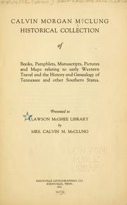

Search results from Open Library.
Recent natural events nearby
Ground air-quality sensors
Recently spotted species
Nearest stream gauge
Events
Gallery
Sources
- • Wikipedia
- • US Census Bureau (ACS 5-year estimates)
- • Wikidata
- • NCES via Urban Institute Education Data Portal
- • CDC PLACES
- • Open-Meteo / sunrise-sunset.org
- • Wikipedia Pageviews API
- • Open Library