Browse / Türkiye / Tokat / Turhal
Turhal
Tokattown

Turhal
Total population
79,916
Demographic figures from TurkStat. Overview below cites Wikipedia and may reference a different year.
City facts
Facts from Wikidata (CC0).
Overview
Turhal is a district in Tokat Province in the Black Sea region of Turkey. It is the seat of Turhal District. Its population is 62,030 (2022). It is 48 km to the west of Tokat. Turhal is situated on a fertile plain fragmented by the Yeşil Irmak river. It has an elevation of approximately 530 m. The city is best known for its sugar beet processing plant established in 1934 as an important enterprise of the young Turkish Republic.
Read more on WikipediaHistory & geography
History
The first nucleus of Turhal appeared as an important fortress or fortification named Talaura (Τάλαυρα in Ancient greek) on the way between today's Amasya and Tokat provinces. It is deduced from the tablets found in the region that Turhal had been inhabited as early as the third millennium BC and had relations as far as the Mesopotamian cultures such as Sumerians who had already invented an effective alphabet. The Persian invasion in Anatolia during the 6th century BC made this region an important center influenced by the cult of Zoroastrianism. The famous geographer of the antiquity, Strabo has, on various occasions, drawn up different accounts on the region describing Turhal as a fortress in the north of another ancient city named Gayyura. In the 3rd century BC, the region was occupied by the contingents of Alexander the Great's Macedonian army, but many insurrections had also taken place in this era as the Macedonian occupiers couldn't build up a total control on the region. After the collapse of Alexander's Empire (as Alexander died in 323 BC), the region was taken over by the Pontus Kingdom founded on the Black Sea coast who later had to retreat in the face of emerging Roman power in the whole Anatolia. The Pontus Kings from the Mithridates descendance constructed an even more powerful fortress on a rocky hill in the center of the outer city whose remains are only two ruined towers and several tunnels today. The struggle between the two powers lasted for decades and ended up in an absolute defeat suffered by the Pontus Kingdom. Having captured the fortress, the Roman General Pompeius destroyed it. In 395, The Roman Empire was divided into two independent states and thus, Turhal became a Byzantine domain together with other eastern Roman provinces. Turhal was the…
Excerpted from the corresponding Wikipedia article (CC BY-SA).
Geography
Coordinates & boundaries from the US Census TIGER/Line shapefiles.
Climate
Air quality
Walkability
Amenities nearby
Wildlife & biodiversity
Earthquake history
Photos
Sights & places nearby
Notable people from here


People born within ~10 km, from Wikidata (CC0). Click any name for their Wikipedia article.
Nearby places in Tokat
- Zile12.2 mi away · pop. 55,673
- Pazar13 mi away · pop. 14,335
- Artova21.7 mi away
- Tokat25.1 mi away · pop. 164,405
- Sulusaray27 mi away · pop. 7,401
- Yeşilyurt27.3 mi away · pop. 164
- Erbaa32.3 mi away · pop. 95,361
- Almus43.2 mi away · pop. 28,413
- Niksar47.3 mi away · pop. 63,193
- Başçiftlik58.1 mi away · pop. 7,058
- Reşadiye66 mi away · pop. 41,178
- San Chao Kai To4135.4 mi away
Geography & sun
Elevation, sunrise/sunset and daylight from Open-Meteo. Solar climatology from NASA POWER.
Nearby airports
Public attention
Pageview totals from the Wikimedia Pageviews API.
Books about Turhal
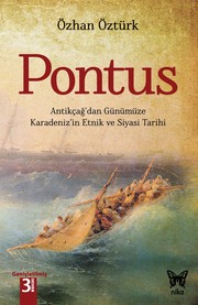
Search results from Open Library.
Recent natural events nearby
Ground air-quality sensors
Recently spotted species
Events
Gallery
Sources
- • Wikipedia
- • Wikidata
- • Open-Meteo / sunrise-sunset.org
- • Wikipedia Pageviews API
- • Open Library