Browse / United States / Texas / Amarillo
Amarillo
Texascity

Amarillo
Total population
197,979
Median home value
$213,900
Bachelor's+
Median income
$67,187
Founded
1887
Demographic figures from US Census Bureau · ACS 5-year estimates. Overview below cites Wikipedia and may reference a different year.
- Freeze Warning · SevereFreeze Warning issued October 16 at 11:01AM CDT until October 17 at 9:00AM CDT by NWS Amarillo TX
Source: NOAA National Weather Service.
City facts
Facts from Wikidata (CC0).
Overview
Amarillo is a city in the U.S. state of Texas and the county seat of Potter County, though most of the southern half of the city extends into Randall County. It is the 17th-most populous city in Texas and the most populous city in the Texas panhandle. The estimated population of Amarillo was 203,729 as of 2024, comprising nearly half of the panhandle's population. The Amarillo metropolitan area had an estimated population of 308,297 as of 2020.
Read more on WikipediaHistory & geography
History
During April 1887, John T. Berry, from Abilene, Texas, established a site for a town, choosing a well-watered section along the right-of-way of the Fort Worth and Denver City Railway that was building across the Texas Panhandle. Berry and merchants from Colorado City, Texas wanted to make his new townsite the region's main trading center. On August 30, 1887, the site won the election for a county seat to be established for Potter County. Availability of the railroad's freight service made the town a fast-growing cattle-marketing center. On June 19, 1888, Henry B. Sanborn, who is given credit as the "Father of Amarillo", and his business partner Joseph F. Glidden began buying land to move Amarillo to the east after arguing that Berry's site was on low ground and would flood during rainstorms. Sanborn offered to trade lots in the new location to businesses in the original city's site and help with the expense of moving to new buildings. His incentives gradually won over some people who moved their businesses to Polk Street in the new commercial district. Heavy rains almost flooded Berry's part of the town in 1889, prompting even more people to move to Sanborn's location. This eventually led to another county-seat election, which made Sanborn's site the new county seat in 1893. The plant was the sole producer of commercial helium in the world for many years. The U.S. National Helium Reserve is stored in the Bush Dome Reservoir at the Cliffside facility. Amarillo was hit by the Dust Bowl in the 1930s and entered an economic depression. World War II led the establishment of Amarillo Army Air Field in east Amarillo and the nearby Pantex Army Ordnance Plant, which produced bombs and ammunition. After the end of the war, both of the facilities were closed. The Pantex Plant…
Geography
Amarillo is located near the middle of the Texas Panhandle. It does not share similar weather characteristics with south and east Texas. It is situated in the grasslands of the Texas Panhandle and is surrounded by dense prairie and desert. Amarillo is infamous for its unpredictable weather patterns, with broad daily temperature changes, raging winds, devastating hailstorms and "northers", long periods of drought, late frosts, spring tornadoes, dust storms, and floods. Though urbanization, agricultural farming, and construction have taken place over the last century in and around Amarillo, the native grasslands that dominate this region have remained largely untouched. The region's surface is relatively flat and has little soil drainage. Due to the lack of developed drainage, much of the rainfall either evaporates, infiltrates into the ground, or accumulates in playa lakes. The city is situated near the Panhandle Field, in a productive gas and oil area, covering in Hartley, Potter, Moore, Hutchinson, Carson, Gray, Wheeler, and Collingsworth Counties. The Potter County portion had the nation's largest natural gas reserve. The Palo Duro Canyon State Park is the United States' second largest canyon system, after the Grand Canyon and is located Approximately southeast of Amarillo is Palo Duro Canyon. Palo Duro Canyon has a distinct hoodoo that resembles a lighthouse. The underground structures known as Amarillo Mountains are an extension of the Arbuckles of Oklahoma and the Ouachita of Arkansas and Oklahoma. They are some thousands of feet underground. The range was discovered by pioneer oilmen. Some of the peaks are believed to be 10,000 feet (3,000 m) high.[21] The tallest peak is reported to be underground in northeastern Potter County under the Alibates Flint…
Excerpted from the corresponding Wikipedia article (CC BY-SA).
Demographics & economy
Race & ethnicity
Source: US Census Bureau — American Community Survey, 5-year estimates.
Geography
Coordinates & boundaries from the US Census TIGER/Line shapefiles.
Climate
Current forecast
Forecast for Amarillo, TX from NOAA NWS API.
Air quality
Industrial & pollution facilities
Natural hazard risk
Health (adults)
Age-adjusted prevalence estimates from CDC PLACES (latest release).
Walkability
Amenities nearby
Wildlife & biodiversity
Schools
Largest nearby schools
- TASCOSA H SHigh · AMARILLO · 2,187 students · 16.6:1 ratio
- PALO DURO H SHigh · AMARILLO · 1,923 students · 15.3:1 ratio
- BOWIE MIDDLEMiddle · AMARILLO · 748 students · 15:1 ratio
- AUSTIN MIDDLEMiddle · AMARILLO · 677 students · 15.4:1 ratio
- HOUSTON MIDDLEMiddle · AMARILLO · 656 students · 13.1:1 ratio
- TRAVIS MIDDLEMiddle · AMARILLO · 629 students · 14:1 ratio
- EASTRIDGE ELElementary · AMARILLO · 596 students · 14.5:1 ratio
- AVONDALE ELElementary · AMARILLO · 548 students · 16.1:1 ratio
Public K–12 schools within ~10 mi from Urban Institute Education Data Portal (NCES Common Core of Data, 2022).
Earthquake history
Photos
Sights & places nearby
Notable people from here


People born within ~10 km, from Wikidata (CC0). Click any name for their Wikipedia article.
Nearby places in Texas
Geography & sun
Elevation, sunrise/sunset and daylight from Open-Meteo. Solar climatology from NASA POWER.
Nearby airports
Public attention
Pageview totals from the Wikimedia Pageviews API.
Books about Amarillo

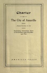
Search results from Open Library.
Recent natural events nearby
- Wildfire Old Deer, Carson, TexasWildfires · 2026-08-23 · 39 mi
- Wildfire Brown, Oldham, TexasWildfires · 2026-08-09 · 66 mi
- Wildfire Rustler, Motley, TexasWildfires · 2026-08-23 · 105 mi
- Wildfire Fowl, Harding, New MexicoWildfires · 2026-09-02 · 113 mi
- Wildfire Rabbit Ear East, Union, New MexicoWildfires · 2026-08-24 · 116 mi
- Wildfire Black Kettle, Roger Mills, OklahomaWildfires · 2026-09-14 · 128 mi
- Wildfire 4V, San Miguel, New MexicoWildfires · 2026-08-29 · 141 mi
- Wildfire Sheep Pen, Las Animas, ColoradoWildfires · 2026-08-12 · 153 mi
Wildfires, storms and other events from NASA EONET (last 12 months, within 250 mi).
Ground air-quality sensors
Recently spotted species
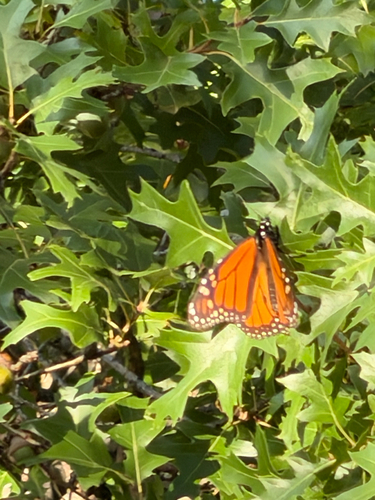
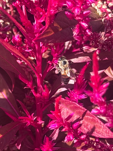
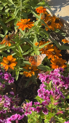
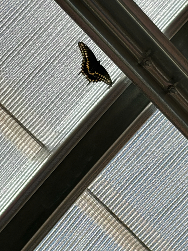
Research-grade observations from iNaturalist (within ~15 mi).
Nearest stream gauge
Live readings from USGS NWIS · measured 2026-10-16 12:15 UTC.
Events
Gallery
Sources
- • Wikipedia
- • US Census Bureau (ACS 5-year estimates)
- • NOAA National Weather Service
- • Wikidata
- • USGS NWIS (water data)
- • NCES via Urban Institute Education Data Portal
- • iNaturalist
- • CDC PLACES
- • Open-Meteo / sunrise-sunset.org
- • Wikipedia Pageviews API
- • Open Library
- • NASA EONET