Browse / United Kingdom / Scotland / Darvel
Darvel
Scotlandtown

Darvel
Total population
3,900
Demographic figures from UK Office for National Statistics. Overview below cites Wikipedia and may reference a different year.
City facts
Overview
Darvel (Scots: Dairvel, Scottish Gaelic: Darbhail) is a town in East Ayrshire, Scotland. It is at the eastern end of the Irvine Valley and is sometimes referred to as "The Lang Toon".
Read more on WikipediaHistory & geography
History
Archaeological excavations and surveys, between 2003 and 2007, by Glasgow University Archaeological Research Division (GUARD) in advance of the extension to the Loudoun Hill Quarry, found that people had been living in the area between the Mesolithic and the Late Iron Age periods. In the earliest periods the area was covered by woodlands and those were probably still undisturbed. An additional excavation, in 2007, found a rare late medieval farmstead. The pottery and radiocarbon dates indicate that the farm was occupied in the 14th–15th centuries. It is thought that this site belonged to the farm of Newton, which was first documented in the late 14th century within the parish of Galston. At that time the parish of Galston belonged to the Lockhart family. Roman settlements have been found at the base of Loudoun Hill on Allanton Plain and visible at one point from the Windy Wizzen. The modern town of Darvel is said to have been established in the late 18th century. The name Darvel was recorded in old charters as variations of 'Dernvale' or 'Darnevaill' and may derive from an old English word 'derne' which means 'hidden.' Sir William Wallace, the Scottish freedom fighter, has also been associated with the area. 15th century minstrel Blind Harry wrote in his poem The Wallace that Wallace and his men defeated an English force at the hill in 1296 during the Wars of Scottish Independence. Blind Harry also tells of how the English general, Fenwick, who supposedly killed Wallace's father, was killed during the battle. Maps of the area now name a mound to the east of Loudoun Hill as 'Wallace's Grave'. A battle between Robert the Bruce and the English was also fought there on 10 May 1307. The land on which Darvel was built was owned by Earls of Loudoun and it was John…
Excerpted from the corresponding Wikipedia article (CC BY-SA).
Geography
Coordinates & boundaries from the US Census TIGER/Line shapefiles.
Climate
Air quality
Walkability
Amenities nearby
Wildlife & biodiversity
Earthquake history
Photos
Sights & places nearby
Notable people from here
Nearby places in Scotland
Geography & sun
Elevation, sunrise/sunset and daylight from Open-Meteo. Solar climatology from NASA POWER.
Nearby airports
Public attention
Pageview totals from the Wikimedia Pageviews API.
Books about Darvel

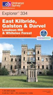
Search results from Open Library.
Recent natural events nearby
Ground air-quality sensors
Recently spotted species
Events
Gallery
Official Identifiers
ONS — UK Office for National Statistics
- ONS code
- osgb4000000074547866
- Local type
- Town
- Region
- Scotland
api.postcodes.io / OS Open Names
Sources
- • Wikipedia
- • Open-Meteo / sunrise-sunset.org
- • Wikipedia Pageviews API
- • Open Library
- • ONS / OS Open Names — UK official place gazetteer, via api.postcodes.io (OS code, local type, county/unitary, district/borough, region)
- • ONS — UK Office for National Statistics — api.postcodes.io / OS Open Names