Browse / United Kingdom / England / Hinckley
Hinckley
Englandtown

Hinckley
Total population
105,078
Demographic figures from UK Office for National Statistics. Overview below cites Wikipedia and may reference a different year.
City facts
Sister cities
Facts from Wikidata (CC0).
Overview
Hinckley is a market town in south-west Leicestershire, England, administered by Hinckley and Bosworth Borough Council. Hinckley is the third largest settlement in Leicestershire, after Leicester and Loughborough, and is about halfway between Leicester and Coventry, close to Nuneaton and Watling Street, on the border with Warwickshire. The town is part of an urban area with the large village of Burbage to the south.
Read more on WikipediaHistory & geography
History
In 2000, archaeologists from Northampton Archaeology discovered evidence of Iron Age and Romano-British settlement on land near Coventry Road and Watling Street. Hinckley has a recorded history going back to Anglo-Saxon times; the name Hinckley is Anglo-Saxon: "Hinck" is a personal name and "ley" is a clearing in a wood. By the time of the Domesday Book in 1086, Hinckley was quite a large village, and it grew over the following 200 years into a small market town—a market was first recorded there in 1311. There is evidence of an Anglo-Saxon church—the remnants of an Anglo-Saxon sundial being visible on the diagonal buttress on the south-east corner of the chancel. Hinckley is around south of what is believed to be the location of the Battle of Bosworth, the last significant battle of the Wars of the Roses, which occurred in 1485, and resulted in Henry Tudor's forces defeating those of King Richard III. In the 17th century, the town developed a hosiery industry, producing stockings and similar items. Hinckley played a prominent part in the English Civil War. Its proximity to several rival strongholds—the royalist garrisons at Caldicote, Ashby de la Zouch and Leicester, and those of the Parliamentarians at Tamworth and Coventry—and the presence of parties of troops or brigands occupying several fortified houses in nearby Warwickshire, led to frequent visits by the warring parties. The local townsfolk were forced to decide whether to declare their allegiances openly or attempt to remain neutral—with the risk of having to pay levies, ransoms, and fines to both sides. In March 1644, Hinckley was occupied by a group of Royalist troops, though they were soon driven out by a force of Parliamentarians, who took many prisoners. The Civil War years were a particularly…
Geography
Hinckley's suburban districts include Hollycroft, Middlefield, Stoneygate, Wykin, Forest View, West Hinckley, Saxon Paddock and Druid Quarter. The suburbs of Burbage, Sketchley and Lash Hill are separated from the rest of Hinckley by the railway line.
Excerpted from the corresponding Wikipedia article (CC BY-SA).
Geography
Coordinates & boundaries from the US Census TIGER/Line shapefiles.
Climate
Air quality
Walkability
Amenities nearby
Wildlife & biodiversity
Most-observed species
- Common Wood-PigeonColumba palumbus Linnaeus, 1758 · Aves10,970
- Eurasian BlackbirdTurdus merula Linnaeus, 1758 · Aves8,668
- European RobinErithacus rubecula (Linnaeus, 1758) · Aves8,591
- Eurasian MagpiePica pica (Linnaeus, 1758) · Aves8,185
- Carrion CrowCorvus corone Linnaeus, 1758 · Aves7,997
- Eurasian Blue TitCyanistes caeruleus (Linnaeus, 1758) · Aves7,469
- MallardAnas platyrhynchos Linnaeus, 1758 · Aves6,081
- Great TitParus major Linnaeus, 1758 · Aves5,675
Citizen-science & research observations from the Global Biodiversity Information Facility (GBIF).
Earthquake history
Most recent
- M 2.7 — 2023-06-282 km SE of Cheadle, United Kingdom
- M 3.6 — 2022-05-302 km ESE of Prees, United Kingdom
- M 3.2 — 2022-02-215 km N of Hockley, United Kingdom
- M 3.1 — 2020-09-225 km N of Aylesbury, United Kingdom
- M 3.9 — 2020-09-082 km WSW of Pitstone, United Kingdom
- M 2.8 — 2015-09-222 km W of Cottesmore, United Kingdom
Events from the USGS Earthquake Catalog (global) (FDSN Event Web Service).
Photos
Sights & places nearby
Notable people from here


People born within ~10 km, from Wikidata (CC0). Click any name for their Wikipedia article.
Nearby places in England
Geography & sun
Elevation, sunrise/sunset and daylight from Open-Meteo. Solar climatology from NASA POWER.
Nearby airports
Public attention
Pageview totals from the Wikimedia Pageviews API.
Books about Hinckley
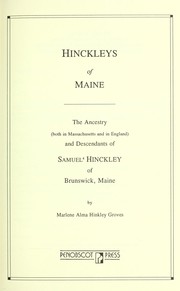


Search results from Open Library.
Recent natural events nearby
Ground air-quality sensors
Recently spotted species
Events
Gallery
Official Identifiers
ONS — UK Office for National Statistics
- ONS code
- osgb4000000074573829
- Local type
- Town
- Region
- East Midlands
api.postcodes.io / OS Open Names
Sources
- • Wikipedia
- • Wikidata
- • USGS Earthquake Catalog (global feed)
- • GBIF (Global Biodiversity Information Facility)
- • Open-Meteo / sunrise-sunset.org
- • Wikipedia Pageviews API
- • Open Library
- • Wikidata SPARQL (CC0) — population, area, elevation, inception, head of government, Commons image
- • ONS / OS Open Names — UK official place gazetteer, via api.postcodes.io (OS code, local type, county/unitary, district/borough, region)
- • ONS — UK Office for National Statistics — api.postcodes.io / OS Open Names