Browse / United Kingdom / England / North Petherton
North Petherton
Englandtown

North Petherton
Total population
3,142
Demographic figures from UK Office for National Statistics. Overview below cites Wikipedia and may reference a different year.
City facts
Overview
North Petherton is a town and civil parish in Somerset, England, lying on the edge of the eastern foothills of the Quantocks, about 2.5 miles (4 km) south of Bridgwater; in the east, the parish extends into the Somerset Levels. The parish includes the villages of North Newton and Huntworth, and the hamlets of Northmoor Green, Shearston and Woolmersdon. The parish population at the 2021 census was 10,050, an increase from the 6,730 recorded in 2011.
Read more on WikipediaHistory & geography
History
Long before the Norman Conquest, during Saxon times North Petherton was at the centre of a large royal estate, located on one of the historic communication routes through Somerset, and was both an important centre and the meeting place for the Hundred of North Petherton At the time of the Norman invasion the Hundred covered a large area corresponding, today, roughly to a north–south corridor along the M5 motorway from Junction 25 near Taunton, to north of Junction 23 at Stretcholt, and east–west from Athelney to Goathurst. The Parish of North Petherton continues to be one of the largest in Somerset to this day. Between 1513 and 1535 Sir William Courtenay (d.1535) of Powderham, Devon was the keeper of North Petherton Park. The town itself it thought to have developed around the minster which, it is supposed, was on the same site as the current church. Believed to have been commissioned by Alfred the Great, it is thought to have been the handle for a pointer that would have fitted into the hole at its base, and been used while reading a book out loud. It is inscribed, "AELFRED MEC HEHT GEWYRCAN," ("Alfred had me made"). It may be one of the "aestels" Alfred had sent to each bishopric with a copy of his translation of Pope Gregory the Great's book Pastoral Care. A replica of the jewel can be found in the church of St Mary. When the Bridgwater and Taunton Canal was opened in 1827 it joined the River Parrett by a lock at Huntworth, where a basin was constructed, but in 1841 the canal was extended to a floating harbour in Bridgwater, and the Huntworth link was filled in. The canal and river were not re-connected at this point when the canal was restored, because the Parrett is by then a salt water river laden with silt, whereas the canal contains fresh water. Not only is…
Geography
North Petherton is situated on one of the historic communication routes through Somerset, and a turnpike through the town was opened between Bridgwater and Taunton in the 1730s. The opening of the nearby M5 motorway in the 1970s which relieved major traffic jams on the A38 through the town, also added to the attraction of the town for commuters and has consequently led to the construction of several new housing estates. The town lies on the route of the Macmillan Way West long-distance footpath. South east of the town near Lyng, on the opposite side of the M5 motorway but within the parish is North Moor, a 676.3 hectare biological Site of Special Scientific Interest. North Moor is a nationally important grazing marsh and ditch system on the Somerset Levels and Moors. A range of neutral grassland types supporting common and scarce plants has developed mainly due to variations in soils and management practices. Aquatic plant communities are exceptionally diverse with good populations of nationally scarce species. The site has special interest in its bird life. Along with the rest of South West England, North Petherton has a temperate climate which is generally wetter and milder than the rest of the country. The annual mean temperature is approximately . Seasonal temperature variation is less extreme than most of the United Kingdom because of the adjacent sea temperatures. The summer months of July and August are the warmest with mean daily maxima of approximately . In winter mean minimum temperatures of or are common. In the summer the Azores high pressure affects the south-west of England, although convective cloud sometimes forms inland, reducing the number of hours of sunshine. Annual sunshine rates are slightly less than the regional average of 1,600 hours.…
Excerpted from the corresponding Wikipedia article (CC BY-SA).
Geography
Coordinates & boundaries from the US Census TIGER/Line shapefiles.
Climate
Air quality
Walkability
Amenities nearby
Wildlife & biodiversity
Earthquake history
Photos
Sights & places nearby
Notable people from here
Nearby places in England
- Burnham-on-Sea10.1 mi away
- Axbridge16 mi away · pop. 2,057
- Weston-super-Mare17.7 mi away
- Axminster21.4 mi away
- Bampton21.6 mi away
- Castle Cary21.7 mi away
- Bradninch25.6 mi away · pop. 2,041
- Wincanton26.3 mi away
- Cranbrook28.8 mi away
- King's Stag30.3 mi away
- Gillingham32.3 mi away
- Sturminster Newton32.9 mi away
Geography & sun
Elevation, sunrise/sunset and daylight from Open-Meteo. Solar climatology from NASA POWER.
Nearby airports
Public attention
Pageview totals from the Wikimedia Pageviews API.
Books about North Petherton
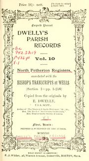
Search results from Open Library.
Recent natural events nearby
Ground air-quality sensors
Recently spotted species
Events
Gallery
Official Identifiers
ONS — UK Office for National Statistics
- ONS code
- osgb4000000074574524
- Local type
- Town
- Region
- South West
api.postcodes.io / OS Open Names
Sources
- • Wikipedia
- • Open-Meteo / sunrise-sunset.org
- • Wikipedia Pageviews API
- • Open Library
- • ONS / OS Open Names — UK official place gazetteer, via api.postcodes.io (OS code, local type, county/unitary, district/borough, region)
- • ONS — UK Office for National Statistics — api.postcodes.io / OS Open Names