Browse / United Kingdom / England / Otley
Otley
Englandtown

Otley
Total population
14,000
Demographic figures from UK Office for National Statistics. Overview below cites Wikipedia and may reference a different year.
City facts
Sister cities
Facts from Wikidata (CC0).
Overview
Otley is a market town and civil parish at a bridging point on the River Wharfe, in the City of Leeds metropolitan borough in West Yorkshire, England. Historically a part of the West Riding of Yorkshire, the population was 13,668 at the 2011 census. It is in two parts: south of the river is the historic town of Otley and to the north is Newall, which was formerly a separate township. The town is in lower Wharfedale on the A660 road which connects it to Leeds.
Read more on WikipediaHistory & geography
History
Otley's name is derived from Otto, Otho, Othe, or Otta, a Saxon personal name and leah, a woodland clearing in Old English. It was recorded as Ottanlege in 972 and Otelai or Othelia in the Domesday Book of 1086. The name Chevin has close parallels to the early Brythonic Welsh term Cefn meaning ridge and may be a survival of the ancient Cumbric language. There are pre-historic settlement finds alongside both sides of the River Wharfe and it is believed the valley has been settled at this site since the Bronze Age. There are Bronze Age carvings on rocks situated on top of The Chevin: one such example is the Knotties Stone. West Yorkshire Geology Trust has reference to Otley Chevin and Caley Crags having a rich history of human settlement stretching back into Palaeolithic times. Flint tools, Bronze Age rock carvings and Iron Age earthworks have been found. In medieval times the forest park was used as common pasture land, as a source of wood and sandstones for buildings and walls. ===Saxon and Medieval=== The majority of the early development of the town dates from Saxon times and was part of an extensive manor granted by King Æthelstan to the see of York. The Archbishops of York had a residence and were lords of the manor. Their palace was located on the site occupied by the Manor House. The Saxon church was replaced by a Norman one, but this contains much Saxon sculpture. Bondgate was for the workers: bondsmen and tenants. A leper hospital was founded on the road to Harewood beyond Cross Green. An early example can be seen in Otley Museum. By 1900 the printing machinery trade, with over 2,000 people employed in seven machine shops, was Otley's most important industry. After the First World War there was a general shortage of housing in Britain, and much of it was…
Geography
Otley lies south-west of York, north-west of Leeds, north-east of Bradford, and from London. The town lies in lower Wharfedale, at a bridging point over the River Wharfe where there is a seven-arched medieval bridge, and is surrounded by arable farmland. The historic town developed on the south bank of the Wharfe, but in the 20th century Otley expanded north of the river, to include new developments at Newall and the Weston Estate. The south side of the valley is dominated by a gritstone escarpment overlooking Otley called the Chevin and to the north is Newall Carr. In 1944, Major Le G.G.W. Horton Fawkes of Farnley Hall donated of land on the Chevin to the people of Otley. This has been expanded to and constitutes Chevin Forest Park. It was from a quarry on the Chevin that the foundation stones for the Houses of Parliament were hewn. To the east and west of Otley are flooded gravel pits, where sand and gravel have been extracted in the 20th century. The gravel pits to the east at Knotford Nook are a noted birdwatching site. Those to the west are devoted to angling and sailing. To the west are the villages of Burley in Wharfedale and Menston. To the east is Pool-in-Wharfedale. To the south is the towns of Guiseley, and Yeadon.
Excerpted from the corresponding Wikipedia article (CC BY-SA).
Geography
Coordinates & boundaries from the US Census TIGER/Line shapefiles.
Climate
Air quality
Walkability
Amenities nearby
Wildlife & biodiversity
Earthquake history
Photos
Sights & places nearby
Notable people from here


People born within ~10 km, from Wikidata (CC0). Click any name for their Wikipedia article.
Nearby places in England
Geography & sun
Elevation, sunrise/sunset and daylight from Open-Meteo. Solar climatology from NASA POWER.
Nearby airports
Public attention
Pageview totals from the Wikimedia Pageviews API.
Books about Otley

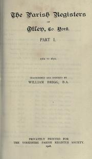
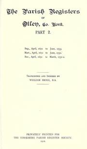
Search results from Open Library.
Recent natural events nearby
Ground air-quality sensors
Recently spotted species
Events
Gallery
Official Identifiers
ONS — UK Office for National Statistics
- ONS code
- osgb4000000074569899
- Local type
- Town
- Region
- Yorkshire and the Humber
api.postcodes.io / OS Open Names
Sources
- • Wikipedia
- • Wikidata
- • Open-Meteo / sunrise-sunset.org
- • Wikipedia Pageviews API
- • Open Library
- • Wikidata SPARQL (CC0) — population, area, elevation, inception, head of government, Commons image
- • ONS / OS Open Names — UK official place gazetteer, via api.postcodes.io (OS code, local type, county/unitary, district/borough, region)
- • ONS — UK Office for National Statistics — api.postcodes.io / OS Open Names