Browse / United Kingdom / England / Towcester
Towcester
Englandtown

Towcester
Total population
9,252
Demographic figures from UK Office for National Statistics. Overview below cites Wikipedia and may reference a different year.
City facts
Overview
Towcester is a market town and civil parish in the West Northamptonshire unitary authority area of Northamptonshire, England. From 1974 to 2021, it was the administrative centre of the South Northamptonshire district.
Read more on WikipediaHistory & geography
History
Towcester lays claim to being the oldest town in Northamptonshire and possibly, because of the antiquity of recent Iron Age finds in the town, to be one of the oldest continuously inhabited settlements in the country. There is evidence that it was settled by humans since the Mesolithic era (middle Stone Age). There is also evidence of Iron Age burials in the area. In Roman Britain, Watling Street, now the A5 road, was built through the area and a garrison town called Lactodurum established on the site of the present-day town. Two candidate sites for the Battle of Watling Street, fought in 61AD, are located close to the town, these are Church Stowe which is located to the north and Paulerspury which is to the south. A stone female head, that mixes Celtic and Roman styles, was found on Watling Street outside the town and was given to the British Museum in 1903. When the Romans left in the 5th century, the area was settled by Saxons. In the 9th century, Watling Street became the frontier between the kingdom of Wessex and the Danelaw, and thus Towcester became a frontier town. Edward the Elder fortified Towcester in 917. In the 11th century, the Normans built a motte-and-bailey castle on the site. Bury Mount is the remains of the fortification and is a scheduled ancient monument. It was renovated in 2008 with an access ramp and explanatory plaques added. In the 18th and early 19th centuries, in the heyday of the stagecoach and the mail coach, Watling Street became a major coaching road between London and Holyhead, and Towcester flourished, becoming a major stopping point. Many coaching inns and stabling facilities were provided for travellers in Towcester, many of which remain. The coaching trade came to an abrupt halt in September 1838 when the London and Birmingham…
Geography
The town is approximately south-west of Northampton and about north-west of Milton Keynes, the nearest main towns. Oxford is about south-west via the A43 road, M40 motorway and A34 road. The A43 now bypasses the town to the north but the A5 road still passes through the town centre. This still carries much traffic in the north–south direction. The 2.1-mile bypass opened on Tuesday 22 December 1987, five months early. Northampton railway station is the nearest railway station, being away from the town. Buses to Northampton, Milton Keynes, Brackley, Potterspury, Deanshanger, Silverstone and Biddlesden operate, but these are infrequent.
Excerpted from the corresponding Wikipedia article (CC BY-SA).
Geography
Coordinates & boundaries from the US Census TIGER/Line shapefiles.
Climate
Air quality
Walkability
Amenities nearby
Wildlife & biodiversity
Earthquake history
Photos
Sights & places nearby
Notable people from here
Nearby places in England
Geography & sun
Elevation, sunrise/sunset and daylight from Open-Meteo. Solar climatology from NASA POWER.
Nearby airports
Public attention
Pageview totals from the Wikimedia Pageviews API.
Books about Towcester
Search results from Open Library.
Recent natural events nearby
Ground air-quality sensors
Recently spotted species


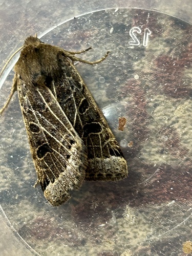






Research-grade observations from iNaturalist (within ~15 mi).
Events
Gallery
Official Identifiers
ONS — UK Office for National Statistics
- ONS code
- osgb4000000074545502
- Local type
- Town
- Region
- East Midlands
api.postcodes.io / OS Open Names
Sources
- • Wikipedia
- • iNaturalist
- • Open-Meteo / sunrise-sunset.org
- • Wikipedia Pageviews API
- • Open Library
- • ONS / OS Open Names — UK official place gazetteer, via api.postcodes.io (OS code, local type, county/unitary, district/borough, region)
- • ONS — UK Office for National Statistics — api.postcodes.io / OS Open Names