Browse / Uruguay / Montevideo / Montevideo
Montevideo
Montevideocity

Montevideo
Total population
1,302,954
Founded
1723
Demographic figures from INE Uruguay. Overview below cites Wikipedia and may reference a different year.
City facts
Sister cities
Facts from Wikidata (CC0).
Overview
Montevideo is the capital and largest city of Uruguay. As of the 2023 census, the city proper has a population of 1,287,452, making up about 36.8% of the country's total population, in an area of 201 square kilometers (78 sq mi). Montevideo is situated on the southern coast of the country, on the northeastern bank of the Río de la Plata.
Read more on WikipediaHistory & geography
History
Between 1680 and 1683, Portugal founded the city of Colonia do Sacramento in the region across the bay from Buenos Aires. This city met with no resistance from the Spanish until 1723, when they began to place fortifications on the elevations around Montevideo Bay. On 22 November 1723, Field Marshal of Portugal built the Montevieu fort. A Spanish expedition was sent from Buenos Aires, organized by the Spanish governor of that city, Bruno Mauricio de Zabala. On 22 January 1724, the Spanish forced the Portuguese to abandon the location and started populating the city, initially with six families moving in from Buenos Aires and soon thereafter by families arriving from the Canary Islands who were known as Guanches or Canarians. There was also one significant early Italian resident by the name of Jorge Burgues. A census of the city's inhabitants was performed in 1724 and then a plan was drawn delineating the city and designating it as San Felipe y Santiago de Montevideo, later shortened to Montevideo. The census counted more than 100 families of Galician and Canary Islands origin, more than 1000 indigenous people, mostly Guaraní, as well as some trafficked slaves of Bantu origin. Until the end of the 18th century, Montevideo remained a fortified area, today known as Ciudad Vieja. On 3 February 1807, British troops under the command of General Samuel Auchmuty and Admiral Charles Stirling occupied the city during the Battle of Montevideo (1807), but it was recaptured by the Spanish in the same year on 2 September when John Whitelocke was forced to surrender to troops formed by forces of the Banda Oriental—roughly the same area as modern Uruguay—and of Buenos Aires. After this conflict, the governor of Montevideo Francisco Javier de Elío opposed the new viceroy Santiago de…
Geography
Montevideo is situated on the north shore of the Río de la Plata, the arm of the Atlantic Ocean that separates the south coast of Uruguay from the north coast of Argentina; Buenos Aires lies west on the Argentine side. The Santa Lucía River forms a natural border between Montevideo and San José Department to its west. To the city's north and east is Canelones Department, with the stream of Carrasco forming the eastern natural border. The coastline forming the city's southern border is interspersed with rocky protrusions and sandy beaches. The Bay of Montevideo forms a natural harbor, the nation's largest and one of the largest in the Southern Cone, and the finest natural port in the region, functioning as a crucial component of the Uruguayan economy and foreign trade. Various streams crisscross the town and empty into the Bay of Montevideo. Its coastline near the emptying rivers are heavily polluted. The city has an average elevation of . Its highest elevations are two hills: the Cerro de Montevideo and the Cerro de la Victoria, with the highest point, the peak of Cerro de Montevideo, crowned by a fortress, the Fortaleza del Cerro at a height of . Closest cities by road are Las Piedras to the north and the so-called Ciudad de la Costa (a conglomeration of coastal towns) to the east, both in the range of 20 to from the city center. The approximate distances to the neighboring department capitals by road are, to San Jose de Mayo (San Jose Department) and to Canelones (Canelones Department). Montevideo has a humid subtropical climate (Köppen Cfa) in a middle latitude, the city experiences the four seasons. It has cool winters (June to August), warm to hot summers (December to February), mild autumns (March to May) and volatile springs (September to November); The…
Excerpted from the corresponding Wikipedia article (CC BY-SA).
Geography
Coordinates & boundaries from the US Census TIGER/Line shapefiles.
Climate
Air quality
Walkability
Amenities nearby
Wildlife & biodiversity
Most-observed species
- Rufous HorneroFurnarius rufus (Gmelin, 1788) · Aves6,347
- Great KiskadeePitangus sulphuratus (Linnaeus, 1766) · Aves6,293
- Picazuro PigeonPatagioenas picazuro (Temminck, 1813) · Aves6,173
- Monk ParakeetMyiopsitta monachus (Boddaert, 1783) · Aves5,721
- Eared DoveZenaida auriculata (Des Murs, 1847) · Aves5,361
- House SparrowPasser domesticus (Linnaeus, 1758) · Aves4,566
- Rufous-bellied ThrushTurdus rufiventris Vieillot, 1818 · Aves4,336
- Rock PigeonColumba livia J.F.Gmelin, 1789 · Aves4,132
Citizen-science & research observations from the Global Biodiversity Information Facility (GBIF).
Earthquake history
Events from the USGS Earthquake Catalog (global) (FDSN Event Web Service).
Photos
Sights & places nearby
Notable people from here
Nearby places in Montevideo
Geography & sun
Elevation, sunrise/sunset and daylight from Open-Meteo. Solar climatology from NASA POWER.
Nearby airports
Public attention
Pageview totals from the Wikimedia Pageviews API.
Books about Montevideo


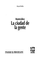

Search results from Open Library.
Recent natural events nearby
Ground air-quality sensors
Recently spotted species
Events
Notable, recurring, and historical events associated with Montevideo, sourced from Wikidata.
- Crisis: information and climateApr 15, 2024meeting
activity organized by Wikimedistas de Uruguay with local alliances in the framework of the Wiki for Human Rights 2024 campaign.
- Q136325182Jan 1, 2023recurring event
- 16th Ibero-American summitNov 3, 2006recurring event edition
- Q131861563festival
Source: Wikidata (CC0).
Gallery
Sources
- • Wikipedia
- • Wikidata
- • USGS Earthquake Catalog (global feed)
- • GBIF (Global Biodiversity Information Facility)
- • Open-Meteo / sunrise-sunset.org
- • Wikipedia Pageviews API
- • Open Library
- • Wikidata SPARQL (CC0) — population, area, elevation, inception, head of government, Commons image