Browse / United States / Washington / Richland
Richland
Washingtoncity

Richland
Total population
62,753
Median home value
$436,700
Bachelor's+
Median income
$95,813
Founded
1905
Demographic figures from US Census Bureau · ACS 5-year estimates. Overview below cites Wikipedia and may reference a different year.
City facts
Sister cities
Facts from Wikidata (CC0).
Overview
Richland is a city in Benton County, Washington, United States. It is located in southeastern Washington at the confluence of the Yakima and the Columbia Rivers. As of the 2020 census, the city's population was 60,560. Along with the nearby cities of Pasco and Kennewick, Richland forms the Tri-Cities metropolitan area.
Read more on WikipediaHistory & geography
History
For centuries, the village of Chemna was at the mouth of the Yakima River. Today the village site is called Columbia Point. From the village, the indigenous Wanapum, Yakama, and Walla Walla people harvested salmon runs entering the Yakima River. Captain William Clark of the Lewis and Clark Expedition visited the mouth of the Yakima River on October 17, 1805. In 1904–1905, W.R. Amon and his son Howard purchased and proposed a town site on the north bank of the Yakima River. Postal authorities approved the designation of this town site as Richland in 1905, naming it for Nelson Rich, a state legislator and land developer. In 1906, the town was registered at the Benton County Courthouse. It was incorporated on April 28, 1910, as a fourth-class city. Population growth in Richland accelerated following the opening of a permanent bridge over the Yakima River in 1907 and a highway to Kennewick in 1926. A cable ferry to Pasco operated across the Columbia River from 1894 to 1931, when it was replaced by a modern bridge. Richland's link to the Army Engineers is suggested by its street nomenclature; many of the streets are named after famous engineers. The main street (George Washington Way) is named after the first president, who was a surveyor; Stevens Drive is named after John Frank Stevens, chief engineer of the Panama Canal and Stevens Pass; Goethals Drive is named after George W. Goethals, designer of the Panama Canal; and Thayer Drive is named after Sylvanus Thayer, superintendent of West Point and later founder of the Thayer School of Engineering at Dartmouth College. The rule is that if alphabet houses reside on a given street, they are named after an engineer or a type of tree. With the end of the war, the Hanford workers' camp, originally located north of Richland…
Geography
According to the United States Census Bureau, the city has a total area of , of which, is land and is water. Elevation at the airport is . In the late 1970s, Richland sought to annex of unincorporated land in Franklin County on the east side of the Columbia River, anticipating development following the construction of Interstate 182. The move was blocked by Pasco, who had planned to annex much of the area themselves. The Richland city government filed an appeal against the Franklin County Boundary Review Board in 1983 following their approval of Pasco's claim; the Washington Supreme Court affirmed the Franklin County decision. Richland Wye () is a community within the eastern city limits of Richland. It is the location of the sole access bridge to Bateman Island over the Columbia River. Richland receives about of precipitation per year, giving it a semi-arid desert climate and resulting in a shrub-steppe environment. Summers are hot with infrequent thunderstorms, while winters are milder than all of Eastern Washington with snow falling only occasionally. During the 2021 Western North America heat wave, the maximum temperature of was recorded in Richland which tied the previous all-time record high temperature in the state of Washington. Nearby, the Hanford Site recorded a high of , the new state record.
Excerpted from the corresponding Wikipedia article (CC BY-SA).
Demographics & economy
Race & ethnicity
Source: US Census Bureau — American Community Survey, 5-year estimates.
Geography
Coordinates & boundaries from the US Census TIGER/Line shapefiles.
Climate
Air quality
Industrial & pollution facilities
Natural hazard risk
Health (adults)
Age-adjusted prevalence estimates from CDC PLACES (latest release).
Walkability
Amenities nearby
Wildlife & biodiversity
Schools
Largest nearby schools
- Richland High SchoolHigh · Richland · 2,137 students · 22.3:1 ratio
- Kamiakin High SchoolHigh · KENNEWICK · 1,884 students · 24.5:1 ratio
- Hanford High SchoolHigh · Richland · 1,788 students · 21.5:1 ratio
- Kennewick High SchoolHigh · Kennewick · 1,785 students · 23.2:1 ratio
- Southridge High SchoolHigh · KENNEWICK · 1,641 students · 22.8:1 ratio
- Desert Hills Middle SchoolMiddle · KENNEWICK · 889 students · 21.2:1 ratio
- Chinook Middle SchoolMiddle · Kennewick · 882 students · 21:1 ratio
- Amistad Elementary SchoolElementary · KENNEWICK · 866 students · 18.8:1 ratio
Public K–12 schools within ~10 mi from Urban Institute Education Data Portal (NCES Common Core of Data, 2022).
Earthquake history
Photos
Sights & places nearby
Notable people from here


People born within ~10 km, from Wikidata (CC0). Click any name for their Wikipedia article.
Nearby places in Washington
Geography & sun
Elevation, sunrise/sunset and daylight from Open-Meteo. Solar climatology from NASA POWER.
Nearby airports
Public attention
Pageview totals from the Wikimedia Pageviews API.
Books about Richland
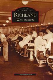
Search results from Open Library.
Recent natural events nearby
Ground air-quality sensors
Recently spotted species
Nearest stream gauge
Events
Notable, recurring, and historical events associated with Richland, sourced from Wikidata.
Source: Wikidata (CC0).
Gallery
Sources
- • Wikipedia
- • US Census Bureau (ACS 5-year estimates)
- • Wikidata
- • NCES via Urban Institute Education Data Portal
- • CDC PLACES
- • Open-Meteo / sunrise-sunset.org
- • Wikipedia Pageviews API
- • Open Library