Browse / United States / Wisconsin / Merrill
Merrill
Wisconsincity

Merrill
Total population
9,356
Median home value
$123,800
Bachelor's+
Median income
$53,148
Founded
1881
Demographic figures from US Census Bureau · ACS 5-year estimates. Overview below cites Wikipedia and may reference a different year.
- Frost Advisory · MinorFrost Advisory issued September 21 at 12:37PM CDT until September 22 at 7:00AM CDT by NWS Green Bay WI
Source: NOAA National Weather Service.
City facts
Facts from Wikidata (CC0).
Overview
Merrill is a city in and the county seat of Lincoln County, Wisconsin, United States. It is located to the south of and adjacent to the Town of Merrill. The population was 9,347, according to the 2020 census. Merrill is part of the United States Census Bureau's Merrill MSA, which includes all of Lincoln County. Together with the Wausau MSA, which includes all of Marathon County, it forms the Wausau-Merrill CSA.
Read more on WikipediaHistory & geography
History
Merrill was first inhabited by the Chippewa Native Americans. The first European settlement there was a logging town named Jenny Bull Falls. By 1843, a trading post was constructed near the town; John Faely was the first settler. Within four years a dam, started by Andrew Warren, was constructed over the Wisconsin River. Warren then established the first mill powered by the dam, and other saw mills in the area. In 1870, T. B. Scott succeeded Warren, and the mill soon became increasingly successful. In 1899 the mill burned down. During that time the name of the community was changed to Merrill, in honor of Sherburn S. Merrill (1818–1885), the general manager of the Chicago, Milwaukee, St. Paul, and Pacific Railroad. In 1881, the Wisconsin Telephone Company began operation, with 20 phones in service. In 1883, the first City Council met and T. B. Scott was named the first mayor. By 1885, the population had risen to 7,000, approximately 3,000 less than Merrill's population today. In July 1912, the Wisconsin River and several of its tributaries flooded from Rothschild to Merrill, destroying several dams (active and abandoned), as well as causing hundreds of thousands of dollars in damage in Merrill.
Geography
Merrill is located at (45.182569, -89.69559), along the Wisconsin River at its confluence with the Prairie River. According to the United States Census Bureau, the city has a total area of , of which is land and is water. Merrill is located west of US Route 51 on State Highway 64 (Main Street). Council Grounds State Park is due west of the city.
Excerpted from the corresponding Wikipedia article (CC BY-SA).
Demographics & economy
Race & ethnicity
Source: US Census Bureau — American Community Survey, 5-year estimates.
Geography
Coordinates & boundaries from the US Census TIGER/Line shapefiles.
Climate
Current forecast
Forecast for Merrill, WI from NOAA NWS API.
Air quality
Industrial & pollution facilities
Natural hazard risk
Health (adults)
Age-adjusted prevalence estimates from CDC PLACES (latest release).
Walkability
Amenities nearby
Wildlife & biodiversity
Most-observed species
- Black-capped ChickadeePoecile atricapillus (Linnaeus, 1766) · Aves1,513
- Blue JayCyanocitta cristata (Linnaeus, 1758) · Aves1,349
- American CrowCorvus brachyrhynchos C.L.Brehm, 1822 · Aves1,302
- American RobinTurdus migratorius Linnaeus, 1766 · Aves1,297
- Mourning DoveZenaida macroura (Linnaeus, 1758) · Aves1,249
- American GoldfinchSpinus tristis (Linnaeus, 1758) · Aves1,103
- Red-winged BlackbirdAgelaius phoeniceus (Linnaeus, 1766) · Aves1,092
- Canada Goose (canadensis Group)Branta canadensis (Linnaeus, 1758) · Aves838
Citizen-science & research observations from the Global Biodiversity Information Facility (GBIF).
Schools
Earthquake history
Most recent
- M 2.5 — 2024-01-073 km NE of Mole Lake, Wisconsin
Events from the USGS Earthquake Catalog (global) (FDSN Event Web Service).
Photos
Sights & places nearby
Notable people from here


People born within ~10 km, from Wikidata (CC0). Click any name for their Wikipedia article.
Nearby places in Wisconsin
Geography & sun
Elevation, sunrise/sunset and daylight from Open-Meteo. Solar climatology from NASA POWER.
Nearby airports
Public attention
Pageview totals from the Wikimedia Pageviews API.
Books about Merrill

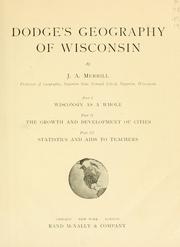
Search results from Open Library.
Recent natural events nearby
Ground air-quality sensors
Recently spotted species
Nearest stream gauge
Live readings from USGS NWIS · measured 2026-09-24 14:00 UTC.
Events
Gallery
Sources
- • Wikipedia
- • US Census Bureau (ACS 5-year estimates)
- • NOAA National Weather Service
- • Wikidata
- • USGS Earthquake Catalog (global feed)
- • USGS NWIS (water data)
- • GBIF (Global Biodiversity Information Facility)
- • CDC PLACES
- • Open-Meteo / sunrise-sunset.org
- • Wikipedia Pageviews API
- • Open Library