Browse / United States / Alaska / Perryville
Perryville
AlaskaCDP

Perryville
Total population
82
Demographic figures from US Census Bureau · ACS 5-year estimates. Overview below cites Wikipedia and may reference a different year.
City facts
Facts from Wikidata (CC0).
Overview
Perryville is a census-designated place (CDP) in Lake and Peninsula Borough, Alaska, United States. The population was 88 at the 2020 census, down from 113 in 2010.
Read more on WikipediaHistory & geography
History
Mount Katmai erupted on June 6, 1912, permanently displacing many local native people. One month after the eruption, 78 of the Katmai refugees boarded the U.S. revenue cutter Manning to return to the Alaska Peninsula and establish a new village. After a failed first village site selection, the natives were relocated yet again to a spot southwest of Mt. Katmai. The new settlement was named "Perry", and later became known as "Perryville", for K.W. Perry, captain of the Manning. On July 29, 2021, a M8.2 Earthquake struck 104 km SE of Perryville.
Geography
Perryville is located in southwestern Lake and Peninsula Borough at . It sits on the south shore of the Alaska Peninsula at the mouth of the Kametolook River and faces the Chiachi Islands about out in the Pacific Ocean. It is served by Perryville Airport. According to the United States Census Bureau, the Perryville CDP has a total area of , of which , or 0.18%, are water.
Excerpted from the corresponding Wikipedia article (CC BY-SA).
Demographics & economy
Geography
Coordinates & boundaries from the US Census TIGER/Line shapefiles.
Climate
Current forecast
Forecast for Perryville, AK from NOAA NWS API.
Air quality
Industrial & pollution facilities
Natural hazard risk
Health (adults)
Age-adjusted prevalence estimates from CDC PLACES (latest release).
Walkability
Amenities nearby
Wildlife & biodiversity
Schools
Largest nearby schools
- Perryville SchoolOther · Perryville · 22 students · 7.3:1 ratio
Public K–12 schools within ~10 mi from Urban Institute Education Data Portal (NCES Common Core of Data, 2022).
Earthquake history
Most recent
- M 2.5 — 2026-09-2375 km SSE of Perryville, Alaska
- M 2.6 — 2026-09-2248 km SSE of Perryville, Alaska
- M 2.7 — 2026-09-2276 km S of Perryville, Alaska
- M 2.5 — 2026-09-2112 km NNW of Ivanof Bay, Alaska
- M 3.6 — 2026-09-2055 km SE of Chignik, Alaska
- M 2.5 — 2026-09-1849 km ESE of Chignik, Alaska
Events from the USGS Earthquake Catalog (global) (FDSN Event Web Service).
Photos
Sights & places nearby
Notable people from here
Nearby places in Alaska
- Ivanof Bay13.1 mi away
- Chignik Lake27.3 mi away
- Sand Point67.3 mi away
- Nelson Lagoon96.3 mi away
- Pilot Point123.6 mi away
- King Cove136.9 mi away
- Ugashik143.8 mi away · pop. 4
- Cold Bay149.8 mi away
- False Pass179.6 mi away
- Akhiok201.2 mi away · pop. 160
- Portage Creek212.6 mi away · pop. 1
- King Salmon216.9 mi away · pop. 323
Geography & sun
Elevation, sunrise/sunset and daylight from Open-Meteo. Solar climatology from NASA POWER.
Nearby airports
Public attention
Pageview totals from the Wikimedia Pageviews API.
Books about Perryville

Search results from Open Library.
Recent natural events nearby
Ground air-quality sensors
Recently spotted species
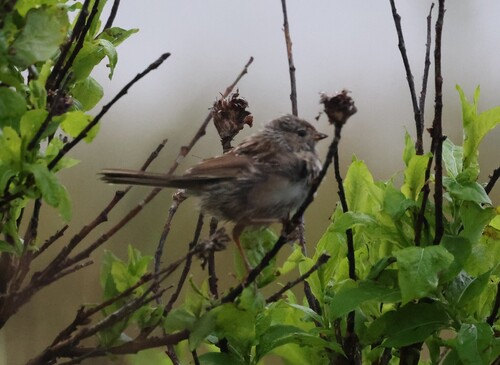
Research-grade observations from iNaturalist (within ~15 mi).
Nearest stream gauge
Events
Gallery
Sources
- • Wikipedia
- • NOAA National Weather Service
- • Wikidata
- • USGS Earthquake Catalog (global feed)
- • NCES via Urban Institute Education Data Portal
- • iNaturalist
- • CDC PLACES
- • Open-Elevation
- • Open-Meteo / sunrise-sunset.org
- • Wikipedia Pageviews API
- • Open Library