Browse / United States / California / Fort Bragg
Fort Bragg
Californiacity

Fort Bragg
Total population
7,032
Median home value
$535,400
Bachelor's+
Median income
$56,481
Demographic figures from US Census Bureau · ACS 5-year estimates. Overview below cites Wikipedia and may reference a different year.
City facts
Sister cities
Facts from Wikidata (CC0).
Overview
Fort Bragg is a city along the North Coast of California in Mendocino County. The city is 24 miles (39 km) west of Willits, at an elevation of 85 feet (26 m). Its population was 6,983 at the 2020 census.
Read more on WikipediaHistory & geography
History
The area known as Fort Bragg was home to Native Americans since before Western expansion, most of whom belong to the Pomo tribe. They historically were hunter-gatherers who lived along the northern coast of California. In 1855, an exploration party from the Bureau of Indian Affairs visited the area looking for a site on which to establish a reservation; in the spring of 1856, the Mendocino Indian Reservation was established at Noyo. It was in size, and its boundary extended north from what became Simpson Lane to Abalobadiah Creek and east from the Pacific Ocean to Bald Hill. In the summer of 1857, 1st Lt. Horatio G. Gibson, then serving at the Presidio of San Francisco, established a military post on the reservation, approximately north of the Noyo River, and named it for his former commanding officer Capt. Braxton Bragg, who later became a General in the Army of the Confederacy. Gibson and Company M, 3rd Artillery, left Fort Bragg in January 1859 to be replaced by Company D, 6th Infantry, which stayed for two years and continued to build up the post. In June 1862, Company D, 2nd California Infantry, were ordered to garrison the post and remained until 1864. In October of that year, the Fort Bragg garrison was loaded aboard the steamer Panama and completed the evacuation and abandonment of Mendocino County's first military post. The Mendocino Indian Reservation was discontinued in March 1866, and the land was opened for settlement three years later. The last remaining building of the Fort Bragg military post is located at 430 North Franklin Street. It may have been the Quartermaster's storehouse and commissary or surgeon's quarters or hospital. The approximate boundaries of the fort extend from the south side of Laurel, east from the railroad depot to the…
Geography
Fort Bragg has an average elevation of above sea level. According to the United States Census Bureau, the city has a total area of , of which is land and , comprising 1.14%, is water.
Excerpted from the corresponding Wikipedia article (CC BY-SA).
Demographics & economy
Race & ethnicity
Source: US Census Bureau — American Community Survey, 5-year estimates.
Geography
Coordinates & boundaries from the US Census TIGER/Line shapefiles.
Climate
Air quality
Industrial & pollution facilities
Natural hazard risk
Health (adults)
Age-adjusted prevalence estimates from CDC PLACES (latest release).
Walkability
Amenities nearby
Wildlife & biodiversity
Schools
Largest nearby schools
- Fort Bragg HighHigh · Fort Bragg · 524 students · 16.4:1 ratio
- Fort Bragg MiddleMiddle · Fort Bragg · 392 students · 17.8:1 ratio
- Dana Gray ElementaryElementary · Fort Bragg · 365 students · 21.5:1 ratio
- Redwood ElementaryElementary · Fort Bragg · 353 students · 16.8:1 ratio
- Mendocino K-8Elementary · Mendocino · 250 students · 13.9:1 ratio
- Mendocino HighHigh · Mendocino · 165 students · 10.3:1 ratio
- Three Rivers CharterElementary · Fort Bragg · 82 students · 20.5:1 ratio
- Noyo High (Continuation)High · Fort Bragg · 26 students · 26:1 ratio
Public K–12 schools within ~10 mi from Urban Institute Education Data Portal (NCES Common Core of Data, 2022).
Earthquake history
Photos
Sights & places nearby
Notable people from here
Nearby places in California
Geography & sun
Elevation, sunrise/sunset and daylight from Open-Meteo. Solar climatology from NASA POWER.
Nearby airports
Public attention
Pageview totals from the Wikimedia Pageviews API.
Books about Fort Bragg
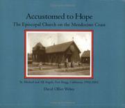
Search results from Open Library.
Recent natural events nearby
Ground air-quality sensors
Recently spotted species
Nearest stream gauge
Events
Gallery
Sources
- • Wikipedia
- • US Census Bureau (ACS 5-year estimates)
- • Wikidata
- • NCES via Urban Institute Education Data Portal
- • CDC PLACES
- • Open-Meteo / sunrise-sunset.org
- • Wikipedia Pageviews API
- • Open Library