Browse / United States / California / San Jose
San Jose
Californiacity

San Jose
Total population
997,395
Median home value
$1,271,200
Bachelor's+
Median income
$148,226
Founded
1777
Air quality index
Demographic figures from US Census Bureau · ACS 5-year estimates. Overview below cites Wikipedia and may reference a different year.
- Heat Advisory · ModerateHeat Advisory issued October 5 at 9:29AM PDT until October 8 at 10:00PM PDT by NWS San Francisco CA
Source: NOAA National Weather Service.
City facts
Facts from Wikidata (CC0).
Overview
San Jose, officially the City of San José, is the most populous city in the San Francisco Bay Area and Northern California, and the 13th-most populous in the United States, with an estimated 989,814 residents as of 2025. The city's metropolitan area is home to nearly two million people, while the broader combined statistical area has a population of over nine million. Located in Santa Clara Valley on the southern shore of San Francisco Bay, San Jose covers an area of 179.97 sq mi (466.1 km2) and is the county seat of Santa Clara County.
Read more on WikipediaHistory & geography
History
San Jose, along with most of the Santa Clara Valley, has been home to the Tamien tribe of the Ohlone people since around 4,000 BC. The Tamien spoke Tamyen language of the Ohlone language family. During the era of Spanish colonization and the subsequent building of Spanish missions in California, the Tamien people's lives changed dramatically. From 1777 onward, most of the Tamien people were forcibly enslaved at Mission Santa Clara de Asís or Mission San José where they were baptized and educated to be Catholic neophytes, also known as Mission Indians. This continued until the mission was secularized by the Mexican Government in 1833. A large majority of the Tamien died either from disease in the missions, or as a result of the state sponsored genocide. Some surviving families remained intact, migrating to Santa Cruz after their ancestral lands were granted to Spanish and Mexican Immigrants. California was claimed as part of the Spanish Empire in 1542, when explorer Juan Rodríguez Cabrillo charted the Californian coast. During this time Alta California and the Baja California peninsula were administered together as Province of Las Californias. For nearly 200 years, the Californias remained a distant frontier region largely controlled by the numerous Native Nations and largely ignored by the government of the Viceroyalty of New Spain in Mexico City. Shifting power dynamics in North America—including the British/American victory and acquisition of North America, east of the Mississippi following the 1763 Treaty of Paris, as well as the start of Russian colonization of northwestern North America— prompted Spanish/Mexican authorities to sponsor the Portolá Expedition to survey Northern California in 1769. In 1776, the Californias were included as part of the Captaincy…
Geography
San Jose is located within the Santa Clara Valley, in the southern part of the Bay Area in Northern California. The northernmost portion of San Jose touches San Francisco Bay at Alviso, though most of the city lies away from the bayshore. According to the United States Census Bureau, the city has a total area of , making it the fourth-largest city in California by land area (after Los Angeles, San Diego, and California City). The most serious earthquake, in 1906, damaged many buildings in San Jose as described earlier. Earlier significant quakes rocked the city in 1839, 1851, 1858, 1864, 1865, 1868, and 1891. The Daly City Earthquake of 1957 caused some damage. The Loma Prieta earthquake of 1989 also did some damage to parts of the city. San Jose's expansion was made by the design of "Dutch" Hamann, the City Manager from 1950 to 1969. During his administration, with his staff referred to as "Dutch's Panzer Division", the city annexed property 1,389 times, growing the city from , absorbing the communities named above, changing their status to "neighborhoods." Sales taxes were a chief source of revenue. Hamann would determine where major shopping areas would be, and then annex narrow bands of land along major roadways leading to those locations, pushing "tentacles" or "finger areas" across the Santa Clara Valley and, in turn, walling off the expansion of adjacent communities. During his reign, it was said the City Council would vote according to Hamann's nod. In 1963, the State of California imposed Local Agency Formation Commissions statewide, but largely to try to maintain order with San Jose's aggressive growth. Eventually the political forces against growth grew as local neighborhoods bonded together to elect their own candidates, ending Hamann's influence and…
Excerpted from the corresponding Wikipedia article (CC BY-SA).
Demographics & economy
Race & ethnicity
Source: US Census Bureau — American Community Survey, 5-year estimates.
Geography
Coordinates & boundaries from the US Census TIGER/Line shapefiles.
Climate
10-year averages from ERA5 reanalysis (Open-Meteo).
Current forecast
Forecast for San Jose, CA from NOAA NWS API.
Air quality
Current readings from Open-Meteo Air Quality API (Copernicus CAMS European reanalysis).
Industrial & pollution facilities
Natural hazard risk
Health (adults)
Age-adjusted prevalence estimates from CDC PLACES (latest release).
Walkability
Amenities nearby
Wildlife & biodiversity
Most-observed species
- House FinchHaemorhous mexicanus (P.L.Statius Müller, 1776) · Aves52,137
- Anna's HummingbirdCalypte anna (R.Lesson, 1829) · Aves51,115
- American CrowCorvus brachyrhynchos C.L.Brehm, 1822 · Aves47,335
- Black PhoebeSayornis nigricans (Swainson, 1827) · Aves44,241
- California TowheeMelozone crissalis (Vigors, 1839) · Aves41,791
- Turkey VultureCathartes aura (Linnaeus, 1758) · Aves34,469
- Lesser GoldfinchSpinus psaltria (Say, 1822) · Aves34,415
- Mourning DoveZenaida macroura (Linnaeus, 1758) · Aves33,356
Citizen-science & research observations from the Global Biodiversity Information Facility (GBIF).
Schools
Largest nearby schools
- Evergreen Valley HighHigh · San Jose · 2,767 students · 24.3:1 ratio
- Independence HighHigh · San Jose · 2,517 students · 22.1:1 ratio
- Silver Creek HighHigh · San Jose · 2,315 students · 24.6:1 ratio
- Santa Teresa HighHigh · San Jose · 2,196 students · 22.6:1 ratio
- Branham HighHigh · San Jose · 1,990 students · 24.3:1 ratio
- Piedmont Hills HighHigh · San Jose · 1,925 students · 22.9:1 ratio
- Santa Clara HighHigh · Santa Clara · 1,849 students · 20.1:1 ratio
- Leigh HighHigh · San Jose · 1,812 students · 24.8:1 ratio
Public K–12 schools within ~10 mi from Urban Institute Education Data Portal (NCES Common Core of Data, 2022).
Earthquake history
Most recent
- M 2.59 — 2026-09-172 km ENE of Aromas, CA
- M 2.62 — 2026-09-1721 km E of Alum Rock, CA
- M 2.99 — 2026-09-149 km SW of Brentwood, CA
- M 2.55 — 2026-09-139 km SW of Brentwood, CA
- M 3.36 — 2026-09-129 km SW of Brentwood, CA
- M 2.53 — 2026-09-102 km ESE of Oakland, CA
Events from the USGS Earthquake Catalog (global) (FDSN Event Web Service).
Photos
Sights & places nearby
Notable people from here


People born within ~10 km, from Wikidata (CC0). Click any name for their Wikipedia article.
Nearby places in California
- East Foothills6 mi away · pop. 7,139
- Lompico18.1 mi away
- Los Altos Hills18.5 mi away · pop. 8,377
- Ben Lomond21.3 mi away · pop. 6,858
- Mount Hermon21.4 mi away
- Felton23 mi away · pop. 4,093
- Pasatiempo23.3 mi away
- Portola Valley23.5 mi away
- Paradise Park23.6 mi away
- Rio del Mar23.7 mi away · pop. 9,201
- La Honda24.4 mi away
- North Fair Oaks24.7 mi away
Geography & sun
Elevation, sunrise/sunset and daylight from Open-Meteo. Solar climatology from NASA POWER.
Nearby airports
Public attention
Pageview totals from the Wikimedia Pageviews API.
Books about San Jose


Search results from Open Library.
Recent natural events nearby
- Wildfire Timber, Monterey, CaliforniaWildfires · 2026-08-09 · 75 mi
- Wildfire GANN, Calaveras, CaliforniaWildfires · 2026-08-03 · 80 mi
- Wildfire Plaskett, Monterey, CaliforniaWildfires · 2026-08-26 · 99 mi
- Wildfire DOME, Mariposa, CaliforniaWildfires · 2026-09-15 · 122 mi
- Wildfire LUCAS, Lake, CaliforniaWildfires · 2026-09-10 · 148 mi
- Wildfire LUCAS, Lake, CaliforniaWildfires · 2026-09-10 · 149 mi
- Prescribed Fire CRAWFORD CORRAL RX, Tulare, CaliforniaWildfires · 2026-09-19 · 164 mi
- Wildfire PLAINS, San Luis Obispo, CaliforniaWildfires · 2026-08-12 · 164 mi
Wildfires, storms and other events from NASA EONET (last 12 months, within 250 mi).
Ground air-quality sensors
Recently spotted species
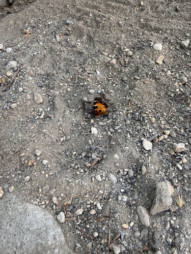
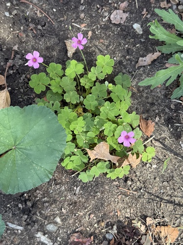
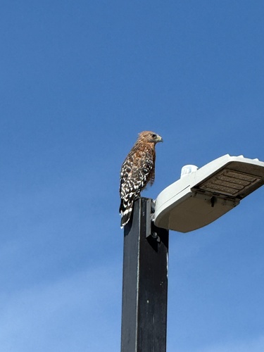
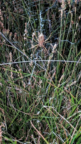
Research-grade observations from iNaturalist (within ~15 mi).
Nearest stream gauge
Events
Notable, recurring, and historical events associated with San Jose, sourced from Wikidata.
- Jul 1, 2011
- Jul 1, 1983
- 01SJ Biennialfestival
Source: Wikidata (CC0).
Gallery
Geotagged photos within ~6 miles of San Jose, from Wikimedia Commons contributors.
 0.8 mi
 0.8 mi
 0.8 mi
 0.8 mi
 0.8 mi
 0.8 mi
 0.9 mi
 0.9 mi
 0.9 mi
 0.9 mi
 1.1 mi
 1.1 mi
 1.1 mi
 1.2 mi
 1.2 mi
 1.3 mi
 1.3 mi
1990.jpg) 1.3 mi
1.3 mi_1991.jpg) 1.3 mi
1.3 mi_1992.jpg) 1.3 mi
1.3 mi 1.3 mi
 1.3 mi
 1.4 mi
 1.4 mi
Photos via Wikimedia Commons — see each image page for license & attribution.
Sources
- • Wikipedia
- • US Census Bureau (ACS 5-year estimates)
- • Open-Meteo (ERA5 reanalysis)
- • NOAA National Weather Service
- • Wikimedia Commons
- • Wikidata
- • Open-Meteo Air Quality (CAMS)
- • USGS Earthquake Catalog (global feed)
- • NCES via Urban Institute Education Data Portal
- • GBIF (Global Biodiversity Information Facility)
- • iNaturalist
- • CDC PLACES
- • Open-Elevation
- • Open-Meteo / sunrise-sunset.org
- • Wikipedia Pageviews API
- • Open Library
- • NASA EONET