Browse / Côte d'Ivoire / Abidjan / Abidjan
Abidjan
Abidjancity

Abidjan
Total population
7,567,409
Founded
1898
Air quality index
Demographic figures from Institut National de la Statistique (Côte d'Ivoire). Overview below cites Wikipedia and may reference a different year.
City facts
Sister cities
Facts from Wikidata (CC0).
Overview
Abidjan is the largest city and the former capital of Ivory Coast. As of the 2021 census, Abidjan's population was 6.3 million, which is 21.5 percent of the overall population of the country, making it the sixth most populous city proper in Africa, after Lagos, Cairo, Kinshasa, Dar es Salaam, and Johannesburg. A cultural crossroads of West Africa, Abidjan is characterised by a high level of industrialisation and urbanisation. It is the most populous French-speaking city in West Africa.
Read more on WikipediaHistory & geography
History
Abidjan was originally a small Atchan fishing village. In 1896, following a series of deadly yellow fever epidemics, French colonists who had initially settled in Grand-Bassam decided to move to a safer place and in 1898 chose the current location of Abidjan. In 1903 it officially became a town. The settlers were followed by the colonial government, created in 1899. But then nearby Bingerville became the capital of the French colony, from 1900 until 1934. The future Abidjan, situated on the edge of the lagoon n'doupé ("the lagoon in hot water"), offered more land and greater opportunities for trade expansion. The wharf in Petit Bassam (now Port-Bouët) south of town quickly overtook the wharf of Grand-Bassam in importance, and became the main point of economic access to the colony. In 1904, the rail terminus was located in the Port-Bouët area of Abidjan. Several villages in Tchaman were then deserted. The leader of the Tchaman community can still be found in Adjame ("center" or "meeting" in Tchaman), north of the Plateau. South of the Plateau district (the current central district of the city of Abidjan), the village of Dugbeo was moved across the lagoon to Anoumabo, "the forest of fruit bats", which became the neighborhood of Treichville (now known as Commikro, city of clerks). Treichville was renamed in 1934, in honour of Marcel Treich-Laplène (1860–1890), the first explorer of the Ivory Coast and its first colonial administrator, considered its founder. Instead of Dugbeyo, is the current Treich-Laplénie Avenue, the bus station and water lagoon buses in Plateau, and the Avenue Charles de Gaulle (commonly called Rue du Commerce). The city was laid out like most colonial towns, on a grid plan. Le Plateau ("m'brato" in Tchaman) were inhabited by settlers. In the…
Geography
Abidjan lies on the south-east coast of the country, on the Gulf of Guinea. The city is located on the Ébrié Lagoon. The business district, Le Plateau, is the center of the city, along with Cocody, Deux Plateaux (the city's wealthiest neighborhood and a hub for diplomats), and Adjamé, a slum on the north shore of the lagoon. Treichville and Marcory lie to the south, Attecoube, Locodjro, Abobo Doume and Yopougon to the west, and Île Boulay is located in the middle of the lagoon. Further south lies Port Bouët, home to the airport and main seaport. Abidjan is located at 5°25' North, 4°2' West (5.41667, –4.03333). Abidjan experiences a tropical wet and dry climate, according to the Köppen climate classification (Köppen climate classification: Aw), closely bordering a tropical monsoon climate. Abidjan has nonconsecutive rainy seasons (precipitation above with a long rainy season from March to July and a short rainy season from September to December, and three dry months (January, February and August). Precipitation is abundant during the summer months, except for August, due to activation of the Benguela Current, which reduces the precipitation total throughout the month. The Benguela Current also lowers the mean temperature during August, making it the coolest month of the year, averaging . Abidjan has two additional dry months (January and February). Abidjan is generally humid, with average relative humidity above 80% throughout the year. {|class="wikitable" |+Abidjan mean sea temperature |- !Jan !Feb !Mar !Apr !May !Jun !Jul !Aug !Sep !Oct !Nov !Dec |- | | | | | | | | | | | | |} A 2019 paper published in PLOS One estimates that under Representative Concentration Pathway 4.5, a "moderate" scenario of climate change where global warming reaches ~ by 2100, the climate…
Excerpted from the corresponding Wikipedia article (CC BY-SA).
Geography
Coordinates & boundaries from the US Census TIGER/Line shapefiles.
Climate
Air quality
Current readings from Open-Meteo Air Quality API (Copernicus CAMS European reanalysis).
Walkability
Amenities nearby
Wildlife & biodiversity
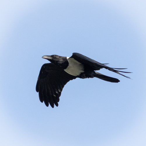
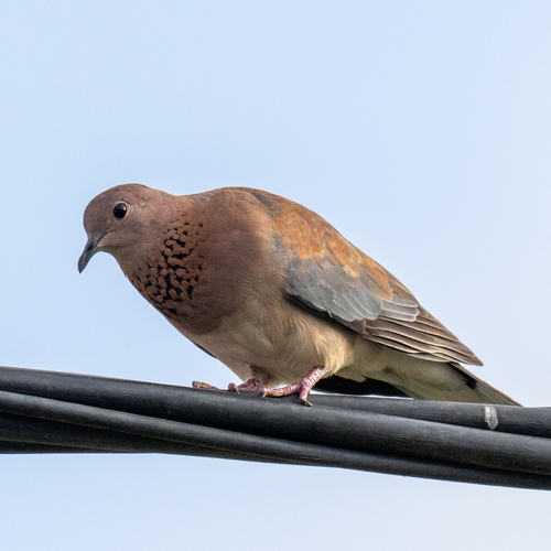
Most-observed species
- Pied CrowCorvus albus Statius Muller, 1776 · Aves228
- Cattle EgretBubulcus ibis (Linnaeus, 1758) · Aves220
- Red-eyed DoveStreptopelia semitorquata (Rüppell, 1837) · Aves207
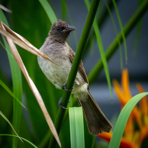
- Common BulbulPycnonotus barbatus (Desfontaines, 1789) · Aves205
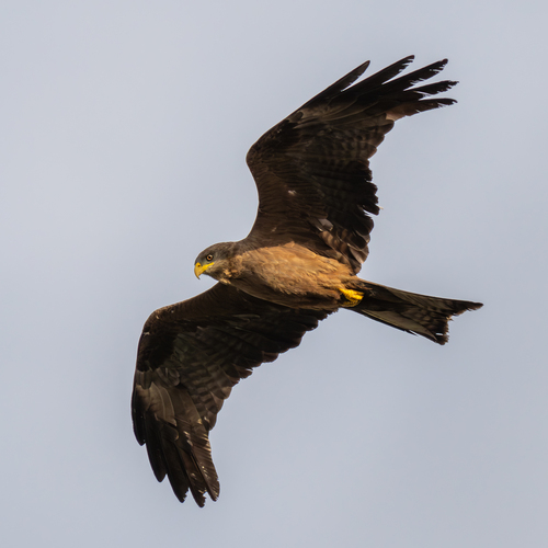
- Black KiteMilvus migrans (Boddaert, 1783) · Aves198
- Laughing DoveSpilopelia senegalensis (Linnaeus, 1766) · Aves163
- Woodland KingfisherHalcyon senegalensis (Linnaeus, 1766) · Aves128
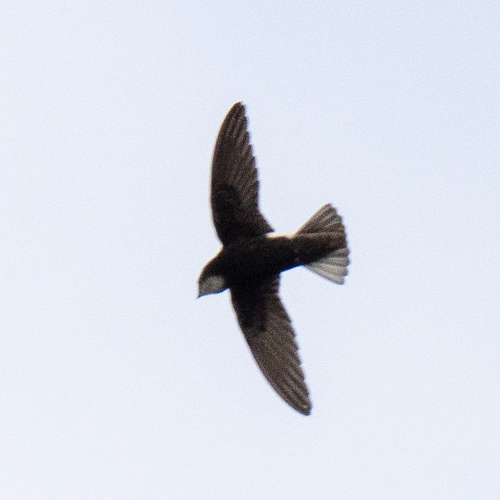
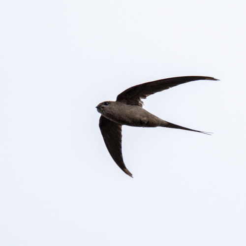
- African Palm-SwiftCypsiurus parvus (M.H.K.Lichtenstein, 1823) · Aves123
Citizen-science & research observations from the Global Biodiversity Information Facility (GBIF).
Earthquake history
Events from the USGS Earthquake Catalog (global) (FDSN Event Web Service).
Photos
Sights & places nearby
Notable people from here


People born within ~10 km, from Wikidata (CC0). Click any name for their Wikipedia article.
Nearby places in Abidjan
- Fitzgerald6499.2 mi away · pop. 9
- Cherry Grove6556.3 mi away
- Fort McKay6557.1 mi away · pop. 742
- Janvier South6558.1 mi away · pop. 100
- Beaver Crossing6560.9 mi away
- Beaver River6563.3 mi away
- Beaverdam6567.9 mi away
- Conklin6569 mi away · pop. 185
- Happy Hollow6571.8 mi away
- Ardmore6572 mi away
- Fort Kent6577.3 mi away
- Durlingville6579.6 mi away
Geography & sun
Elevation, sunrise/sunset and daylight from Open-Meteo. Solar climatology from NASA POWER.
Nearby airports
Public attention
Pageview totals from the Wikimedia Pageviews API.
Books about Abidjan
Search results from Open Library.
Recent natural events nearby
Ground air-quality sensors
Recently spotted species
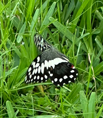
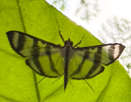
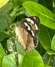
Research-grade observations from iNaturalist (within ~15 mi).
Events
Notable, recurring, and historical events associated with Abidjan, sourced from Wikidata.
- Q138634599festival
- Q136379143festival
Source: Wikidata (CC0).
Gallery
Geotagged photos within ~6 miles of Abidjan, from Wikimedia Commons contributors.
 0 mi
0 mi 0 mi
0 mi 0 mi
0 mi 0 mi
0 mi 0 mi
0 mi 0 mi
0 mi 0 mi
0 mi 0 mi
0 mi 0 mi
0 mi 0.1 mi
 0.1 mi
 0.1 mi
 0.1 mi
 0.1 mi
 0.1 mi
 0.1 mi
 0.1 mi
 0.1 mi
 0.2 mi
 0.2 mi
 0.2 mi
 0.2 mi
 0.2 mi
 0.2 mi
Photos via Wikimedia Commons — see each image page for license & attribution.
Sources
- • Wikipedia
- • Wikimedia Commons
- • Wikidata
- • Open-Meteo Air Quality (CAMS)
- • USGS Earthquake Catalog (global feed)
- • GBIF (Global Biodiversity Information Facility)
- • iNaturalist
- • Open-Elevation
- • Open-Meteo / sunrise-sunset.org
- • Wikipedia Pageviews API
- • Open Library
- • Wikidata SPARQL (CC0) — population, area, elevation, inception, head of government, Commons image