Browse / Ireland / Westmeath / Athlone
Athlone
Westmeathtown

Athlone
Total population
22,869
Demographic figures from Central Statistics Office (Ireland). Overview below cites Wikipedia and may reference a different year.
City facts
Sister cities
Facts from Wikidata (CC0).
Overview
Athlone is a town on the border of County Roscommon and County Westmeath, Ireland. It is located on the River Shannon near the southern shore of Lough Ree. It is the second most populous town in the Midlands Region with a population of 22,869 in the 2022 census.
Read more on WikipediaHistory & geography
History
{{Historical populations |state=collapsed |1821|7543 |1831|11406 |1841|6393 |1851|6199 |1861|5902 |1871|6565 |1881|6755 |1891|6742 |1901|6617 |1911|7472 |1926|7540 |1936|7257 |1946|8379 |1951|9015 |1956|10369 |1961|10767 |1966|10987 |1971|11611 |1981|14426 |1986|15571 |1991|15358 |1996|15544 |2002|15936 |2006|17544 |2011|20153 |2016|21349 |2022|22869 |footnote= Throughout the wars that wracked Ireland in the 17th century, Athlone contained the vital, main bridge over the River Shannon into Connacht. During the Irish Confederate Wars (1641–53), the town was held by Irish Confederate troops until it was taken in late 1650 by Charles Coote, who attacked the town from the west, having crossed into Connacht at Sligo. Forty years later, during the pan-European War of the Grand Alliance (1688–97), the town was again of key strategic importance. In the Irish phase of the conflict (the Williamite War in Ireland of 1688–1691), Athlone was one of the Jacobite strongholds that defended the river-crossings into the Jacobite-held Province of Connacht following the Battle of the Boyne on 1 July 1690. That same year, Colonel Richard Grace's Jacobite forces in Athlone repelled an attack by 10,000 men led by Commander Douglas. In the following year's campaign, the Siege of Athlone saw a further assault by a larger allied force, during which the invading troops of King William and Queen Mary eventually overran the entire city. The defenders were forced to flee further west, toward the River Suck, at such speed that eyewitness accounts record that they "flung their cannons into the morass" as they fled. The most recently discovered account of the Siege of Athlone, written after the attack, on 5 July 1691, was found in 2004 in an archive in the Netherlands. The account was penned by the…
Excerpted from the corresponding Wikipedia article (CC BY-SA).
Geography
Coordinates & boundaries from the US Census TIGER/Line shapefiles.
Climate
Air quality
Walkability
Amenities nearby
Wildlife & biodiversity
Earthquake history
Photos
Sights & places nearby
Notable people from here


People born within ~10 km, from Wikidata (CC0). Click any name for their Wikipedia article.
Nearby places in Westmeath
Geography & sun
Elevation, sunrise/sunset and daylight from Open-Meteo. Solar climatology from NASA POWER.
Nearby airports
Public attention
Pageview totals from the Wikimedia Pageviews API.
Books about Athlone
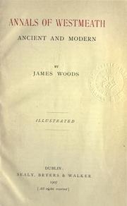
Search results from Open Library.
Recent natural events nearby
Ground air-quality sensors
Recently spotted species
Events
Gallery
Sources
- • Wikipedia
- • Wikidata
- • Open-Meteo / sunrise-sunset.org
- • Wikipedia Pageviews API
- • Open Library