Browse / Ireland / Westmeath / Fore
Fore
Westmeathvillage

Featured view
Fore
Elevation101 m
Coordinates53.68°, -7.23°
Demographic figures from Central Statistics Office (Ireland). Overview below cites Wikipedia and may reference a different year.
Loading additional data from public sources…0 / 11
CensusWikipediaWeatherPlacesPeopleEnvironmentHealth & SchoolsRelatedGeography & CultureLive MonitoringEvents & Gallery
0% completeCity facts
Elevation
101 m
Facts from Wikidata (CC0).
Overview
Fore is a village, next to the old Benedictine Abbey ruin of Fore Abbey, situated to the north of Lough Lene in County Westmeath, in Ireland. The nearest town is Castlepollard, 5 km to the west.
Read more on WikipediaHistory & geography
Geography
Latitude
53.6805
Longitude
-7.2263
Water area
—
Coordinates & boundaries from the US Census TIGER/Line shapefiles.
Climate
Air quality
Walkability
Amenities nearby
Wildlife & biodiversity
Earthquake history
Photos
Sights & places nearby
Notable people from here
D
Donie Cassidy
Irish politician and businessman

Paul Gogarty
Irish politician
D
Denis ApIvor
British composer (1916–2004)
D
Derek McNicholas
Irish hurler

Maurice Dease
recipient of the Victoria Cross
P
Peter Kelly
Irish Fianna Fáil politician (1944-2019)
S
Samuel Holt
Irish politician

Thomas William Drumm
Catholic bishop (1871–1933)
W
William Pollard-Urquhart
British politician
M
Michael Kennedy
Irish politician
T
Tommy Ring
Irish hurler
M
Michael Cosgrove
Irish hurler
K
Killian Cosgrove
Irish hurler
S
Shane McGovern
Irish hurler
D
Darren McCormack
Irish hurler and Gaelic football player
A
Annie Lynch
Irish-Australian Religious and hospital administrator
People born within ~10 km, from Wikidata (CC0). Click any name for their Wikipedia article.
Nearby places in Westmeath
Geography & sun
Avg solar (kWh/m²/day)
2.74
Annual solar (kWh/m²)
1,001
Elevation, sunrise/sunset and daylight from Open-Meteo. Solar climatology from NASA POWER.
Nearby airports
Public attention
Wikipedia views (last 30 days)
92
Avg daily Wikipedia views
3
Attention level
Obscure
Pageview totals from the Wikimedia Pageviews API.
Books about Fore
Medieval Fore, County Westmeath
Rory Masterson · 2014
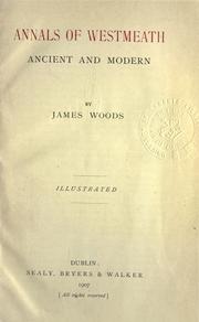
Annals of Westmeath
Woods, James · 1907
Fore, Co. Westmeath
Harold Graham Leask · 1930

Fore, its history and buildings
Olive Sharkey · 1999
Search results from Open Library.
Recent natural events nearby
Ground air-quality sensors
Recently spotted species
Events
Gallery
Sources
- • Wikipedia
- • Wikidata
- • Open-Meteo / sunrise-sunset.org
- • Wikipedia Pageviews API
- • Open Library