Browse / Ireland / Westmeath / Street
Street
Westmeathvillage

Featured view
Street
Coordinates53.68°, -7.49°
Demographic figures from Central Statistics Office (Ireland). Overview below cites Wikipedia and may reference a different year.
Loading additional data from public sources…0 / 11
CensusWikipediaWeatherPlacesPeopleEnvironmentHealth & SchoolsRelatedGeography & CultureLive MonitoringEvents & Gallery
0% completeCity facts
Overview
Street or Streete is a village and parish in County Westmeath, Ireland. It lies on the regional road between Lismacaffery and Rathowen. Its Irish name was historically anglicised as Straid or Strade before it became Street or Streete.
Read more on WikipediaHistory & geography
Geography
Latitude
53.6826
Longitude
-7.4897
Water area
—
Coordinates & boundaries from the US Census TIGER/Line shapefiles.
Climate
Air quality
Walkability
Amenities nearby
Wildlife & biodiversity
Earthquake history
Photos
Sights & places nearby
Notable people from here
Nearby places in Westmeath
Geography & sun
Avg solar (kWh/m²/day)
2.74
Annual solar (kWh/m²)
1,001
Elevation, sunrise/sunset and daylight from Open-Meteo. Solar climatology from NASA POWER.
Nearby airports
Public attention
Wikipedia views (last 30 days)
109
Avg daily Wikipedia views
4
Attention level
Obscure
Pageview totals from the Wikimedia Pageviews API.
Books about Street
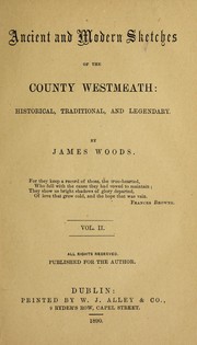
Ancient and modern sketches of the County Westmeath
Woods, James · 1890
A full and complete report of the trial, the King, at the prosecution of the Marquis of Westmeath, against Anne Connell, John Monaghan, Bernard Maguire, Patrick Farley, and William M'Kenzie
Anne Connell · 1825
The central area in the Irish town
Brian Callanan · 1973
Parnham's 1911 census references for Ireland
John T. Parnham · 1996

Report of the debate in the House of Commons of Ireland on Friday the 14th of February, 1800, on the subject of a legislative union with Great Britain
Ireland. Parliament. House of Commons · 1800
Search results from Open Library.
Recent natural events nearby
Ground air-quality sensors
Recently spotted species
Events
Gallery
Sources
- • Wikipedia
- • Open-Meteo / sunrise-sunset.org
- • Wikipedia Pageviews API
- • Open Library