Browse / India / West Bengal / Adra
Adra
West Bengaltown

Adra
Total population
5,000
Demographic figures from Ministry of Statistics (India). Overview below cites Wikipedia and may reference a different year.
City facts
Facts from Wikidata (CC0).
Overview
Adra is a town and a railway colony situated in the Raghunathpur subdivision of Purulia district in the Indian state of West Bengal. It was well known for its Anglo-Indian population. It is also an important town of north east Purulia. Adra is also a well known railway divisional headquarter of South Eastern Railways.
Read more on WikipediaHistory & geography
Geography
The major sub-divisions of Adra are Agradoot, Subhasnagar, Beniasole, Sixty Four Unit, Palashkola, Kantaranguni, Jhariadih, Panchudanga, Mission para, Laldanga, Daulatpur, Arabinda Pally and SER colonies (North and South). Purulia district forms the lowest step of the Chota Nagpur Plateau. The general scenario is undulating land with scattered hills. Raghunathpur subdivision occupies the northern part of the district. 83.80% of the population of the subdivision lives in rural areas. However, there are pockets of urbanization and 16.20% of the population lives in urban areas. There are 14 census towns in the subdivision. It is presented in the map given alongside. There is a coal mining area around Parbelia and two thermal power plants are there – the 500 MW Santaldih Thermal Power Station and the 1200 MW Raghunathpur Thermal Power Station. The subdivision has a rich heritage of old temples, some of them belonging to the 11th century or earlier. The Banda Deul is a monument of national importance. The comparatively more recent in historical terms, Panchkot Raj has interesting and intriguing remains in the area. Note: The map alongside presents some of the notable locations in the subdivision. All places marked in the map are linked in the larger full screen map. Adra is the divisional headquarters of the Adra division of South Eastern Railway. The economy of the town is driven by the presence of the railways there. It is one of the three important coal loading divisions (the other two being Bilaspur and Dhanbad) which supply coal to power plants across India. An important railway junction, Adra railway station connects to Asansol on the Howrah-Delhi Main Line, Tatanagar on the Howrah-Nagpur-Mumbai line, Kharagpur on the Kolkata-Chennai and Kolkata-Mumbai lines, and…
Excerpted from the corresponding Wikipedia article (CC BY-SA).
Geography
Coordinates & boundaries from the US Census TIGER/Line shapefiles.
Climate
Air quality
Walkability
Amenities nearby
Wildlife & biodiversity
Earthquake history
Photos
Sights & places nearby
Notable people from here
People born within ~10 km, from Wikidata (CC0). Click any name for their Wikipedia article.
Nearby places in West Bengal
- Raghunathpur2.8 mi away · pop. 10,000
- Kashipur4.4 mi away
- Saltora16.6 mi away · pop. 1,000
- Sitarampur20.8 mi away
- Chhatna22.5 mi away
- Purulia22.7 mi away · pop. 121,100
- Asansol23.1 mi away · pop. 500,000
- Chittaranjan28.2 mi away
- Indpur28.3 mi away
- Bankura30.7 mi away · pop. 137,400
- Andal32.8 mi away
- Ukhra37.5 mi away
Geography & sun
Elevation, sunrise/sunset and daylight from Open-Meteo. Solar climatology from NASA POWER.
Nearby airports
Public attention
Pageview totals from the Wikimedia Pageviews API.
Books about this place
Recent natural events nearby
Ground air-quality sensors
Recently spotted species



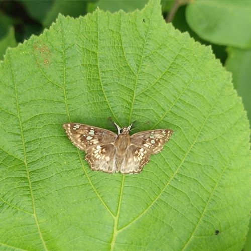


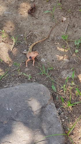


Research-grade observations from iNaturalist (within ~15 mi).
Events
Gallery
Sources
- • Wikipedia
- • Wikidata
- • iNaturalist
- • Open-Meteo / sunrise-sunset.org
- • Wikipedia Pageviews API