Browse / United States / Massachusetts / Granby
Granby
MassachusettsCDP

Granby
Total population
1,152
Median home value
$340,100
Bachelor's+
Median income
$135,750
Air quality index
Demographic figures from US Census Bureau · ACS 5-year estimates. Overview below cites Wikipedia and may reference a different year.
City facts
Facts from Wikidata (CC0).
Overview
Granby is a town in Hampshire County, Massachusetts, United States. The population was 6,110 at the 2020 census. It is part of the Springfield, Massachusetts Metropolitan Statistical Area. The census-designated place of Granby corresponds to the main village of Granby in the center of the town.
Read more on WikipediaHistory & geography
History
Granby was once part of Hadley, as were other towns, as part of Hadley Equivalent Lands. Old Hadley was first settled in 1659 by people from Hartford and Wethersfield, Connecticut. These settlers left Connecticut because of religious differences within their communities. John Pynchon was commissioned to buy wilderness land for their new community. In 1658, Pynchon negotiated a deed with three Norwottuck sachems: Chickwalloppe (alias Wawhillowa), Umpanchela (alias Womscom), and Quonquont (alias Wompshaw). The deed reserved land for a cornfield for the Norwottuck and promised rights to hunt, fish and set up wigwams within the negotiated land. Ownership was transferred to the settlers and confirmed by the General Court. These original boundaries include part of present-day Granby. In August 1662, Pynchon negotiated a deed with Awonunsk, her husband Wequagon, and her son Squomp, for land also in present-day Granby, South Hadley and Belchertown. Ownership was transferred to the settlers and Awonunsk and her family were paid in 150 fathoms of wampum (approximately 54,000 wampum beads), 10 coats, and 2 yards of cloth, among other items. The deed also promised rights for the Norwottuck to hunt, fish, collect wood, and set up wigwams on the commons. Granby was settled in 1727. In November 1727, residents of what are now South Hadley and Granby petitioned the General Court to form a precinct within the Town of Hadley. This petition was granted on July 4, 1732, creating Hadley's South Precinct. In 1753, the precinct was granted district status. From 1751 through 1761, the district was deadlocked over whether to build a new meetinghouse west of Cold Hill, in present-day South Hadley, or to its east, in present-day Granby. In the Summer of 1761, the district's west side began…
Geography
According to the United States Census Bureau, the town has a total area of , of which are land and , or 0.92%, is water. Granby is bordered by South Hadley to the west, Amherst to the north, Belchertown to the east, and Ludlow and Chicopee to the south. Two highways pass through the town: U.S. Route 202 runs eastward though town from South Hadley to Belchertown on East State Street and West State Street, while Route 116 runs northeastward from South Hadley to Amherst along Amherst Road. Granby is north of Springfield, the largest city in western Massachusetts. The Holyoke Range is in the northern part of Granby. Major peaks within the town are Long Mountain and Mount Norwottuck. Norwottuck is the highest point in town at above sea level. The Metacomet-Monadnock Trail runs along this mountain range as it passes through Granby. The Horse Caves are geological ledges along this trail.
Excerpted from the corresponding Wikipedia article (CC BY-SA).
Demographics & economy
Race & ethnicity
Source: US Census Bureau — American Community Survey, 5-year estimates.
Geography
Coordinates & boundaries from the US Census TIGER/Line shapefiles.
Climate
Current forecast
Forecast for Granby, MA from NOAA NWS API.
Air quality
Current readings from Open-Meteo Air Quality API (Copernicus CAMS European reanalysis).
Industrial & pollution facilities
Natural hazard risk
Health (adults)
Age-adjusted prevalence estimates from CDC PLACES (latest release).
Walkability
Amenities nearby
Wildlife & biodiversity
Most-observed species
- Blue JayCyanocitta cristata (Linnaeus, 1758) · Aves63,860
- Northern CardinalCardinalis cardinalis (Linnaeus, 1758) · Aves60,593
- American RobinTurdus migratorius Linnaeus, 1766 · Aves56,644
- Black-capped ChickadeePoecile atricapillus (Linnaeus, 1766) · Aves55,841
- Tufted TitmouseBaeolophus bicolor (Linnaeus, 1766) · Aves50,606
- Song SparrowMelospiza melodia (A.Wilson, 1810) · Aves50,416
- Mourning DoveZenaida macroura (Linnaeus, 1758) · Aves48,755
- American GoldfinchSpinus tristis (Linnaeus, 1758) · Aves46,295
Citizen-science & research observations from the Global Biodiversity Information Facility (GBIF).
Schools
Largest nearby schools
- Northampton HighHigh · Northampton · 903 students · 14.6:1 ratio
- Amherst Regional HighHigh · Amherst · 858 students · 11.8:1 ratio
- Belchertown HighHigh · Belchertown · 637 students · 12.7:1 ratio
- John F Kennedy Middle SchoolMiddle · Florence · 583 students · 9.7:1 ratio
- Smith Vocational and Agricultural HighHigh · Northampton · 566 students · 9.4:1 ratio
- Pioneer Valley Chinese Immersion Charter SchoolOther · Hadley · 549 students · 8.7:1 ratio
- Michael E. Smith Middle SchoolMiddle · South Hadley · 526 students · 12.8:1 ratio
- South Hadley HighHigh · South Hadley · 500 students · 8.6:1 ratio
Public K–12 schools within ~10 mi from Urban Institute Education Data Portal (NCES Common Core of Data, 2022).
Earthquake history
Most recent
- M 2.6 — 2015-01-132 km E of Wauregan, Connecticut
- M 3.3 — 2015-01-120 km NE of Wauregan, Connecticut
- M 2.5 — 2007-10-192 km WSW of Littleton Common, Massachusetts
- M 2.8 — 2002-09-282 km N of Wilton, New Hampshire
- M 2.5 — 2002-06-073 km NNW of Hopedale, Massachusetts
Events from the USGS Earthquake Catalog (global) (FDSN Event Web Service).
Photos
Sights & places nearby
Notable people from here


People born within ~10 km, from Wikidata (CC0). Click any name for their Wikipedia article.
Nearby places in Massachusetts
- Chicopee6.5 mi away · pop. 55,295
- Easthampton Town7.3 mi away
- Deerfield19.8 mi away · pop. 458
- Spencer27.4 mi away · pop. 11,992
- Cheshire38.2 mi away
- Pittsfield39.5 mi away · pop. 43,457
- Cordaville51.4 mi away
- West Concord58.9 mi away · pop. 6,320
- Cochituate60.3 mi away
- Methuen Town76.3 mi away
- Ocean Grove77.3 mi away · pop. 3,453
- Peabody81.7 mi away · pop. 54,695
Geography & sun
Elevation, sunrise/sunset and daylight from Open-Meteo. Solar climatology from NASA POWER.
Nearby airports
Public attention
Pageview totals from the Wikimedia Pageviews API.
Books about Granby
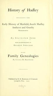


Search results from Open Library.
Recent natural events nearby
Ground air-quality sensors
Recently spotted species
Nearest stream gauge
Live readings from USGS NWIS · measured 2026-09-21 20:30 UTC.
Events
Gallery
Sources
- • Wikipedia
- • US Census Bureau (ACS 5-year estimates)
- • NOAA National Weather Service
- • Wikidata
- • Open-Meteo Air Quality (CAMS)
- • USGS Earthquake Catalog (global feed)
- • USGS NWIS (water data)
- • NCES via Urban Institute Education Data Portal
- • GBIF (Global Biodiversity Information Facility)
- • CDC PLACES
- • Open-Meteo / sunrise-sunset.org
- • Wikipedia Pageviews API
- • Open Library
- • Wikidata SPARQL (CC0) — population, area, elevation, inception, head of government, Commons image