Browse / United States / Massachusetts / Hatfield
Hatfield
MassachusettsCDP

Hatfield
Total population
1,449
Median home value
$459,900
Bachelor's+
Median income
$110,972
Air quality index
Demographic figures from US Census Bureau · ACS 5-year estimates. Overview below cites Wikipedia and may reference a different year.
City facts
Facts from Wikidata (CC0).
Overview
Hatfield is a town in Hampshire County, Massachusetts, United States. The population was 3,352 at the 2020 census. It is part of the Springfield, Massachusetts Metropolitan Statistical Area. The census-designated place of Hatfield consists of the town center and surrounding areas.
Read more on WikipediaHistory & geography
History
Hatfield was founded in 1660 on land granted to General Daniel Dennison and Governor William Bradford. It was formally incorporated as a town in 1670 and has a board of selectmen and an annual town meeting. One of the theories of Hatfield's incorporation in 1670 was that during that time it was a colony of Hadley and Hadley's church was located across the Connecticut River on what is now West Street in present-day Hadley. The citizens living in what is now Hatfield asked the officials if they could build the church on the west side of the river, so that they could go to church and not have to cross the river, which was hard to cross every week, especially during the winter season when the river would freeze. When the citizens asked main Hadley, Hadley said "No." Enraged, they held a vote on whether Hatfield would still remain territory of Hadley, or secede into its own town. The vote for secession won. Many believed this was a good decision as during that time, travel was not easy, and it was very unusual for the already large Hadley, which had already claimed many of its surrounding towns, to have a spot on the west side of the river. As a center for agriculture, the region produced cattle, sheep, corn, and tobacco. At first their relations with the local Native Americans were very welcoming on both sides. On October 16, 1675, a substantial part of the town was destroyed in the Raid on Hatfield during King Philip's War, and surviving settlers sought refuge in Springfield. On September 19, 1677, another raid occurred, killing thirteen and resulting in seventeen hostages being taken to Canada. After nine months, the surviving hostages were ransomed and returned to Hatfield. During the American Revolution, Hatfield was an important source of supplies and men for the…
Geography
Hatfield is located on the west bank of the Connecticut River at the mouth of the Mill River, north of Springfield and about west of Boston. It is bordered to the west by Horse Mountain (a typical New England granite glacial remnant) and the town of Williamsburg, to the north by the town of Whately, to the east and south across the Connecticut River by the town of Hadley, and to the southwest by the city of Northampton. The village of Hatfield is in the southern part of the town, next to the Connecticut River, while the villages of Westbrook, North Hatfield, and Bradstreet are near the northern border. West Hatfield is in the southwest part of town, next to the Northampton border. U.S. Route 5/Route 10 and Interstate 91 pass through the town, with access to I-91 from Exits 27 and 30, where it intersects with US 5/Route 10. The village of Hatfield is approximately east of Routes 5 and 91. According to the United States Census Bureau, the town of Hatfield has a total area of , of which are land and , or 5.51%, are water.
Excerpted from the corresponding Wikipedia article (CC BY-SA).
Demographics & economy
Race & ethnicity
Source: US Census Bureau — American Community Survey, 5-year estimates.
Geography
Coordinates & boundaries from the US Census TIGER/Line shapefiles.
Climate
Air quality
Current readings from Open-Meteo Air Quality API (Copernicus CAMS European reanalysis).
Industrial & pollution facilities
Natural hazard risk
Health (adults)
Walkability
Amenities nearby
Wildlife & biodiversity
Most-observed species
- Blue JayCyanocitta cristata (Linnaeus, 1758) · Aves60,977
- Northern CardinalCardinalis cardinalis (Linnaeus, 1758) · Aves58,532
- Black-capped ChickadeePoecile atricapillus (Linnaeus, 1766) · Aves54,242
- American RobinTurdus migratorius Linnaeus, 1766 · Aves53,494
- Tufted TitmouseBaeolophus bicolor (Linnaeus, 1766) · Aves49,804
- Song SparrowMelospiza melodia (A.Wilson, 1810) · Aves48,000
- Mourning DoveZenaida macroura (Linnaeus, 1758) · Aves46,536
- American GoldfinchSpinus tristis (Linnaeus, 1758) · Aves45,154
Citizen-science & research observations from the Global Biodiversity Information Facility (GBIF).
Schools
Earthquake history
Most recent
- M 2.6 — 2015-01-132 km E of Wauregan, Connecticut
- M 3.3 — 2015-01-120 km NE of Wauregan, Connecticut
- M 2.5 — 2007-10-192 km WSW of Littleton Common, Massachusetts
- M 2.8 — 2002-09-282 km N of Wilton, New Hampshire
- M 2.5 — 2002-06-073 km NNW of Hopedale, Massachusetts
Events from the USGS Earthquake Catalog (global) (FDSN Event Web Service).
Photos
Sights & places nearby
Notable people from here


People born within ~10 km, from Wikidata (CC0). Click any name for their Wikipedia article.
Nearby places in Massachusetts
- Deerfield12.1 mi away · pop. 458
- Chicopee13.6 mi away · pop. 55,295
- Cheshire31.3 mi away · pop. 674
- Pittsfield34 mi away · pop. 43,457
- Cochituate64 mi away
- Methuen Town76.9 mi away
- Peabody84.1 mi away · pop. 54,695
- Ocean Grove84.3 mi away · pop. 3,453
- Boxford84.9 mi away · pop. 2,284
- Amesbury Town90.1 mi away
- Duxbury101.1 mi away · pop. 1,994
- Bourne111.2 mi away · pop. 1,806
Geography & sun
Elevation, sunrise/sunset and daylight from Open-Meteo. Solar climatology from NASA POWER.
Nearby airports
Public attention
Pageview totals from the Wikimedia Pageviews API.
Books about Hatfield


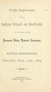
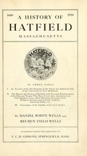

Search results from Open Library.
Recent natural events nearby
Ground air-quality sensors
Recently spotted species
Nearest stream gauge
Events
Gallery
Sources
- • Wikipedia
- • US Census Bureau (ACS 5-year estimates)
- • Wikidata
- • Open-Meteo Air Quality (CAMS)
- • USGS Earthquake Catalog (global feed)
- • GBIF (Global Biodiversity Information Facility)
- • Open-Meteo / sunrise-sunset.org
- • Wikipedia Pageviews API
- • Open Library
- • Wikidata SPARQL (CC0) — population, area, elevation, inception, head of government, Commons image