Browse / United States / Massachusetts / Lee
Lee
MassachusettsCDP

Lee
Total population
1,511
Median home value
$300,500
Bachelor's+
Median income
$70,724
Founded
1760
Demographic figures from US Census Bureau · ACS 5-year estimates. Overview below cites Wikipedia and may reference a different year.
City facts
Facts from Wikidata (CC0).
Overview
Lee is a town in Berkshire County, Massachusetts, United States. It is part of the Pittsfield, Massachusetts, metropolitan statistical area. The population was 5,788 at the 2020 census. Lee, which includes the villages of South and East Lee and the census-designated place of Lee, is part of the Berkshires resort area.
Read more on WikipediaHistory & geography
History
Lee occupies land that was originally territory of Mahican Indians. The first non-native settlement in the area was known as Dodgetown as early as 1760. Dodgetown was named after its founding settler, Asahel Dodge, who immigrated to the area from Cape Cod. Lee was incorporated in 1777 from parts of Great Barrington and Washington. It is named after Revolutionary War General Charles Lee. Lee is a former mill town. In the autumn of 1786 during Shays' Rebellion, about 250 followers of Daniel Shays encountered state troops commanded by General John Paterson near East Lee. The Shaysites paraded a fake cannon crafted from a yarn beam, and the troops fled. Early industries included agriculture, lumbering, and lime making. Abundant streams and rivers provided water power for mills that produced textiles and wire. Papermaking became the principal industry in 1806 with the construction of the Willow Mill by Samuel Church in South Lee. The Columbia Mill in central Lee was established in 1827, and eventually became the first to supply 100% groundwood newsprint to The New York Times. By 1857, there were 25 paper mills in Lee. The Smith Paper Company discovered how to manufacture paper solely from wood pulp in 1867, and through the 1870s was the country's largest producer of paper. The mills previously owned by Smith Paper Company were closed in 2008. Today, Lee has only a single papermaking facility. The town's marble is famous for its quality. The first quarry was established in 1852. In 1867, almost of marble was excavated and shipped on the Housatonic Railroad. Buildings constructed of Lee marble include a wing of the Capitol in Washington, 250 sculptures adorning Philadelphia City Hall, as well as the General Grant National Memorial, and St. Patrick's Cathedral (both in New…
Geography
According to the United States Census Bureau, the town has a total area of , of which is land and , or 3.22%, is water. Lee is bordered by Lenox to the northwest, Washington to the northeast, Becket to the east, Tyringham in the southeast, Great Barrington to the southwest, and Stockbridge to the west. Lee is south of Pittsfield, west-northwest of Springfield, and west of Boston. Lee is in the southern section of the Berkshires, in a valley along the Housatonic River. It is west of October Mountain State Forest, with two sections of the forest in Lee. In the southwestern corner of town lies a portion of Beartown State Forest, where Burgoyne Pass crosses the northern end of the mountain. Hop Brook, a marshy brook which flows from Tyringham, flows into the Housatonic in the south; other bodies of water include Laurel Lake to the north and Goose Pond to the southeast. The Appalachian Trail skirts the eastern part of town, passing through Tyringham, Becket and Washington. Lee is on Interstate 90 (the Massachusetts Turnpike), and is home to Exit 10, the westernmost full exit on the turnpike (Exit 1, in West Stockbridge, is only a turnaround exit) as well as the first service area along the Pike. Lee is also on U.S. Route 20, the "old Mass Pike", which was the main route to New York until the interstate. A small section of U.S. Route 7 crosses through the northwestern corner of town before meeting Route 20 in Lenox. Massachusetts Route 102's eastern terminus is at Route 20, at the Exit 2 toll plaza. Lee lies along the Housatonic Railroad line, which travels from Pittsfield to Great Barrington and Sheffield, terminating near New Milford, Connecticut, near Danbury. The line is still the area's primary rail link to New York City's metropolitan area, Boston, and Albany.…
Excerpted from the corresponding Wikipedia article (CC BY-SA).
Demographics & economy
Race & ethnicity
Source: US Census Bureau — American Community Survey, 5-year estimates.
Geography
Coordinates & boundaries from the US Census TIGER/Line shapefiles.
Climate
Current forecast
Forecast for Lee, MA from NOAA NWS API.
Air quality
Industrial & pollution facilities
Natural hazard risk
Health (adults)
Age-adjusted prevalence estimates from CDC PLACES (latest release).
Walkability
Amenities nearby
Wildlife & biodiversity
Most-observed species
- Black-capped ChickadeePoecile atricapillus (Linnaeus, 1766) · Aves20,013
- American CrowCorvus brachyrhynchos C.L.Brehm, 1822 · Aves18,295
- American RobinTurdus migratorius Linnaeus, 1766 · Aves15,671
- Blue JayCyanocitta cristata (Linnaeus, 1758) · Aves15,665
- Song SparrowMelospiza melodia (A.Wilson, 1810) · Aves15,124
- Northern CardinalCardinalis cardinalis (Linnaeus, 1758) · Aves14,051
- American GoldfinchSpinus tristis (Linnaeus, 1758) · Aves14,017
- Tufted TitmouseBaeolophus bicolor (Linnaeus, 1766) · Aves12,690
Citizen-science & research observations from the Global Biodiversity Information Facility (GBIF).
Schools
Largest nearby schools
- Pittsfield HighHigh · Pittsfield · 651 students · 9.6:1 ratio
- Theodore Herberg MiddleMiddle · Pittsfield · 496 students · 9.5:1 ratio
- Monument Mt Regional HighHigh · Great Barrington · 472 students · 10.5:1 ratio
- Lenox Memorial HighHigh · Lenox · 431 students · 8.6:1 ratio
- EgremontElementary · Pittsfield · 382 students · 11.9:1 ratio
- Muddy Brook Regional Elementary SchoolElementary · Great Barrington · 372 students · 9.8:1 ratio
- Lee ElementaryElementary · Lee · 341 students · 9.5:1 ratio
- MorrisElementary · Lenox · 339 students · 14.1:1 ratio
Public K–12 schools within ~10 mi from Urban Institute Education Data Portal (NCES Common Core of Data, 2022).
Earthquake history
Most recent
- M 2.79 — 2015-09-27New York
- M 2.76 — 2011-08-275 km WSW of Altamont, New York
- M 2.69 — 2011-08-255 km WSW of Altamont, New York
- M 3.15 — 2009-12-1315 km N of Medusa, New York
- M 2.56 — 2009-12-1314 km N of Medusa, New York
- M 2.9 — 2009-10-2115 km N of Medusa, New York
Events from the USGS Earthquake Catalog (global) (FDSN Event Web Service).
Photos
Sights & places nearby
Notable people from here


People born within ~10 km, from Wikidata (CC0). Click any name for their Wikipedia article.
Nearby places in Massachusetts
- Pittsfield10 mi away · pop. 43,457
- Cheshire18.1 mi away
- Easthampton Town29.8 mi away
- Agawam Town34.9 mi away · pop. 28,539
- Chicopee35.9 mi away · pop. 55,295
- Deerfield37 mi away · pop. 458
- Spencer64.4 mi away · pop. 11,992
- Cordaville88.4 mi away
- West Concord94.8 mi away · pop. 6,320
- Cochituate97 mi away
- Methuen Town109.7 mi away
- Ocean Grove112.1 mi away · pop. 3,453
Geography & sun
Elevation, sunrise/sunset and daylight from Open-Meteo. Solar climatology from NASA POWER.
Nearby airports
Public attention
Pageview totals from the Wikimedia Pageviews API.
Books about Lee

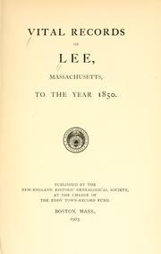

Search results from Open Library.
Recent natural events nearby
Ground air-quality sensors
Recently spotted species







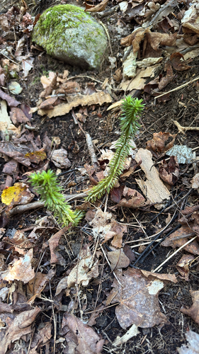

Research-grade observations from iNaturalist (within ~15 mi).
Nearest stream gauge
Events
Gallery
Sources
- • Wikipedia
- • US Census Bureau (ACS 5-year estimates)
- • NOAA National Weather Service
- • Wikidata
- • USGS Earthquake Catalog (global feed)
- • NCES via Urban Institute Education Data Portal
- • GBIF (Global Biodiversity Information Facility)
- • iNaturalist
- • CDC PLACES
- • Open-Meteo / sunrise-sunset.org
- • Wikipedia Pageviews API
- • Open Library
- • Wikidata SPARQL (CC0) — population, area, elevation, inception, head of government, Commons image