Browse / United States / Massachusetts / Lunenburg
Lunenburg
MassachusettsCDP

Lunenburg
Total population
2,057
Median home value
$494,800
Bachelor's+
Median income
$109,662
Founded
1718
Demographic figures from US Census Bureau · ACS 5-year estimates. Overview below cites Wikipedia and may reference a different year.
- Wind Advisory · ModerateWind Advisory issued September 25 at 12:30PM EDT until September 27 at 8:00AM EDT by NWS Boston/Norton MA
Source: NOAA National Weather Service.
City facts
Facts from Wikidata (CC0).
Overview
Lunenburg is a town in Worcester County, Massachusetts, United States. The population was 11,782 at the 2020 census. It contains the census-designated place of the same name.
Read more on WikipediaHistory & geography
History
Lunenburg was first settled by Europeans in 1718 and was officially incorporated in 1728. The name stems from one of the titles of King George II of Great Britain, Duke of Brunswick-Lüneburg. During King George's War (1744–1748), French-allied First Nations, such as warriors of the Mi'kmaq or Abenaki Confederacy, raided the village and took settlers captive to Quebec. Areas of neighboring Fitchburg were once part of Lunenburg, but broke away around 1764. The settlers found the walking distance to church and town meetings too great and needed their own town center. Whalom Park on Whalom Lake had long been a noted amusement park in Lunenburg during the 20th century. It was home of the famous Flyer Comet, now demolished. The park closed in 2000, unable to survive the competition with the newer and increasingly popular Six Flags New England in Agawam.
Geography
According to the United States Census Bureau, the town has a total area of , of which is land and , or 4.59%, is water. Lunenburg is bordered by Townsend to the north, Shirley to the east, Lancaster to the southeast, Leominster to the south, Fitchburg to the west, and Ashby to the northwest. Three state highways pass through Lunenburg. Route 2A follows Mass Ave from the Shirley line to the Fitchburg line. Rt 13 follows Electric Ave from the Leominster line to Mass Ave. Rt 13 then follows Mass Ave/Rt 2a for 0.3 miles. Rt 13 then follows Chase Rd to the Townsend Line. Rt 225 begins in Lunenburg, at an intersection with Rt 2a/Mass Ave near the Shirley line. Rt 225 follows West Groton Rd from Rt 2a to the Shirley line.
Excerpted from the corresponding Wikipedia article (CC BY-SA).
Demographics & economy
Race & ethnicity
Source: US Census Bureau — American Community Survey, 5-year estimates.
Geography
Coordinates & boundaries from the US Census TIGER/Line shapefiles.
Climate
Current forecast
Forecast for Lunenburg, MA from NOAA NWS API.
Air quality
Industrial & pollution facilities
Natural hazard risk
Health (adults)
Age-adjusted prevalence estimates from CDC PLACES (latest release).
Walkability
Amenities nearby
Wildlife & biodiversity
Schools
Largest nearby schools
- Montachusett Regional Vocational TechnicalHigh · Fitchburg · 1,409 students · 11.7:1 ratio
- Fitchburg HighHigh · Fitchburg · 1,246 students · 13:1 ratio
- Leominster High SchoolHigh · Leominster · 1,034 students · 11:1 ratio
- Sky View Middle SchoolMiddle · Leominster · 886 students · 15.3:1 ratio
- Center For Technical Education InnovationHigh · Leominster · 800 students · 25:1 ratio
- McKay Elementary SchoolElementary · Fitchburg · 727 students · 11:1 ratio
- NorthwestElementary · Leominster · 727 students · 14:1 ratio
- Johnny AppleseedElementary · Leominster · 661 students · 14.1:1 ratio
Public K–12 schools within ~10 mi from Urban Institute Education Data Portal (NCES Common Core of Data, 2022).
Earthquake history
Photos
Sights & places nearby
Notable people from here


People born within ~10 km, from Wikidata (CC0). Click any name for their Wikipedia article.
Nearby places in Massachusetts
- Cochituate26.5 mi away
- Boxford38.1 mi away · pop. 2,284
- Peabody38.8 mi away · pop. 54,695
- Amesbury Town43 mi away
- Deerfield44.7 mi away · pop. 458
- Chicopee51.7 mi away · pop. 55,295
- Ocean Grove65.4 mi away · pop. 3,453
- Duxbury65.6 mi away · pop. 1,994
- Cheshire73.1 mi away · pop. 674
- Pittsfield78.7 mi away · pop. 43,457
- Bourne82.3 mi away · pop. 1,806
- Yarmouth Port98.5 mi away · pop. 5,961
Geography & sun
Elevation, sunrise/sunset and daylight from Open-Meteo. Solar climatology from NASA POWER.
Nearby airports
Public attention
Pageview totals from the Wikimedia Pageviews API.
Books about Lunenburg


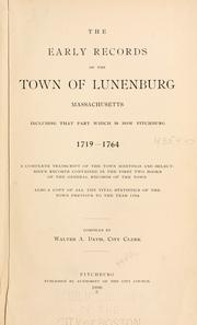
Search results from Open Library.
Recent natural events nearby
Ground air-quality sensors
Recently spotted species
Nearest stream gauge
Events
Gallery
Sources
- • Wikipedia
- • US Census Bureau (ACS 5-year estimates)
- • NOAA National Weather Service
- • Wikidata
- • NCES via Urban Institute Education Data Portal
- • CDC PLACES
- • Open-Elevation
- • Open-Meteo / sunrise-sunset.org
- • Wikipedia Pageviews API
- • Open Library
- • Wikidata SPARQL (CC0) — population, area, elevation, inception, head of government, Commons image