Browse / United States / Massachusetts / Oxford
Oxford
MassachusettsCDP

Oxford
Total population
5,671
Median home value
$345,700
Bachelor's+
Median income
$89,623
Founded
1687
Demographic figures from US Census Bureau · ACS 5-year estimates. Overview below cites Wikipedia and may reference a different year.
- Wind Advisory · ModerateWind Advisory issued September 25 at 12:30PM EDT until September 27 at 8:00AM EDT by NWS Boston/Norton MA
Source: NOAA National Weather Service.
City facts
Facts from Wikidata (CC0).
Overview
Oxford is a town in Worcester County, Massachusetts, United States. The population was 13,347 as of the 2020 United States census. The town contains the census-designated place of the same name. It was the birthplace of Clara Barton, the first president and founder of the American Red Cross.
Read more on WikipediaHistory & geography
History
Present day Oxford and the areas surrounding it were inhabited for thousands of years before European colonization. Although archaeological sites exist in Central Massachusetts dating back to the Paleoindian period (12,000–9000 years before present) there are much more abundant archaeological remains starting in the period from 6500 to 3000 years before present, including an arrowhead identified in Oxford Massachusetts. An arrowhead collected at an archaeological site in Oxford has been radiocarbon dated to 2990 ± 155 years before present. To this end, out of unceded Nipmuc lands, the Society for the Propagation of the Gospel in New England created the praying town of Manchaug in the early 1670s, which included present day Oxford in its bounds. This sale included the present day town of Oxford. Oxford was first colonized intermittently by Europeans in 1687, with several breaks during the French and Indian Wars, and was officially incorporated in 1713. In 1687, Robert Thompson arranged for a group of 52 French Huguenots he had connected with in London to colonize the land recently purchased from Black James. out of concern for conflict with local Native Americans The English investors who received the deed from Black James in 1682 continued to try to recruit settlers to the Oxford area, and by 1720, a group of around 30 English families had founded a new church there with a new minister. From 1699 to 1704, Huguenot settlers attempted to return to the settlement but it was abandoned again during Queen Anne's War. The first town clerk of Oxford was John Town, who also served as selectman and as a church deacon.
Geography
According to the United States Census Bureau, the town has a total area of , of which is land and , or 3.20%, is water. The town sits in a valley, and much of its area lies in the flood plain of the French River, which runs through the town. A substantial parcel north and west of Oxford Center is held, for flood control purposes, by the U.S. Army Corps of Engineers. The land, known as Greenbriar, also serves as a nature preserve. It also serves to cut off east–west travel on former roads through the site. Route 20 runs east–west through North Oxford, running north–south Route 12, locally called Main Street; less than a mile from Route 56, connecting North Oxford with points north; and Interstate 395, linking Oxford to Worcester and eastern Connecticut with three local exits: Depot Road in North Oxford; Sutton Avenue, the main east–west street in Oxford Center; and Cudworth Road, near the Webster town line. The town used to include much of what is now Webster, on its southern border, but Oxford and neighboring Dudley both gave portions of their land to allow the creation of that town. Other towns bordering Oxford are Charlton to the west, Leicester and Auburn to the north, Millbury and Sutton to the east, and Douglas to the southeast.
Excerpted from the corresponding Wikipedia article (CC BY-SA).
Demographics & economy
Race & ethnicity
Source: US Census Bureau — American Community Survey, 5-year estimates.
Geography
Coordinates & boundaries from the US Census TIGER/Line shapefiles.
Climate
Current forecast
Forecast for Oxford, MA from NOAA NWS API.
Air quality
Industrial & pollution facilities
Natural hazard risk
Health (adults)
Walkability
Amenities nearby
Wildlife & biodiversity
Schools
Earthquake history
Photos
Sights & places nearby
Notable people from here


People born within ~10 km, from Wikidata (CC0). Click any name for their Wikipedia article.
Nearby places in Massachusetts
- Cochituate30.3 mi away
- Chicopee36.1 mi away · pop. 55,295
- Ocean Grove43.2 mi away · pop. 3,453
- Deerfield47.9 mi away · pop. 458
- Peabody54.3 mi away · pop. 54,695
- Boxford59 mi away · pop. 2,284
- Duxbury61.3 mi away · pop. 1,994
- Amesbury Town68.9 mi away
- Bourne69.7 mi away · pop. 1,806
- Cheshire72.8 mi away · pop. 674
- Pittsfield74.8 mi away · pop. 43,457
- Yarmouth Port89.4 mi away · pop. 5,403
Geography & sun
Elevation, sunrise/sunset and daylight from Open-Meteo. Solar climatology from NASA POWER.
Nearby airports
Public attention
Pageview totals from the Wikimedia Pageviews API.
Books about Oxford
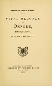


Search results from Open Library.
Recent natural events nearby
Ground air-quality sensors
Recently spotted species
Nearest stream gauge
Events
Gallery
Sources
- • Wikipedia
- • US Census Bureau (ACS 5-year estimates)
- • NOAA National Weather Service
- • Wikidata
- • Open-Meteo / sunrise-sunset.org
- • Wikipedia Pageviews API
- • Open Library
- • Wikidata SPARQL (CC0) — population, area, elevation, inception, head of government, Commons image