Browse / United States / North Carolina / Kill Devil Hills
Kill Devil Hills
North Carolinatown

Kill Devil Hills
Total population
7,761
Median home value
$442,200
Bachelor's+
Median income
$89,773
Demographic figures from US Census Bureau · ACS 5-year estimates. Overview below cites Wikipedia and may reference a different year.
City facts
Facts from Wikidata (CC0).
Overview
Kill Devil Hills is a town in Dare County, North Carolina, United States. The population was 7,633 at the 2020 census. It is the most populous settlement in both Dare County and on the Outer Banks of North Carolina. The Kill Devil Hills micropolitan statistical area, consisting of all of Dare County, is part of the larger Virginia Beach–Norfolk combined statistical area.
Read more on WikipediaHistory & geography
History
Kill Devil Hills is the site of the Wright Brothers National Memorial, commemorating the siblings' four powered airplane flights in the Wright Flyer on Thursday, December 17, 1903. Orville returned in 1911, and on October 25 he set a new world glider record, remaining in the air 10 minutes and 34 seconds, soaring against the wind with very little forward movement. In addition to the Wright Brothers National Memorial, Sam's Diner in the town is on the National Register of Historic Places, listed in 1999.
Geography
Kill Devil Hills is located at (36.025448, −75.670105), on the barrier islands known as the Outer Banks. The average seasonal (Dec-Mar) snowfall total is < 2 inches (< 5 cm), and the average annual peak in nor'easter activity is in February. According to the A. W. Kuchler U.S. potential natural vegetation types, Kill Devil Hills, North Carolina would have a dominant vegetation type of Live oak/Sea Oats Uniola paniculata (90) with a dominant vegetation form of Coastal Prairie (20).
Excerpted from the corresponding Wikipedia article (CC BY-SA).
Demographics & economy
Race & ethnicity
Source: US Census Bureau — American Community Survey, 5-year estimates.
Geography
Coordinates & boundaries from the US Census TIGER/Line shapefiles.
Climate
Air quality
Industrial & pollution facilities
Natural hazard risk
Health (adults)
Age-adjusted prevalence estimates from CDC PLACES (latest release).
Walkability
Amenities nearby
Wildlife & biodiversity
Schools
Largest nearby schools
- First Flight High SchoolHigh · Kill Devil Hills · 956 students · 18:1 ratio
- Manteo Elementary SchoolElementary · Manteo · 660 students · 12.2:1 ratio
- First Flight Middle SchoolMiddle · Kill Devil Hills · 612 students · 13.3:1 ratio
- Manteo High SchoolHigh · Manteo · 578 students · 15.2:1 ratio
- Nags Head Elementary SchoolElementary · Nags Head · 538 students · 12.8:1 ratio
- Kitty Hawk Elementary SchoolElementary · Kitty Hawk · 453 students · 12.2:1 ratio
- Manteo Middle SchoolMiddle · Manteo · 369 students · 12.3:1 ratio
- First Flight Elementary SchoolElementary · Kill Devil Hills · 320 students · 10.7:1 ratio
Public K–12 schools within ~10 mi from Urban Institute Education Data Portal (NCES Common Core of Data, 2022).
Earthquake history
Photos
Sights & places nearby
Notable people from here

People born within ~10 km, from Wikidata (CC0). Click any name for their Wikipedia article.
Nearby places in North Carolina
Geography & sun
Elevation, sunrise/sunset and daylight from Open-Meteo. Solar climatology from NASA POWER.
Nearby airports
Public attention
Pageview totals from the Wikimedia Pageviews API.
Books about Kill Devil Hills

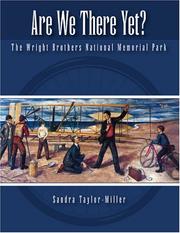
Search results from Open Library.
Recent natural events nearby
Ground air-quality sensors
Recently spotted species
Nearest stream gauge
Events
Gallery
Sources
- • Wikipedia
- • US Census Bureau (ACS 5-year estimates)
- • Wikidata
- • NCES via Urban Institute Education Data Portal
- • CDC PLACES
- • Open-Meteo / sunrise-sunset.org
- • Wikipedia Pageviews API
- • Open Library