Browse / United States / North Carolina / Mount Olive
Mount Olive
North Carolinatown

Mount Olive
Total population
4,453
Median home value
$153,500
Bachelor's+
Median income
$48,700
Demographic figures from US Census Bureau · ACS 5-year estimates. Overview below cites Wikipedia and may reference a different year.
City facts
Facts from Wikidata (CC0).
Overview
Mount Olive is a town in Duplin and Wayne counties in the U.S. state of North Carolina. At the 2020 census, the population was 4,198. It is included in the Goldsboro metropolitan area. The town is home to the Mt. Olive Pickle Company and the University of Mount Olive.
Read more on WikipediaHistory & geography
History
The Mount Olive High School (Former), Mount Olive Historic District, Perry-Cherry House, Southerland-Burnette House, former United States Post Office, and Vernon are listed on the National Register of Historic Places. The Wilmington & Raleigh Railroad (which was renamed the Wilmington & Weldon Railroad in 1855) completed in 1840 ran through Mt. Olive on land sold to the railroad by Adam Winn Sr., a prominent free black landowner. Today the line is part of the CSX W&W Subdivision.
Geography
Mount Olive is located in southern Wayne County with a small portion of the town extending south into Duplin County. U.S. Route 117, a four-lane highway, runs along the western edge of Mount Olive, leading north to Goldsboro and south to Warsaw. North Carolina Highway 55, which crosses US 117 at the northern end of town, leads east to Kinston and west to Newton Grove. According to the United States Census Bureau, the town of Mount Olive has a total area of , all land.
Excerpted from the corresponding Wikipedia article (CC BY-SA).
Demographics & economy
Race & ethnicity
Source: US Census Bureau — American Community Survey, 5-year estimates.
Geography
Coordinates & boundaries from the US Census TIGER/Line shapefiles.
Climate
Air quality
Industrial & pollution facilities
Natural hazard risk
Health (adults)
Age-adjusted prevalence estimates from CDC PLACES (latest release).
Walkability
Amenities nearby
Wildlife & biodiversity
Schools
Largest nearby schools
- Southern Wayne HighHigh · Dudley · 1,066 students · 19.4:1 ratio
- Brogden PrimaryElementary · Dudley · 764 students · 15.6:1 ratio
- Spring Creek HighHigh · Seven Springs · 753 students · 16.7:1 ratio
- Spring Creek MiddleMiddle · Seven Springs · 624 students · 17.8:1 ratio
- Brogden MiddleMiddle · Dudley · 588 students · 24.5:1 ratio
- Carver ElementaryElementary · Mount Olive · 556 students · 16.4:1 ratio
- Grantham ElementaryElementary · Goldsboro · 435 students · 13.6:1 ratio
- Mount Olive MiddleMiddle · Mount Olive · 377 students · 18.9:1 ratio
Public K–12 schools within ~10 mi from Urban Institute Education Data Portal (NCES Common Core of Data, 2022).
Earthquake history
Photos
Sights & places nearby
Notable people from here
Nearby places in North Carolina
Geography & sun
Elevation, sunrise/sunset and daylight from Open-Meteo. Solar climatology from NASA POWER.
Nearby airports
Public attention
Pageview totals from the Wikimedia Pageviews API.
Books about Mount Olive
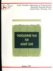


Search results from Open Library.
Recent natural events nearby
Ground air-quality sensors
Recently spotted species
Nearest stream gauge
Events
Gallery
Sources
- • Wikipedia
- • US Census Bureau (ACS 5-year estimates)
- • Wikidata
- • NCES via Urban Institute Education Data Portal
- • CDC PLACES
- • Open-Meteo / sunrise-sunset.org
- • Wikipedia Pageviews API
- • Open Library