Browse / United States / North Carolina / Spring Lake
Spring Lake
North Carolinatown

Spring Lake
Total population
11,573
Median home value
$124,000
Bachelor's+
Median income
$51,958
Founded
1923
Demographic figures from US Census Bureau · ACS 5-year estimates. Overview below cites Wikipedia and may reference a different year.
City facts
Facts from Wikidata (CC0).
Overview
Spring Lake is a town in Cumberland County, North Carolina, United States. As of the 2020 census, Spring Lake had a population of 11,660.
Read more on WikipediaHistory & geography
History
The current name of the town first appeared around 1923 for a spring fed lake, which probably formed when the railroad was built about 1860. The community grew slowly until World War II. At its incorporation, the town selected the post office on Main Street as the center of town. The town limits extended only eight-tenths of a mile from its center, but increased rapidly as nearby Fort Bragg was built up. Today, Spring Lake remains a quaint town with its close ties to nearby Fort Bragg. Previously, the area was called "Clayton Cut", due to the pathway cut that ran through the area where the railroad later resided, and also "Prince's Siding", after a man named Prince who owned a sawmill on this land. Spring Lake was officially incorporated on April 9, 1951. Grady Howard was named interim mayor on this date, and was officially elected the first mayor of Spring Lake on June 5, 1951. The modern growth spurt beginning in World War II is attributed to the proximity of Fort Bragg. Long Valley Farm was listed on the National Register of Historic Places in 1994.
Geography
Spring Lake is located in northwestern Cumberland County. It is bordered to the south by the city of Fayetteville, the Cumberland County seat, to the west by Hoke and Moore counties, and to the north by Harnett County. Large portions of the town limits are occupied by Pope Air Force Base and parts of Fort Bragg. North Carolina Highways 87 and 24 run concurrently through the town, leading south to downtown Fayetteville. NC 87 leads north to Sanford, while NC 24 runs northwest to Carthage. North Carolina Highway 210 leads northeast to Lillington and southeast as Murchison Road to downtown Fayetteville. According to the United States Census Bureau, the town of Spring Lake has a total area of , of which is land and , or 0.88%, is water. The Little River, a tributary of the Cape Fear River, runs the length of the town from west to east, passing north of the town center. It includes sections of the Fort Bragg property, including Pope Field.
Excerpted from the corresponding Wikipedia article (CC BY-SA).
Demographics & economy
Race & ethnicity
Source: US Census Bureau — American Community Survey, 5-year estimates.
Geography
Coordinates & boundaries from the US Census TIGER/Line shapefiles.
Climate
Current forecast
Forecast for Spring Lake, NC from NOAA NWS API.
Air quality
Industrial & pollution facilities
Natural hazard risk
Health (adults)
Age-adjusted prevalence estimates from CDC PLACES (latest release).
Walkability
Amenities nearby
Wildlife & biodiversity
Schools
Largest nearby schools
- Pine Forest HighHigh · Fayetteville · 1,572 students · 19.2:1 ratio
- Terry Sanford HighHigh · Fayetteville · 1,224 students · 20.1:1 ratio
- Westover HighHigh · Fayetteville · 1,202 students · 17.9:1 ratio
- E E Smith HighHigh · Fayetteville · 1,004 students · 17:1 ratio
- Westover MiddleMiddle · Fayetteville · 784 students · 16:1 ratio
- Pine Forest MiddleMiddle · Fayetteville · 738 students · 16:1 ratio
- Cliffdale ElementaryElementary · Fayetteville · 658 students · 15:1 ratio
- Bill Hefner ElementaryElementary · Fayetteville · 651 students · 15.5:1 ratio
Public K–12 schools within ~10 mi from Urban Institute Education Data Portal (NCES Common Core of Data, 2022).
Earthquake history
Photos
Sights & places nearby
Notable people from here


People born within ~10 km, from Wikidata (CC0). Click any name for their Wikipedia article.
Nearby places in North Carolina
Geography & sun
Elevation, sunrise/sunset and daylight from Open-Meteo. Solar climatology from NASA POWER.
Nearby airports
Public attention
Pageview totals from the Wikimedia Pageviews API.
Books about Spring Lake



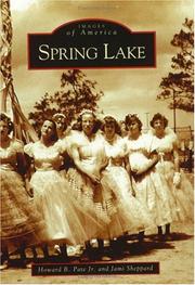

Search results from Open Library.
Recent natural events nearby
Ground air-quality sensors
Recently spotted species
Nearest stream gauge
Events
Gallery
Sources
- • Wikipedia
- • US Census Bureau (ACS 5-year estimates)
- • NOAA National Weather Service
- • Wikidata
- • NCES via Urban Institute Education Data Portal
- • CDC PLACES
- • Open-Meteo / sunrise-sunset.org
- • Wikipedia Pageviews API
- • Open Library