Browse / United States / Oklahoma / Norman
Norman
Oklahomacity

Norman
Total population
131,008
Median home value
$276,800
Bachelor's+
Median income
$73,618
Founded
1889
Air quality index
Demographic figures from US Census Bureau · ACS 5-year estimates. Overview below cites Wikipedia and may reference a different year.
City facts
Sister cities
Facts from Wikidata (CC0).
Overview
Norman is the third-most populous city in the U.S. state of Oklahoma, with a population of 128,026 as of the 2020 census. It is the most populous city in and the county seat of Cleveland County and the second-most populous city in the Oklahoma City Metro Area after the state capital, Oklahoma City, 20 miles north of Norman.
Read more on WikipediaHistory & geography
History
The Oklahoma region became part of the United States with the Louisiana Purchase in 1803. Before the American Civil War, the U.S. government began relocating the Five Civilized Tribes—the five Native American tribes that the United States officially recognized via treaty—to Oklahoma. Treaties of 1832 and 1833 assigned the area known today as Norman to the Creek Nation. After the Civil War, the Creeks were accused of aiding the Confederacy; as a result they ceded the region back to the United States in 1866. In 1887, the Atchison, Topeka and Santa Fe Railway began service to the area, early settlers decided to keep the name "Norman." The new Norman was a sundown town. African Americans were not allowed to live within the city limits or stay overnight until the early 1960s, nor could they study at the University of Oklahoma. In 2020, the Norman City Council issued an apology. Norman has grown throughout the decades. By 1902 the downtown district contained two banks, two hotels, a flour mill, and other businesses; by 1913 over 3,700 people lived in Norman when the Oklahoma Railway Company decided to extend its interurban streetcar running from Oklahoma City to Moore into Norman, spurring additional population growth. The rail lines eventually transitioned to freight during the 1940s as the United States Numbered Highway system developed. The population reached 11,429 in 1940. With the completion of Interstate 35 in June 1959, Norman found its role as a bedroom community to Oklahoma City increasing rapidly; in 1960 Norman's population was 33,412 but by the end of the decade had grown to 52,117. Today the airstrip is called the University of Oklahoma Westheimer Airport. Following the war the remaining military presence and post-war veterans who came to Norman to get an…
Geography
As of 2010, the city has a total area of , of which is land and is water. The center of this large incorporated area is from the center of Oklahoma City, and separated primarily by Moore, is in the Oklahoma City metropolitan area. Norman and the surrounding areas are mostly flat with an elevation near . The terrain in the western section of Norman is prairie, while the eastern section, including the area surrounding Lake Thunderbird, consists of some of lakes and Cross Timbers forest. }} Norman falls within a temperate, humid subtropical climate region that is identified as "Cfa" class on the Köppen climate classification. On average Norman receives about of precipitation per year; The risk for tornadoes is greatest in the springtime months of March through June when the majority of all reported tornadoes occur. There have been several other tornado events in recent years. On May 10, 2010, numerous tornadoes occurred in Cleveland County, resulting in the loss of multiple homes and businesses within Norman city limits. Weak tornadoes also struck Norman on April 13, 2012 and May 6, 2015.
Excerpted from the corresponding Wikipedia article (CC BY-SA).
Demographics & economy
Race & ethnicity
Source: US Census Bureau — American Community Survey, 5-year estimates.
Geography
Coordinates & boundaries from the US Census TIGER/Line shapefiles.
Climate
Current forecast
Forecast for Norman, OK from NOAA NWS API.
Air quality
Current readings from Open-Meteo Air Quality API (Copernicus CAMS European reanalysis).
Industrial & pollution facilities
Natural hazard risk
Health (adults)
Age-adjusted prevalence estimates from CDC PLACES (latest release).
Walkability
Amenities nearby
Wildlife & biodiversity
Most-observed species
- Northern CardinalCardinalis cardinalis (Linnaeus, 1758) · Aves9,849
- American CrowCorvus brachyrhynchos C.L.Brehm, 1822 · Aves7,317
- Carolina ChickadeePoecile carolinensis (Audubon, 1834) · Aves6,249
- American RobinTurdus migratorius Linnaeus, 1766 · Aves6,057
- Mourning DoveZenaida macroura (Linnaeus, 1758) · Aves5,456
- Blue JayCyanocitta cristata (Linnaeus, 1758) · Aves5,277
- Carolina WrenThryothorus ludovicianus (Latham, 1790) · Aves4,534
- European StarlingSturnus vulgaris Linnaeus, 1758 · Aves4,087
Citizen-science & research observations from the Global Biodiversity Information Facility (GBIF).
Schools
Largest nearby schools
- NORMAN NORTH HSHigh · Norman · 2,401 students · 20.5:1 ratio
- NORMAN HSHigh · Norman · 2,137 students · 20.7:1 ratio
- WHITTIER MSMiddle · Norman · 1,016 students · 17.2:1 ratio
- NOBLE HSHigh · Noble · 883 students · 18.8:1 ratio
- HIGHLAND EAST JHSMiddle · Moore · 789 students · 19.2:1 ratio
- IRVING MSMiddle · Norman · 788 students · 16.1:1 ratio
- ALCOTT MSMiddle · Norman · 713 students · 17.8:1 ratio
- CURTIS INGE MSMiddle · Noble · 712 students · 16.6:1 ratio
Public K–12 schools within ~10 mi from Urban Institute Education Data Portal (NCES Common Core of Data, 2022).
Earthquake history
Most recent
- M 2.54 — 2026-09-274 km NNE of Tatums, Oklahoma
- M 2.57 — 2026-09-146 km E of Calumet, Oklahoma
- M 2.9 — 2026-09-115 km N of Stroud, Oklahoma
- M 3.29 — 2026-09-042 km SSW of Dibble, Oklahoma
- M 2.56 — 2026-06-136 km ENE of Edmond, Oklahoma
- M 2.7 — 2026-05-205 km N of Stroud, Oklahoma
Events from the USGS Earthquake Catalog (global) (FDSN Event Web Service).
Photos
Sights & places nearby
Notable people from here


People born within ~10 km, from Wikidata (CC0). Click any name for their Wikipedia article.
Nearby places in Oklahoma
- Moore9.5 mi away · pop. 63,420
- Slaughterville10.7 mi away
- Pink13.9 mi away
- Purcell15.1 mi away · pop. 6,803
- Midwest City15.2 mi away · pop. 58,297
- Del City15.3 mi away · pop. 21,494
- Lexington15.4 mi away · pop. 1,972
- Smith Village15.8 mi away
- Tribbey16.5 mi away · pop. 423
- Nicoma Park17.4 mi away · pop. 2,566
- Oklahoma City18.3 mi away · pop. 713,014
- Harrah18.4 mi away · pop. 6,684
Geography & sun
Elevation, sunrise/sunset and daylight from Open-Meteo. Solar climatology from NASA POWER.
Nearby airports
Public attention
Pageview totals from the Wikimedia Pageviews API.
Books about Norman


Search results from Open Library.
Recent natural events nearby
- Wildfire 2690, Caddo, OklahomaWildfires · 2026-08-21 · 48 mi
- Wildfire GRACEMONT, Caddo, OklahomaWildfires · 2026-09-13 · 51 mi
- Wildfire PINTO, Stephens, OklahomaWildfires · 2026-09-08 · 59 mi
- Wildfire WRIGHT, Hughes, OklahomaWildfires · 2026-08-29 · 69 mi
- Wildfire MEERS, Comanche, OklahomaWildfires · 2026-09-08 · 80 mi
- Wildfire SOUTH RAILROAD, Comanche, OklahomaWildfires · 2026-08-30 · 89 mi
- Wildfire RAILROAD SOUTH, Comanche, OklahomaWildfires · 2026-08-29 · 89 mi
- Wildfire Atoka Lake, Atoka, OklahomaWildfires · 2026-09-14 · 91 mi
Wildfires, storms and other events from NASA EONET (last 12 months, within 250 mi).
Ground air-quality sensors
Recently spotted species

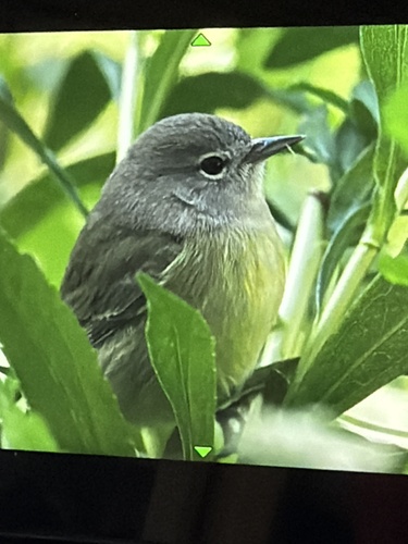
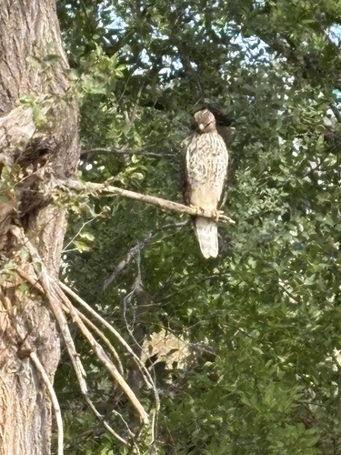

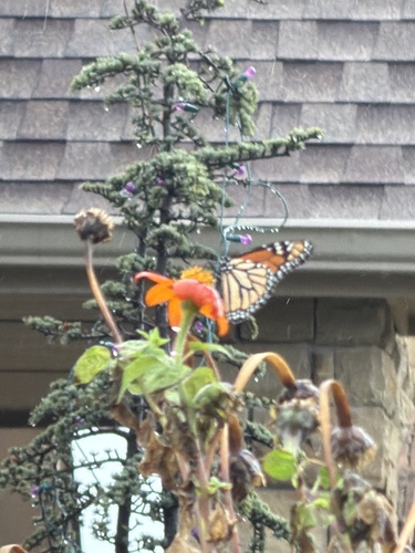




Research-grade observations from iNaturalist (within ~15 mi).
Nearest stream gauge
Live readings from USGS NWIS · measured 2026-10-16 19:00 UTC.
Events
Gallery
Sources
- • Wikipedia
- • US Census Bureau (ACS 5-year estimates)
- • NOAA National Weather Service
- • Wikidata
- • Open-Meteo Air Quality (CAMS)
- • USGS Earthquake Catalog (global feed)
- • USGS NWIS (water data)
- • NCES via Urban Institute Education Data Portal
- • GBIF (Global Biodiversity Information Facility)
- • iNaturalist
- • CDC PLACES
- • Open-Meteo / sunrise-sunset.org
- • Wikipedia Pageviews API
- • Open Library
- • NASA EONET