Browse / United States / Pennsylvania / Braddock Hills
Braddock Hills
Pennsylvaniaborough

Braddock Hills
Total population
1,629
Median home value
$129,800
Bachelor's+
Median income
$39,981
Founded
1753
Demographic figures from US Census Bureau · ACS 5-year estimates. Overview below cites Wikipedia and may reference a different year.
City facts
Facts from Wikidata (CC0).
Overview
Braddock Hills is a borough in Allegheny County, Pennsylvania, United States. The population was 1,730 at the 2020 census. Braddock Hills is located approximately 8 miles (13 km) east of downtown Pittsburgh and is a residential suburb of the Pittsburgh metropolitan area.
Read more on WikipediaHistory & geography
History
Braddock Hills is located northwest of Braddock's Field, the site of General Edward Braddock's 1755 defeat during the French and Indian War. The main road which winds through the borough, Brinton Road, was originally an Indian trail, used by the area's indigenous people to keep watch for their enemies. The other main road in the borough, Braddock Road, was the main link between Braddock Hills and Braddock used by farmers and coal miners. The first area of the borough to be settled was along Brinton Road, first settled as Hannatown. First settled in 1753, the area was part of Wilkins Township until 1885, when Braddock Township was incorporated. On May 2, 1946, after Braddock Township had already been broken up into the boroughs of Swissvale, North Braddock, and Rankin, the remaining area incorporated itself as Braddock Hills. Braddock Hills experienced a housing boom following World War II. Many GIs used their VA loans to acquire newly built homes. Most of the new homes were built on Illinois Ave, Park Ave, Columbia Ave, Circle Drive, McKelvey Ave, and Kings Road. These homes were generally small brick Cape Cods, colonials, or brick ranches. While much of the borough has new housing, there are many older structures. Miners built shotgun-style homes. Many of these homes were located on Indiana Avenue. Some are still in use. Many older residents can recall when the Braddock Hills Shopping Center on Yost Boulevard was the location of a drive-in movie theater. The Ardmore Drive-In operated from 1959 to 1976; it was then torn down and was replaced with a shopping center. During the 1980s the shopping center's parking lot hosted a Sunday flea market and the Braddock Hills Days Festival. Like many Western Pennsylvania communities, Braddock Hills was a coal town.…
Geography
Braddock Hills is located at . According to the United States Census Bureau, the borough has a total area of , all land. Its average elevation is above sea level. Braddock Hills has five borders, including Wilkinsburg to the north, Forest Hills from the north-northeast to the east, North Braddock to the south, Swissvale to the west and southwest, and finally Edgewood to the west.
Excerpted from the corresponding Wikipedia article (CC BY-SA).
Demographics & economy
Race & ethnicity
Source: US Census Bureau — American Community Survey, 5-year estimates.
Geography
Coordinates & boundaries from the US Census TIGER/Line shapefiles.
Climate
Air quality
Industrial & pollution facilities
Natural hazard risk
Health (adults)
Walkability
Amenities nearby
Wildlife & biodiversity
Schools
Largest nearby schools
- Baldwin SHSHigh · Pittsburgh · 2,086 students · 18.6:1 ratio
- Pittsburgh Allderdice HSHigh · Pittsburgh · 1,362 students · 13.1:1 ratio
- Fox Chapel Area HSHigh · Pittsburgh · 1,283 students · 13.6:1 ratio
- Penn Hills El SchElementary · Pittsburgh · 1,279 students · 13.8:1 ratio
- Plum SHSHigh · Plum · 1,226 students · 17.5:1 ratio
- Shaler Area HSHigh · Pittsburgh · 1,225 students · 11.9:1 ratio
- J.E. Harrison Education CtrElementary · Pittsburgh · 1,143 students · 15.7:1 ratio
- Gateway SHSHigh · Monroeville · 1,135 students · 14.4:1 ratio
Public K–12 schools within ~10 mi from Urban Institute Education Data Portal (NCES Common Core of Data, 2022).
Earthquake history
Photos
Sights & places nearby
Notable people from here


People born within ~10 km, from Wikidata (CC0). Click any name for their Wikipedia article.
Nearby places in Pennsylvania
- Forest Hills0.8 mi away
- Braddock1 mi away · pop. 2,039
- Duquesne2.9 mi away
- Etna7.3 mi away · pop. 3,364
- Greenock7.6 mi away · pop. 1,815
- Cheswick9.4 mi away · pop. 1,661
- Blaine Hill9.7 mi away · pop. 587
- Elizabeth10 mi away · pop. 1,371
- Green Tree10.2 mi away · pop. 4,833
- Crafton11.1 mi away · pop. 5,961
- Bethel Park11.2 mi away · pop. 32,881
- Bellevue11.6 mi away · pop. 8,128
Geography & sun
Elevation, sunrise/sunset and daylight from Open-Meteo. Solar climatology from NASA POWER.
Nearby airports
Public attention
Pageview totals from the Wikimedia Pageviews API.
Books about Braddock Hills
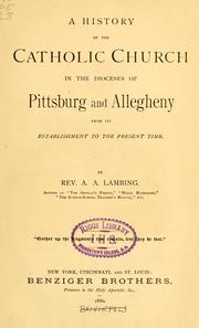
Search results from Open Library.
Recent natural events nearby
Ground air-quality sensors
Recently spotted species
Nearest stream gauge
Events
Gallery
Sources
- • Wikipedia
- • US Census Bureau (ACS 5-year estimates)
- • Wikidata
- • NCES via Urban Institute Education Data Portal
- • Open-Meteo / sunrise-sunset.org
- • Wikipedia Pageviews API
- • Open Library