Browse / United States / South Dakota / Wounded Knee
Wounded Knee
South DakotaCDP

Wounded Knee
Total population
524
Demographic figures from US Census Bureau · ACS 5-year estimates. Overview below cites Wikipedia and may reference a different year.
City facts
Facts from Wikidata (CC0).
Overview
Wounded Knee is a census-designated place (CDP) on the Pine Ridge Indian Reservation in Oglala Lakota County, South Dakota, United States. The population was 364 at the 2020 census.
Read more on WikipediaHistory & geography
History
On December 29, 1890, in the same area, in an incident known as the Wounded Knee Massacre, the United States 7th Cavalry killed more than 300 men, women and children who were being relocated to the Sioux reservation at Pine Ridge. On February 27, 1973, during the Wounded Knee Occupation, the American Indian Movement (AIM) occupied the Pine Ridge Reservation near Wounded Knee in protest against the federal government and its policies related to Native Americans. A 71-day standoff between federal authorities and the AIM ensued. The group members surrendered on May 8.
Geography
According to the United States Census Bureau, the CDP has a total area of , all land.
Excerpted from the corresponding Wikipedia article (CC BY-SA).
Demographics & economy
Geography
Coordinates & boundaries from the US Census TIGER/Line shapefiles.
Climate
Current forecast
Forecast for Wounded Knee, SD from NOAA NWS API.
Air quality
Industrial & pollution facilities
Natural hazard risk
Health (adults)
Age-adjusted prevalence estimates from CDC PLACES (latest release).
Walkability
Amenities nearby
Wildlife & biodiversity
Schools
Largest nearby schools
- Wolf Creek School - 02Elementary · Pine Ridge · 624 students · 15.6:1 ratio
- Lakota Tech High School - 10High · Batesland · 449 students · 19.5:1 ratio
Public K–12 schools within ~10 mi from Urban Institute Education Data Portal (NCES Common Core of Data, 2022).
Earthquake history
Photos
Sights & places nearby
Notable people from here
Nearby places in South Dakota
- Porcupine8.8 mi away
- Manderson-White Horse Creek8.9 mi away
- Buffalo Gap53.4 mi away · pop. 131
- Hot Springs58.4 mi away · pop. 3,548
- Wall59.1 mi away · pop. 622
- Cottonwood61.7 mi away · pop. 66
- Spring Creek67.5 mi away · pop. 330
- Parmelee68 mi away · pop. 584
- Soldier Creek75.2 mi away
- Custer75.3 mi away · pop. 2,341
- Box Elder75.8 mi away · pop. 12,902
- Colonial Pine Hills76.6 mi away
Geography & sun
Elevation, sunrise/sunset and daylight from Open-Meteo. Solar climatology from NASA POWER.
Nearby airports
Public attention
Pageview totals from the Wikimedia Pageviews API.
Books about Wounded Knee


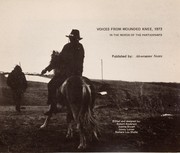
Search results from Open Library.
Recent natural events nearby
Ground air-quality sensors
Recently spotted species
Nearest stream gauge
Events
Notable, recurring, and historical events associated with Wounded Knee, sourced from Wikidata.
- Wounded Knee incidentMay 8, 1973demonstration
protest which began on February 27, 1973, when ~200 Oglala Lakota and followers of the American Indian Movement seized and occupied the town of Wounded Knee, South Dakota and controlled it for 71 days
Source: Wikidata (CC0).
Gallery
Sources
- • Wikipedia
- • NOAA National Weather Service
- • Wikidata
- • NCES via Urban Institute Education Data Portal
- • CDC PLACES
- • Open-Meteo / sunrise-sunset.org
- • Wikipedia Pageviews API
- • Open Library