Browse / United Kingdom / England / Bracknell
Bracknell
Englandtown

Bracknell
Total population
52,696
Demographic figures from UK Office for National Statistics. Overview below cites Wikipedia and may reference a different year.
City facts
Facts from Wikidata (CC0).
Overview
Bracknell is a town and civil parish in Berkshire, England, the westernmost area within the Greater London Urban Area and the administrative centre of the borough of Bracknell Forest. It lies 11 miles (18 km) to the east of Reading, 9 miles (14 km) south of Maidenhead, 10 miles (16 km) southwest of Windsor and 25 miles (40 km) west of central London. Bracknell is the third largest town in Berkshire.
Read more on WikipediaHistory & geography
History
The name Bracknell is first recorded in a Winkfield Boundary Charter of AD 942 as both Braccan heal and Braccan heale. This was previously thought to mean "a nook of land belonging to a man called Bracca", from the Old English Braccan (genitive singular of a personal name) + heal, healh (a corner, nook or secret place), although recent academic evidence suggests it means simply "a hidden place where bracken grows." Bracknell was subsequently named on maps as Brakenhale (a name that still survives as the name of one of its schools), Brakehal and Brackenhal. The town today covers all of the old village of Easthampstead (though not all of the old parish) and the hamlet of Ramslade. Evidence of human existence in Bracknell dates back to the end of the last ice age (c. 10,000BC), with abundant flint tools found in nearby Amen Corner. and to the south-west, just over the border in Crowthorne, is Caesar's Camp, an Iron Age hill fort. One of the oldest buildings in the town is the Old Manor public house, a 17th-century brick manor house featuring a number of priest holes. Other surviving old pubs are the Red Lion and the Bull, both timber-framed and dating from before the 18th century. The oldest place of worship in the town is the parish church of St Michael and St Mary Magdalene's Church, Easthampstead. There has been a church there since Saxon times, although the present building dates from the mid 19th century, except for the lower portions of the Tudor tower. Holy Trinity Church near the town centre was built in 1851. Bracknell was designated a new town on 17 June 1949, in the aftermath of the Second World War. The site was originally a small market town in the civil parish of Warfield in the Easthampstead Rural District. Very little of the original Bracknell is…
Geography
The town covers areas previously in the parishes of Easthampstead, Warfield, Binfield and Winkfield. The town's centre lies just north of the railway station with completely pedestrianised and much undercover shopping around Princess Square, Charles Square and the Broadway. There are 'out-of-town' shops, a multiscreen cinema and ten pin bowling complex at the Peel Centre. Just to the west are the Western and Southern industrial estates, either side of the railway line. There are many residential suburbs (see settlement table below) of varying dates, the oldest being Priestwood and, of course, Easthampstead village. The former RAF Staff College buildings in Harmans Water, now closed, was part of the Joint Services Command and Staff College. From 2008, the site was redeveloped for housing by Wimpey, with an estimated 730 houses. The south-western corner of the town remains rural around Easthampstead Park and the wooded Yew Tree Corner. A newer housing development called Jennett's Park was built (from 2007) at Peacock Farm and on part of what was historically the grounds of Easthampstead Park. There are large ponds at Farley Wood and the Easthampstead Mill Pond between Great Hollands and Wildridings, and two lakes at South Hill Park. The Bull Brook emerges above ground just within the bounds of the suburb of Bullbrook.
Excerpted from the corresponding Wikipedia article (CC BY-SA).
Geography
Coordinates & boundaries from the US Census TIGER/Line shapefiles.
Climate
Air quality
Walkability
Amenities nearby
Wildlife & biodiversity
Earthquake history
Photos
Sights & places nearby
Notable people from here


People born within ~10 km, from Wikidata (CC0). Click any name for their Wikipedia article.
Nearby places in England
Geography & sun
Elevation, sunrise/sunset and daylight from Open-Meteo. Solar climatology from NASA POWER.
Nearby airports
Public attention
Pageview totals from the Wikimedia Pageviews API.
Books about Bracknell
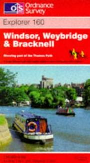
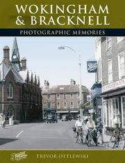

Search results from Open Library.
Recent natural events nearby
Ground air-quality sensors
Recently spotted species
Events
Gallery
Official Identifiers
ONS — UK Office for National Statistics
- ONS code
- osgb4000000074579742
- Local type
- Town
- Region
- South East
api.postcodes.io / OS Open Names
Sources
- • Wikipedia
- • Wikidata
- • Open-Meteo / sunrise-sunset.org
- • Wikipedia Pageviews API
- • Open Library
- • Wikidata SPARQL (CC0) — population, area, elevation, inception, head of government, Commons image
- • ONS / OS Open Names — UK official place gazetteer, via api.postcodes.io (OS code, local type, county/unitary, district/borough, region)
- • ONS — UK Office for National Statistics — api.postcodes.io / OS Open Names