Browse / United Kingdom / England / Knebworth
Knebworth
Englandvillage

Knebworth
Total population
4,155
Demographic figures from UK Office for National Statistics. Overview below cites Wikipedia and may reference a different year.
City facts
Overview
Knebworth is a village and civil parish in the north of Hertfordshire, England, immediately south of Stevenage. The civil parish covers an area between the villages of Datchworth, Woolmer Green, Codicote, Kimpton, Whitwell, St Paul's Walden and Langley, and encompasses the village of Knebworth, the small village of Old Knebworth and Knebworth House.
Read more on WikipediaHistory & geography
History
There is evidence of people living in the area as far back as the 11th century as it is mentioned in the Domesday Book of 1086 where it is referred to as Chenepeworde with a recorded population of 33 households and land belonging to Eskil (of Ware), or simply There is an alternative interpretation, though, that the name could instead have meant 'village on the hill'. The spelling of the name 'Chenepeworde' has since changed to become the modern spelling of 'Knebworth'. The original village, now known as Old Knebworth, developed within the parish of the Church of St Mary and St Thomas. The stone church was built around 1120, and although the Domesday Book makes no mention of the church there is speculation to suggest there may have been a Saxon church of timber on the site before the more substantial one was built. The manor passed into the hands of the Lytton family around 1492, when the manor house was rebuilt to a Late Gothic manor house. The house changed very little until the 19th century when it was re-modelled into the present-day Tudor Gothic building. Knebworth was a largely agricultural community, producing wheat and barley in particular. The proximity to London via the Great North Road (subsequently the A1, and now the B197 since the opening of the A1(M) motorway in 1962) made it possible to transport produce. Her daughter, the suffragette Constance Lytton, also lived there, until just before her death in 1923. Edith's third daughter, Lady Emily Bulwer-Lytton, had married Lutyens in 1897. Lutyens was responsible for a number of notable buildings in the new village of Knebworth as well, including the Bank, St Martin's church, the Golf Clubhouse and the telephone exchange. Knebworth has, since 1974, been famously associated with numerous major open air…
Excerpted from the corresponding Wikipedia article (CC BY-SA).
Geography
Coordinates & boundaries from the US Census TIGER/Line shapefiles.
Climate
Air quality
Walkability
Amenities nearby
Wildlife & biodiversity
Earthquake history
Photos
Sights & places nearby
Notable people from here


People born within ~10 km, from Wikidata (CC0). Click any name for their Wikipedia article.
Nearby places in England
Geography & sun
Elevation, sunrise/sunset and daylight from Open-Meteo. Solar climatology from NASA POWER.
Nearby airports
Public attention
Pageview totals from the Wikimedia Pageviews API.
Books about Knebworth
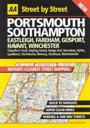



Search results from Open Library.
Recent natural events nearby
Ground air-quality sensors
Recently spotted species
Events
Gallery
Official Identifiers
ONS — UK Office for National Statistics
- ONS code
- osgb4000000074569875
- Local type
- Village
- Region
- Eastern
api.postcodes.io / OS Open Names
Sources
- • Wikipedia
- • Wikidata
- • Open-Meteo / sunrise-sunset.org
- • Wikipedia Pageviews API
- • Open Library
- • ONS / OS Open Names — UK official place gazetteer, via api.postcodes.io (OS code, local type, county/unitary, district/borough, region)
- • ONS — UK Office for National Statistics — api.postcodes.io / OS Open Names