Browse / United Kingdom / England / Walsall
Walsall
Englandtown

Walsall
Total population
67,594
Demographic figures from UK Office for National Statistics. Overview below cites Wikipedia and may reference a different year.
City facts
Sister cities
Facts from Wikidata (CC0).
Overview
Walsall is a market town and administrative centre of the Metropolitan Borough of Walsall, part of the Black Country in the West Midlands, England. Historically part of Staffordshire, it is located 9 miles (14 km) north-west of Birmingham, 7 miles (11 km) east of Wolverhampton and 9 miles (14 km) south-west of Lichfield.
Read more on WikipediaHistory & geography
History
The name Walsall is derived from "Walh halh", meaning "valley of the Welsh", referring to the Celtic Britons who first lived in the area. Later, it is believed that a manor was held here by William Fitz-Ansculf, who held numerous manors in the Midlands. By the first part of the 13th century, Walsall was a small market town with a manor house, Walsall Castle; the weekly market was introduced in 1220 and held on Tuesdays. The mayor of Walsall was created as a political position in the 14th century. The Manor of Walsall was held by the Crown and given as a reward to royal proteges. In 1525, it was given to the King's illegitimate son, Henry Duke of Richmond, and in 1541 to the courtier Sir John Dudley, later Duke of Northumberland. It was seized by Queen Mary in 1553, after Northumberland had been found guilty of treason. Queen Mary's Grammar School was founded in 1554 and the school carries the queen's personal badge as its emblem: the Tudor Rose and the sheaf of arrows of Mary's mother Catherine of Aragon tied with a Stafford knot. The town was visited by Queen Elizabeth I, when it was known as 'Walshale'. The Manor of Walsall was later sold to the Wilbraham and Newport families, and passed by inheritance to the Earls of Bradford. On the death of the fourth Earl in 1762, the estate was transferred to his sister Diana, Countess of Mountrath and then reverted to the Earls of Bradford until the estates were sold after World War II. In 1824, the Walsall Corporation received an Act of Parliament to improve the town by providing lighting and a gasworks. The gasworks was built in 1826 at a cost of £4,000. In 1825, the corporation built eleven tiled, brick almshouses for poor women. They were known to the area as 'Molesley's Almshouses'. The 'Walsall Improvement and…
Geography
A local landmark is Barr Beacon, which is reportedly the highest point following its latitude eastwards until the Ural Mountains in Russia. The soil of Walsall consists mainly of clay with areas of limestone, which were quarried during the Industrial Revolution.
Excerpted from the corresponding Wikipedia article (CC BY-SA).
Geography
Coordinates & boundaries from the US Census TIGER/Line shapefiles.
Climate
Air quality
Walkability
Amenities nearby
Wildlife & biodiversity
Earthquake history
Photos
Sights & places nearby
Notable people from here
Nearby places in England
Geography & sun
Elevation, sunrise/sunset and daylight from Open-Meteo. Solar climatology from NASA POWER.
Nearby airports
Public attention
Pageview totals from the Wikimedia Pageviews API.
Books about Walsall
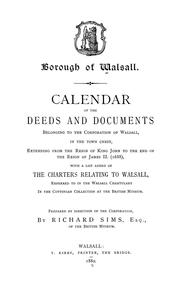
Search results from Open Library.
Recent natural events nearby
Ground air-quality sensors
Recently spotted species
Events
Gallery
Official Identifiers
ONS — UK Office for National Statistics
- ONS code
- osgb4000000074560826
- Local type
- Town
- Region
- West Midlands
api.postcodes.io / OS Open Names
Sources
- • Wikipedia
- • Wikidata
- • Open-Meteo / sunrise-sunset.org
- • Wikipedia Pageviews API
- • Open Library
- • Wikidata SPARQL (CC0) — population, area, elevation, inception, head of government, Commons image
- • ONS / OS Open Names — UK official place gazetteer, via api.postcodes.io (OS code, local type, county/unitary, district/borough, region)
- • ONS — UK Office for National Statistics — api.postcodes.io / OS Open Names