Browse / Australia / Queensland / Stokes
Stokes
Queenslandhamlet

Stokes
Demographic figures from Australian Bureau of Statistics. Overview below cites Wikipedia and may reference a different year.
City facts
Overview
Stokes is an outback locality in the Shire of Carpentaria, Queensland, Australia. In the 2021 census, Stokes had a population of 75 people.
Read more on WikipediaHistory & geography
History
The locality is named after John Lort Stokes, who was commanding officer of HMS Beagle from 1841 to 1846.
Geography
The Leichhardt River forms the western boundary of the locality. Together with the Alexandra River, the Cloncurry River, the Flinders River and the Saxby River and numerous creeks, they all flow from south to north through the locality. The Alexandra River becomes a tributary of the Leichhardt River at the north-western point of the locality and the Cloncurry River and Saxby Rivers both become tributaries of the Flinders River in the north-east of the locality, leaving only the Leichhardt and Flinders Rivers to continue to flow into the Gulf of Carpentaria to the north. The flatness of the land gives emphasis to a hill locally known as Bang Bang Jump Up on the Burke Developmental Road as it is the only sudden change in elevation within a very long distance and is of interest to tourists both as a lookout over the surrounding countryside and because they find the name amusing.
Excerpted from the corresponding Wikipedia article (CC BY-SA).
Geography
Coordinates & boundaries from the US Census TIGER/Line shapefiles.
Climate
10-year averages from ERA5 reanalysis (Open-Meteo).
Air quality
Walkability
Amenities nearby
Wildlife & biodiversity
Most-observed species
- Spotted NightjarEurostopodus argus Hartert, 1892 · Aves6
- Brown FalconFalco berigora Vigors & Horsfield, 1827 · Aves3
- Magpie-larkGrallina cyanoleuca (Latham, 1802) · Aves3
- Zebra FinchTaeniopygia guttata (Vieillot, 1817) · Aves3
- Black KiteMilvus migrans (Boddaert, 1783) · Aves3
- Little EagleHieraaetus morphnoides (Gould, 1841) · Aves2
- Black-faced CuckooshrikeCoracina novaehollandiae (Gmelin, 1789) · Aves2
- Common BronzewingPhaps chalcoptera (Latham, 1790) · Aves2
Citizen-science & research observations from the Global Biodiversity Information Facility (GBIF).
Earthquake history
Events from the USGS Earthquake Catalog (global) (FDSN Event Web Service).
Photos
Sights & places nearby
Notable people from here
Nearby places in Queensland
- Burke and Wills38.3 mi away
- Normanton79.8 mi away · pop. 1,326
- Karumba85.9 mi away · pop. 487
- Burketown90.9 mi away · pop. 167
- Kajabbi97.5 mi away
- Quamby117 mi away
- Riversleigh117.7 mi away
- Croydon118.8 mi away
- Doomadgee121.6 mi away · pop. 1,387
- Strathmore146.5 mi away
- Julia Creek158 mi away · pop. 377
- Camooweal177.3 mi away · pop. 152
Geography & sun
Elevation, sunrise/sunset and daylight from Open-Meteo. Solar climatology from NASA POWER.
Nearby airports
Public attention
Pageview totals from the Wikimedia Pageviews API.
Books about Stokes



Search results from Open Library.
Recent natural events nearby
Ground air-quality sensors
Recently spotted species
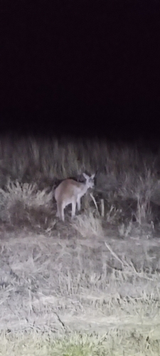
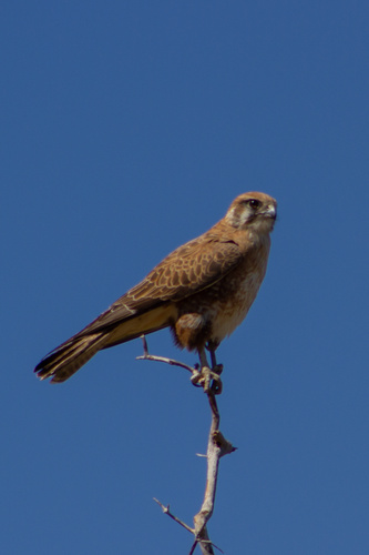
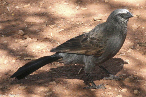
Research-grade observations from iNaturalist (within ~15 mi).
Events
Gallery
Geotagged photos within ~6 miles of Stokes, from Wikimedia Commons contributors.

Photos via Wikimedia Commons — see each image page for license & attribution.
Official Identifiers
ABS — Australian Bureau of Statistics
- ASGS 2021
- SAL32667
- Population (Wikidata)
- 75
- Wikidata
- Q48813766
ASGS 2021 ID via Wikidata P10112
Sources
- • Wikipedia
- • Open-Meteo (ERA5 reanalysis)
- • Wikimedia Commons
- • Wikidata
- • USGS Earthquake Catalog (global feed)
- • GBIF (Global Biodiversity Information Facility)
- • iNaturalist
- • Open-Meteo / sunrise-sunset.org
- • Wikipedia Pageviews API
- • Open Library
- • ABS — Australian Bureau of Statistics — ASGS 2021 ID via Wikidata P10112