Browse / United States / California / San Jacinto
San Jacinto
Californiacity

San Jacinto
Total population
55,180
Median home value
$433,700
Bachelor's+
Median income
$80,647
Air quality index
Demographic figures from US Census Bureau · ACS 5-year estimates. Overview below cites Wikipedia and may reference a different year.
- High Wind Warning · SevereHigh Wind Warning issued October 16 at 5:10AM PDT until October 17 at 8:00PM PDT by NWS San Diego CA
Source: NOAA National Weather Service.
City facts
Overview
San Jacinto is a city in Riverside County, California, United States. It is at the north end of the San Jacinto Valley, with Hemet to its south and Beaumont to its north. The mountains associated with the valley are the San Jacinto Mountains. The population was 53,898 at the 2020 census. The city was founded in 1870 and incorporated on April 20, 1888, making it one of the oldest cities in Riverside County.
Read more on WikipediaHistory & geography
History
The Luiseño were the original inhabitants of what later would be called the San Jacinto Valley, having many villages with residents. The Anza Trail, one of the first European overland routes to California, named after Juan Bautista de Anza,4 crossed the valley in the 1770s. Mission padres named the valley, San Jacinto, which is Spanish for Saint Hyacinth, and around 1820 they established an outpost there. On July 15, 1937, San Jacinto was the end point for the longest uninterrupted airplane flight to that date when Mikhail Gromov's crew of three made the historic polar flight from Moscow, USSR, in a Tupolev ANT-25. This flight followed another similar historic flight over the pole when Valery Chkalov's crew of three ended up in Vancouver's Pearson Airfield earlier that same year. With these two flights, the USSR earned two major milestones in the Fédération Aéronautique Internationale (FAI) flight records. In the early 1950s the fraternal group E Clampus Vitus and the Riverside County Department of Transportation commemorated the Gromov flight by erecting a stone marker on Cottonwood Avenue, just west of Sanderson Avenue in west-central San Jacinto. The landing site is also marked by California State Historical Landmark Number 989.
Geography
San Jacinto is located at (33.787119, −116.966672). According to the United States Census Bureau, the city has a total area of , of which is land and , or 0.63%, is water. The San Jacinto reservoir is an artificial lake used as a basin for the San Diego Aqueduct, a branch of the Colorado River Aqueduct, west of town. Since local geological records have been kept, the city has been struck by two large earthquakes, one on Christmas Day in 1899, and the other on April 21, 1918.
Excerpted from the corresponding Wikipedia article (CC BY-SA).
Demographics & economy
Race & ethnicity
Source: US Census Bureau — American Community Survey, 5-year estimates.
Geography
Coordinates & boundaries from the US Census TIGER/Line shapefiles.
Climate
Current forecast
Forecast for San Jacinto, CA from NOAA NWS API.
Air quality
Current readings from Open-Meteo Air Quality API (Copernicus CAMS European reanalysis).
Industrial & pollution facilities
Natural hazard risk
Health (adults)
Age-adjusted prevalence estimates from CDC PLACES (latest release).
Walkability
Amenities nearby
Wildlife & biodiversity
Most-observed species
- Common RavenCorvus corax Linnaeus, 1758 · Aves6,442
- Red-tailed HawkButeo jamaicensis (Gmelin, 1788) · Aves5,827
- Black PhoebeSayornis nigricans (Swainson, 1827) · Aves5,448
- MallardAnas platyrhynchos Linnaeus, 1758 · Aves4,883
- American CootFulica americana Gmelin, 1789 · Aves4,748
- House FinchHaemorhous mexicanus (P.L.Statius Müller, 1776) · Aves4,693
- Red-winged BlackbirdAgelaius phoeniceus (Linnaeus, 1766) · Aves4,620
- Song SparrowMelospiza melodia (A.Wilson, 1810) · Aves4,264
Citizen-science & research observations from the Global Biodiversity Information Facility (GBIF).
Schools
Largest nearby schools
- San Jacinto HighHigh · San Jacinto · 2,617 students · 21.3:1 ratio
- Hemet HighHigh · Hemet · 2,438 students · 23.4:1 ratio
- Heritage HighHigh · Romoland · 2,428 students · 22.9:1 ratio
- West Valley HighHigh · Hemet · 1,898 students · 23.1:1 ratio
- Tahquitz HighHigh · Hemet · 1,727 students · 21.6:1 ratio
- San Jacinto Valley AcademyOther · San Jacinto · 1,571 students · 20.7:1 ratio
- Diamond Valley MiddleMiddle · Hemet · 1,078 students · 22.9:1 ratio
- Dartmouth MiddleMiddle · Hemet · 1,037 students · 24.7:1 ratio
Public K–12 schools within ~10 mi from Urban Institute Education Data Portal (NCES Common Core of Data, 2022).
Earthquake history
Most recent
- M 2.77 — 2026-10-153 km NNW of San Jacinto, CA
- M 2.71 — 2026-10-114 km E of San Jacinto, CA
- M 2.7 — 2026-10-082 km WNW of Fontana, CA
- M 2.6 — 2026-10-064 km NNW of Big Bear City, CA
- M 3.08 — 2026-10-0120 km ESE of Anza, CA
- M 2.63 — 2026-09-239 km WNW of Anza, CA
Events from the USGS Earthquake Catalog (global) (FDSN Event Web Service).
Photos
Sights & places nearby
Notable people from here


People born within ~10 km, from Wikidata (CC0). Click any name for their Wikipedia article.
Nearby places in California
- East Hemet5.7 mi away
- Nuevo8.4 mi away
- Banning11.6 mi away · pop. 31,093
- Cabazon14.5 mi away
- Idyllwild-Pine Cove15.7 mi away
- Mountain Center16.8 mi away
- Oak Glen16.8 mi away
- Mentone19.3 mi away · pop. 9,514
- Loma Linda22.2 mi away · pop. 25,122
- Grand Terrace24.3 mi away
- El Sobrante27.3 mi away
- Rainbow28.1 mi away
Geography & sun
Elevation, sunrise/sunset and daylight from Open-Meteo. Solar climatology from NASA POWER.
Nearby airports
Public attention
Pageview totals from the Wikimedia Pageviews API.
Books about San Jacinto
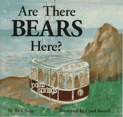

Search results from Open Library.
Recent natural events nearby
- Cyclone RachelSevere Storms · 2026-10-11 · 92 mi
- Wildfire BOUQUET, Los Angeles, CaliforniaWildfires · 2026-10-03 · 96 mi
- Wildfire RIDGE, Los Angeles, CaliforniaWildfires · 2026-08-07 · 125 mi
- Wildfire BUZZARD, Kern, CaliforniaWildfires · 2026-08-05 · 134 mi
- Wildfire CYRUS, Kern, CaliforniaWildfires · 2026-10-09 · 154 mi
- Wildfire PLAINS, San Luis Obispo, CaliforniaWildfires · 2026-08-12 · 204 mi
- Prescribed Fire CRAWFORD CORRAL RX, Tulare, CaliforniaWildfires · 2026-09-19 · 223 mi
- Wildfire Campwood, Yavapai, ArizonaWildfires · 2026-08-23 · 230 mi
Wildfires, storms and other events from NASA EONET (last 12 months, within 250 mi).
Ground air-quality sensors
Recently spotted species
Nearest stream gauge
Live readings from USGS NWIS · measured 2026-10-16 05:30 UTC.
Events
Gallery
Sources
- • Wikipedia
- • US Census Bureau (ACS 5-year estimates)
- • NOAA National Weather Service
- • Wikidata
- • Open-Meteo Air Quality (CAMS)
- • USGS Earthquake Catalog (global feed)
- • USGS NWIS (water data)
- • NCES via Urban Institute Education Data Portal
- • GBIF (Global Biodiversity Information Facility)
- • CDC PLACES
- • Open-Meteo / sunrise-sunset.org
- • Wikipedia Pageviews API
- • Open Library
- • NASA EONET