Browse / Ireland / Tipperary / Clonmel
Clonmel
Tipperarytown

Clonmel
Total population
18,369
Demographic figures from Central Statistics Office (Ireland). Overview below cites Wikipedia and may reference a different year.
City facts
Facts from Wikidata (CC0).
Overview
Clonmel is the county town and largest settlement of County Tipperary, Ireland. The town is noted in Irish history for its resistance to the Cromwellian army which sacked the towns of Drogheda and Wexford. With the exception of the townland of Suir Island, most of the borough is situated in the civil parish of "St Mary's" which is part of the ancient barony of Iffa and Offa East.
Read more on WikipediaHistory & geography
History
Clonmel grew significantly in medieval times and was protected by town walls. A small section of the town walls remains in place near Old St. Mary's Church. This church was originally built in the 14th century or earlier but has been reconstructed or renovated on numerous occasions. It was fortified early in its history, the town being strategically important, initially for the Earls of Ormonde, and later the Earl of Kildare. Some fortified parts of the church were destroyed or damaged during the mid-17th century Cromwellian occupation. One of the former entry points into the town is now the site of the West Gate, a 19th-century reconstruction of an older structure. There were originally three gates in the walled town, North, East and West – with the South being protected by the river Suir and the Comeragh Mountains. The West Gate is now an open arched entrance onto O'Connell Street, the main street of the town. On 17 September 1583, while a fugitive during the last stages of the Second Desmond Rebellion, Fr. Muiris Mac Ionrachtaigh, chaplain and confessor to the Rebel Earl of Desmond, was taken prisoner upon Sliabh Luachra and taken to Clonmel for imprisonment, while he continued his priestly ministry to the best of his ability. According to historian James Coombes, "Here, as in other southern towns, Counter-Reformation Catholicism was already beginning to make a real impact; and, as in these other towns, the citizens of Clonmel were beginning to come up against the problem of combining loyalty to the Pope with loyalty to the Queen. Maurice MacKenraghty continued his ministry during what proved to be a long imprisonment". In April 1585, his jailer was bribed by Victor White, a leading townsman, to release the priest for one night to say Mass and administer…
Geography
The town is built in the valley of the River Suir. It divides the town which is mainly located on the north bank. To the south, the town is surrounded by the Comeragh Mountains and Slievenamon to the northeast. To the north, east and west is some of Ireland's richest farmland, known as the Golden Vale. The town covers a land area of approximately 11.59 km2. The River Suir floods the local area after very heavy rainfalls in the up-river catchment area of 2,173 km2. The Office of Public Works (OPW) completed and installed a Flood Forecasting System which has been used since 2007. The flood of 2015 had a flow of 390m3/s, 2004 had a flow of 354m3/s with the flood of 2000 having a flow of 353m3/s. The 2015 flood was the worst since that of 1946, which had seen a flow of 479m3/s. Phase 1 of the Clonmel Flood Defence (planned to cope with a 100-year flood) started in 2007. It was scheduled to be completed by late 2009. Phases two and three were completed by 2012. Property omitted from Phase 1 along the Convent Road were protected in 2014 and the access to the river for the workmen's boat club was also raised. Flooding of October 2014 was less than a 1–5 flood with a flow of 300m3/s. As part of a media exercise by the OPW the barriers were all put up. The flood defence consists of demountable barriers, walls and earth banks. Flooding occurred at the Gashouse Bridge, Coleville Road, Davis Road, the Quays and the Old Bridge area before the flood defences.
Excerpted from the corresponding Wikipedia article (CC BY-SA).
Geography
Coordinates & boundaries from the US Census TIGER/Line shapefiles.
Climate
Air quality
Walkability
Amenities nearby
Wildlife & biodiversity
Earthquake history
Events from the USGS Earthquake Catalog (global) (FDSN Event Web Service).
Photos
Sights & places nearby
Notable people from here


People born within ~10 km, from Wikidata (CC0). Click any name for their Wikipedia article.
Nearby places in Tipperary
Geography & sun
Elevation, sunrise/sunset and daylight from Open-Meteo. Solar climatology from NASA POWER.
Nearby airports
Public attention
Pageview totals from the Wikimedia Pageviews API.
Books about Clonmel
Search results from Open Library.
Recent natural events nearby
Ground air-quality sensors
Recently spotted species
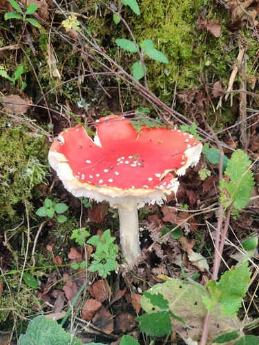
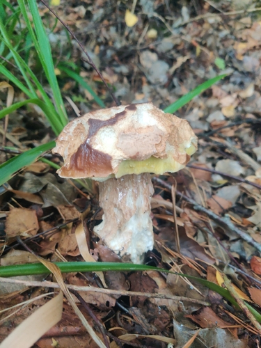
Research-grade observations from iNaturalist (within ~15 mi).
Events
Gallery
Sources
- • Wikipedia
- • Wikidata
- • USGS Earthquake Catalog (global feed)
- • iNaturalist
- • Open-Meteo / sunrise-sunset.org
- • Wikipedia Pageviews API
- • Open Library