Browse / United States / North Carolina / Wanchese
Wanchese
North CarolinaCDP

Wanchese
Total population
1,956
Demographic figures from US Census Bureau · ACS 5-year estimates. Overview below cites Wikipedia and may reference a different year.
City facts
Facts from Wikidata (CC0).
Overview
Wanchese is a census-designated place (CDP) on Roanoke Island in Dare County, North Carolina, United States. It was named after Wanchese, the last known ruler of the Roanoke Native American tribe encountered by English colonists in the sixteenth century. As of the 2020 census, Wanchese had a population of 1,522. Today, Wanchese is the center of commercial fishing and boatbuilding on the Outer Banks.
Read more on WikipediaHistory & geography
History
Also see: History of Roanoke Island Archeological evidence shows that Wanchese was the site of the first fishing village on Roanoke Island. Indigenous people inhabited the area 1500 years ago, and their various cultures used this site for fishing for 1100 years. They also collected oysters and shellfish from nearby beds in the Sound. What is called the Tillett Site (after the last owners) had been occupied originally when it was still part of the mainland, during the entire Archaic Period (8000-1000 BC). After the sea levels rose and it became an island, the saline conditions of the Sound became established, giving rise to the later indigenous fishing culture, including that of the historic Roanoke tribe. In the 1980s, it was to be redeveloped for a major commercial fishing port and seafood processing facility.
Geography
Wanchese is located at , and on the southern end of Roanoke Island. According to the United States, the CDP has a total area of , of which is land and (14.26%) is water.
Excerpted from the corresponding Wikipedia article (CC BY-SA).
Demographics & economy
Geography
Coordinates & boundaries from the US Census TIGER/Line shapefiles.
Climate
Current forecast
Forecast for Wanchese, NC from NOAA NWS API.
Air quality
Industrial & pollution facilities
Natural hazard risk
Health (adults)
Age-adjusted prevalence estimates from CDC PLACES (latest release).
Walkability
Amenities nearby
Wildlife & biodiversity
Schools
Largest nearby schools
- Manteo Elementary SchoolElementary · Manteo · 660 students · 12.2:1 ratio
- Manteo High SchoolHigh · Manteo · 578 students · 15.2:1 ratio
- Nags Head Elementary SchoolElementary · Nags Head · 538 students · 12.8:1 ratio
- Manteo Middle SchoolMiddle · Manteo · 369 students · 12.3:1 ratio
- Dare Learning AcademyHigh · Nags Head · 20 students · 10:1 ratio
Public K–12 schools within ~10 mi from Urban Institute Education Data Portal (NCES Common Core of Data, 2022).
Earthquake history
Photos
Sights & places nearby
Notable people from here


People born within ~10 km, from Wikidata (CC0). Click any name for their Wikipedia article.
Nearby places in North Carolina
Geography & sun
Elevation, sunrise/sunset and daylight from Open-Meteo. Solar climatology from NASA POWER.
Nearby airports
Public attention
Pageview totals from the Wikimedia Pageviews API.
Books about Wanchese
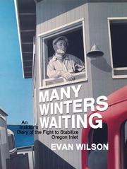
Search results from Open Library.
Recent natural events nearby
Ground air-quality sensors
Recently spotted species
Nearest stream gauge
Events
Gallery
Sources
- • Wikipedia
- • NOAA National Weather Service
- • Wikidata
- • NCES via Urban Institute Education Data Portal
- • CDC PLACES
- • Open-Meteo / sunrise-sunset.org
- • Wikipedia Pageviews API
- • Open Library