Browse / United States / New Hampshire / Hancock
Hancock
New HampshireCDP

Hancock
Total population
132
Median home value
$381,000
Bachelor's+
Median income
$55,278
Founded
1779
Demographic figures from US Census Bureau · ACS 5-year estimates. Overview below cites Wikipedia and may reference a different year.
City facts
Facts from Wikidata (CC0).
Overview
Hancock is a town in Hillsborough County, New Hampshire, United States. The population was 1,731 at the 2020 census. Hancock is home to the Welch Family Farm Forest.
Read more on WikipediaHistory & geography
History
Hancock started as an unidentified settlement on the Contoocook River, in lands known as "Society Land" or "Cumberland", which had been reserved for the proprietors of the lands which became New Hampshire. First settled in 1764, the town was set off from Peterborough and incorporated in 1779, named "Hancock" in honor of John Hancock. A landowner of in the community, Hancock was the first governor of the state of Massachusetts, president of the Continental Congress, and signer of the Declaration of Independence. Almost every building on Main Street in downtown Hancock is listed on the National Register of Historic Places as part of the Hancock Village Historic District. Hancock's Meetinghouse is home to Paul Revere's #236 bell, which chimes on the hour, day and night. The town does not have paved sidewalks, but gravel paths leading from home to home. Image:Main Street looking East, Hancock, NH.jpg|Main Street in 1907 Image:Historical Society, Hancock, NH.jpg|Historical Society in 1915 Image:Public Library & Main Street, Hancock, NH.jpg|Old Library Image:HancockNH BenningtonRoad.jpg|Bennington Road with Historical Society, 2013
Geography
According to the United States Census Bureau, the town has a total area of , of which are land and are water, comprising 4.12% of the town. * Antrim (north) * Bennington (northeast) * Greenfield (east) * Peterborough (south) * Harrisville (southwest) * Nelson (west)
Excerpted from the corresponding Wikipedia article (CC BY-SA).
Demographics & economy
Race & ethnicity
Source: US Census Bureau — American Community Survey, 5-year estimates.
Geography
Coordinates & boundaries from the US Census TIGER/Line shapefiles.
Climate
Current forecast
Forecast for Hancock, NH from NOAA NWS API.
Air quality
Industrial & pollution facilities
Natural hazard risk
Health (adults)
Age-adjusted prevalence estimates from CDC PLACES (latest release).
Walkability
Amenities nearby
Wildlife & biodiversity
Schools
Largest nearby schools
- Conval Regional High SchoolHigh · Peterborough · 683 students · 12:1 ratio
- South Meadow SchoolMiddle · Peterborough · 339 students · 9.7:1 ratio
- Peterborough Elementary SchoolElementary · Peterborough · 238 students · 8.8:1 ratio
- Great Brook SchoolMiddle · Antrim · 224 students · 8.6:1 ratio
- Antrim Elementary SchoolElementary · Antrim · 128 students · 9.1:1 ratio
- Greenfield Elementary SchoolElementary · Greenfield · 93 students · 11.6:1 ratio
- Hancock Elementary SchoolElementary · Hancock · 69 students · 8.6:1 ratio
- Pierce Elementary SchoolElementary · Bennington · 65 students · 8.1:1 ratio
Public K–12 schools within ~10 mi from Urban Institute Education Data Portal (NCES Common Core of Data, 2022).
Earthquake history
Photos
Sights & places nearby
Notable people from here
Nearby places in New Hampshire
Geography & sun
Elevation, sunrise/sunset and daylight from Open-Meteo. Solar climatology from NASA POWER.
Nearby airports
Public attention
Pageview totals from the Wikimedia Pageviews API.
Books about Hancock
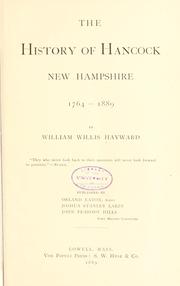


Search results from Open Library.
Recent natural events nearby
Ground air-quality sensors
Recently spotted species
Nearest stream gauge
Events
Gallery
Sources
- • Wikipedia
- • US Census Bureau (ACS 5-year estimates)
- • NOAA National Weather Service
- • Wikidata
- • NCES via Urban Institute Education Data Portal
- • CDC PLACES
- • Open-Meteo / sunrise-sunset.org
- • Wikipedia Pageviews API
- • Open Library