Browse / United States / New Hampshire / New Boston
New Boston
New HampshireCDP

New Boston
Total population
245
Median home value
$0
Bachelor's+
Median income
$250,001
Founded
1763
Demographic figures from US Census Bureau · ACS 5-year estimates. Overview below cites Wikipedia and may reference a different year.
City facts
Facts from Wikidata (CC0).
Overview
New Boston is a town in Hillsborough County, New Hampshire, United States. The population was 6,108 at the 2020 census, up from 5,321 at the 2010 census. New Boston is home to the annual Hillsborough County Agricultural Fair and the Molly Stark Cannon. The 1743 cannon, which appears on the town seal, was given by General John Stark to the New Boston Artillery Company after the Battle of Bennington.
Read more on WikipediaHistory & geography
History
The town was first granted in 1736 by colonial governor Jonathan Belcher of Massachusetts and New Hampshire. At the time, lands to the west of the Merrimack River, disputed between the two provinces, were treated by Belcher as part of Massachusetts, and he granted the town to several Boston families. It was to have been called "Lanestown" or "Piscataquog Township", but by 1751 they called it "New Boston" after their hometown. Not all the grantees took up their claims, and the land was regranted 10 years later to settlers from Londonderry, New Hampshire. When the town was incorporated in 1763, Governor Benning Wentworth formally recognized the long-used name of "New Boston". In 1820, the town had 25 sawmills, six grain mills, two clothing mills, two carding mills, two tanneries and a bark mill. It also had 14 schoolhouses and a tavern. The Great Village Fire of 1887, which started when a spark from a cooper's shop set a barn on fire, destroyed nearly 40 buildings in the lower village. In 1893, the railroad came to New Boston, and farm produce was sent by rail to city markets. Passenger service was discontinued in 1931, and the tracks were removed in 1935. Today the former grade is the multi-use New Boston Rail Trail. The town is home to the New Boston Space Force Station, which started as an Army Air Corps bombing range in 1942. By 1960, it had become a U.S. Air Force base for tracking military satellites. In July 2021, the facility was given its current name and began operating as part of the United States Space Force. New Boston was also home to the Gravity Research Foundation from the late 1940s through the mid-1960s. Founder Roger Babson placed it in New Boston because he believed it safe from nuclear fallout should New York or Boston be attacked. Dodge's Store,…
Geography
According to the United States Census Bureau, the town has a total area of , of which are land and are water, comprising 0.92% of the town. New Boston is drained by the South Branch and Middle Branch of the Piscataquog River, except for the town's southeastern corner, which is drained by Joe English Brook, a tributary of Baboosic Brook. The entire town is part of the Merrimack River watershed. Joe English Hill, elevation above sea level and the highest point in the town, is in the south. The town is crossed by state routes 13, 77, and 136. The three state highways meet in the center of the town at New Boston village. Klondike Corner is a low-density residential area in the southeastern part of the town. * Weare (north) * Goffstown (east) * Bedford (southeast) * Amherst (southeast) * Mont Vernon (south) * Lyndeborough (southwest) * Francestown (west)
Excerpted from the corresponding Wikipedia article (CC BY-SA).
Demographics & economy
Race & ethnicity
Source: US Census Bureau — American Community Survey, 5-year estimates.
Geography
Coordinates & boundaries from the US Census TIGER/Line shapefiles.
Climate
Current forecast
Forecast for New Boston, NH from NOAA NWS API.
Air quality
Industrial & pollution facilities
Natural hazard risk
Health (adults)
Age-adjusted prevalence estimates from CDC PLACES (latest release).
Walkability
Amenities nearby
Wildlife & biodiversity
Most-observed species
- Black-capped ChickadeePoecile atricapillus (Linnaeus, 1766) · Aves10,460
- Blue JayCyanocitta cristata (Linnaeus, 1758) · Aves9,146
- Tufted TitmouseBaeolophus bicolor (Linnaeus, 1766) · Aves7,580
- Northern CardinalCardinalis cardinalis (Linnaeus, 1758) · Aves7,304
- American GoldfinchSpinus tristis (Linnaeus, 1758) · Aves7,043
- American RobinTurdus migratorius Linnaeus, 1766 · Aves6,998
- Mourning DoveZenaida macroura (Linnaeus, 1758) · Aves6,631
- American CrowCorvus brachyrhynchos C.L.Brehm, 1822 · Aves6,230
Citizen-science & research observations from the Global Biodiversity Information Facility (GBIF).
Schools
Largest nearby schools
- Bedford High SchoolHigh · Bedford · 1,391 students · 13.1:1 ratio
- Goffstown High SchoolHigh · Goffstown · 1,033 students · 11.7:1 ratio
- Mountain View Middle SchoolMiddle · Goffstown · 829 students · 11.5:1 ratio
- Clark-Wilkins SchoolElementary · Amherst · 708 students · 13.4:1 ratio
- Ross A. Lurgio Middle SchoolMiddle · Bedford · 700 students · 12.5:1 ratio
- Riddle Brook SchoolElementary · Bedford · 526 students · 14.6:1 ratio
- Maple Avenue SchoolElementary · Goffstown · 524 students · 13.1:1 ratio
- Weare Middle SchoolMiddle · Weare · 524 students · 11.9:1 ratio
Public K–12 schools within ~10 mi from Urban Institute Education Data Portal (NCES Common Core of Data, 2022).
Earthquake history
Most recent
- M 3.8 — 2025-01-279 km SE of York Harbor, Maine
- M 2.7 — 2023-12-235 km SW of Chichester, New Hampshire
- M 2.9 — 2023-04-254 km SW of Center Sandwich, New Hampshire
- M 2.7 — 2018-02-150 km SE of East Kingston, New Hampshire
- M 2.8 — 2016-03-214 km ESE of Warner, New Hampshire
- M 2.61 — 2013-10-11New Hampshire
Events from the USGS Earthquake Catalog (global) (FDSN Event Web Service).
Photos
Sights & places nearby
Notable people from here


People born within ~10 km, from Wikidata (CC0). Click any name for their Wikipedia article.
Nearby places in New Hampshire
Geography & sun
Elevation, sunrise/sunset and daylight from Open-Meteo. Solar climatology from NASA POWER.
Nearby airports
Public attention
Pageview totals from the Wikimedia Pageviews API.
Books about New Boston
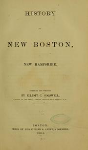
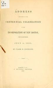

Search results from Open Library.
Recent natural events nearby
Ground air-quality sensors
Recently spotted species
Nearest stream gauge
Events
Gallery
Sources
- • Wikipedia
- • US Census Bureau (ACS 5-year estimates)
- • NOAA National Weather Service
- • Wikidata
- • USGS Earthquake Catalog (global feed)
- • NCES via Urban Institute Education Data Portal
- • GBIF (Global Biodiversity Information Facility)
- • CDC PLACES
- • Open-Meteo / sunrise-sunset.org
- • Wikipedia Pageviews API
- • Open Library