Browse / United States / New Hampshire / Hanover
Hanover
New HampshireCDP
Total population
8,479
Median home value
$842,600
Bachelor's+
Median income
$153,281
Founded
1761
Demographic figures from US Census Bureau · ACS 5-year estimates. Overview below cites Wikipedia and may reference a different year.
City facts
Sister cities
Facts from Wikidata (CC0).
Overview
Hanover is a small census-designated community that lies in New Hampshire, United States. Around 8,479 people are recorded as living there in the most recent open data. Its coordinates of 43.712°, -72.273° place it in the temperate zone of the northern hemisphere. It covers about 11.7 km² of land area. That works out to roughly 725 residents per square kilometre — a medium-density urban fabric. The latitude suggests four distinct seasons with warm summers and cold winters. The location receives about 1,337 kWh/m² of solar irradiance per year and sunshine for roughly 52% of daylight hours. Additional figures on demographics, climate, geography and points of interest appear in the sections that follow, all drawn from open public datasets.
Summary composed automatically from structured open data on this page. See our Terms for details.
History & geography
History
Hanover was chartered by Governor Benning Wentworth on July 4, 1761, and in 1765–1766 its first European inhabitants arrived, the majority from Connecticut. Although the surface is uneven, the town developed into an agricultural community. Dartmouth College was established in 1769 beside the town common at a village called "the Plain"—an extensive and level tract of land a mile (1.6 kilometers) from the Connecticut River, and about above it. At one point in its history, the southwest corner of Hanover, site of "The Plain", was known as "Dresden", which in the 1780s joined other disgruntled New Hampshire towns along the Connecticut River that briefly defected to what was then the independent Vermont Republic. After various political posturings, however, the towns returned to New Hampshire at the heated insistence of George Washington. One remnant of this era is that the name "Dresden" is still used in the Dresden School District, an interstate school district serving both Hanover and Norwich, Vermont—the first and one of the few interstate school districts in the nation. The film Winter Carnival (1939) was shot in Hanover.
Geography
According to the United States Census Bureau, the town has a total area of , of which are land and are water, comprising 2.21% of the town. Hanover borders the towns of Lyme, Canaan, and Enfield in New Hampshire; the town of Norwich, Vermont; and the city of Lebanon, New Hampshire. Inside the limits of Hanover are the small rural villages of Etna and Hanover Center. The highest point in Hanover is the north peak of Moose Mountain, at above sea level. Hanover lies fully within the Connecticut River watershed. There are a number of trails and nature preserves in Hanover, and the majority of these trails are suitable for snowshoes and cross-country skis. The Velvet Rocks Trail, located on the Appalachian Trail, has a number of rock climbing and bouldering spots. According to the Köppen Climate Classification system, Hanover has a hot-summer humid continental climate, abbreviated "Dfa" on climate maps. The hottest temperature recorded in Hanover was on August 2, 1975, while the coldest temperature recorded was on February 16, 1943. |source 2 = National Weather Service }}
Excerpted from the corresponding Wikipedia article (CC BY-SA).
Demographics & economy
Race & ethnicity
Source: US Census Bureau — American Community Survey, 5-year estimates.
Geography
Coordinates & boundaries from the US Census TIGER/Line shapefiles.
Climate
Current forecast
Forecast for Hanover, NH from NOAA NWS API.
Air quality
Industrial & pollution facilities
Natural hazard risk
Health (adults)
Age-adjusted prevalence estimates from CDC PLACES (latest release).
Walkability
Amenities nearby
Wildlife & biodiversity
Schools
Largest nearby schools
- Hanover High SchoolHigh · Hanover · 654 students · 11.1:1 ratio
- Lebanon High SchoolHigh · Lebanon · 598 students · 12.2:1 ratio
- Lebanon Middle SchoolMiddle · Lebanon · 471 students · 11.5:1 ratio
- Bernice A. Ray SchoolElementary · Hanover · 455 students · 11.1:1 ratio
- Frances C. Richmond SchoolMiddle · Hanover · 360 students · 9.2:1 ratio
- Mascoma Valley Regional High SchoolHigh · Canaan · 338 students · 12.1:1 ratio
- Hanover Street SchoolElementary · Lebanon · 328 students · 9.6:1 ratio
- Indian River SchoolMiddle · Canaan · 313 students · 10.8:1 ratio
Public K–12 schools within ~10 mi from Urban Institute Education Data Portal (NCES Common Core of Data, 2022).
Earthquake history
Photos
Sights & places nearby
Notable people from here


People born within ~10 km, from Wikidata (CC0). Click any name for their Wikipedia article.
Nearby places in New Hampshire
Geography & sun
Elevation, sunrise/sunset and daylight from Open-Meteo. Solar climatology from NASA POWER.
Nearby airports
Public attention
Pageview totals from the Wikimedia Pageviews API.
Books about Hanover

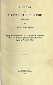


Search results from Open Library.
Recent natural events nearby
Ground air-quality sensors
Recently spotted species
Nearest stream gauge
Events
Gallery
Sources
- • Wikipedia
- • US Census Bureau (ACS 5-year estimates)
- • NOAA National Weather Service
- • Wikidata
- • NCES via Urban Institute Education Data Portal
- • CDC PLACES
- • Open-Meteo / sunrise-sunset.org
- • Wikipedia Pageviews API
- • Open Library