Browse / United States / New Hampshire / Hudson
Hudson
New HampshireCDP

Hudson
Total population
7,469
Median home value
$366,400
Bachelor's+
Median income
$95,842
Demographic figures from US Census Bureau · ACS 5-year estimates. Overview below cites Wikipedia and may reference a different year.
City facts
Overview
Hudson is a town in Hillsborough County, New Hampshire, United States. It is located along the Massachusetts state line. The population was 25,394 at the 2020 census. It is the tenth-largest municipality in the state, by population.
Read more on WikipediaHistory & geography
History
Hudson began as part of the Dunstable Land Grant that encompassed the current city of Nashua, New Hampshire, and the towns of Dunstable and Pepperell, Massachusetts, as well as parts of other nearby towns on both sides of the border. In 1732, all of Dunstable east of the Merrimack River became the town of Nottingham, Massachusetts. Nine years later, the northern boundary of Massachusetts was finally officially established, and the New Hampshire portion of Nottingham became Nottingham West, to avoid confusion with Nottingham, New Hampshire, to the northeast. In 1830, after the better part of a century, the name was changed to "Hudson" to avoid confusion with the older town of Nottingham. The name apparently comes from an early belief that the Merrimack River had once been thought to be a tributary of the Hudson River, or that the area had once been explored by Henry Hudson; both proved to be entirely apocryphal stories, but the name of the town remains today. A prominent family in Hudson history was the Alfred and Virginia Hills family, who owned a large tract of land north of Hudson Village. Dr. Hills' ancestors were original settlers of Hudson. The Hills House on Derry Road (now listed on the National Register of Historic Places) is the original family's vacation home and current location of the Hudson Historical Society. The grounds host the annual "Old Home Days" fair every year as well as "Harvest Fest" and the "Bronco Belly Bustin' Chili Fiesta", an Alvirne High School Friends of Music fundraiser. Hills Memorial Library (also listed on the National Register) is one of the oldest public lending libraries in the state, and occupies a stone and mortar building on Library Street. Alvirne High School and the Alvirne Chapel, located on family land across Derry Road…
Geography
Hudson is located in southeastern Hillsborough County along the southern edge of New Hampshire, with its southern boundary forming the Massachusetts state line. According to the United States Census Bureau, the town has a total area of , of which are land and are water, comprising 3.35% of the town. The town of Hudson had two historic centers, though modern development and suburban sprawl have obscured the difference. Hudson Village, roughly equivalent to the Hudson census-designated place, is located at the western edge of town on the Merrimack River near the junctions of Routes 3A, 111, and 102, and was home to most of the original schools, libraries, and town government, though many of these functions have moved to new facilities elsewhere in town. The Town Hall still remains, though the main police station has moved to the eastern edge of town into an industrial park off Route 111. The Hills Memorial Library building remains as a historic landmark, though its collection has been moved to a new building, the Rodgers Memorial Library, located on Route 102 in the northeastern part of town. The historic Kimball Webster School no longer holds classes, but today houses the town superintendent's office, though both the Library Street School and the H.O. Smith School are still active. The Town Common at the intersection of Derry, Ferry, and Library streets is a park that displays large toy soldiers and other decorations at Christmas time. Hudson Center, historically Hudson's other town center, is located at the five-way intersection of Central Street (Route 111), Greeley Street, Kimball Hill Road, and Windham Road near the geographic center of the town. The two most important landmarks of Hudson Center have been lost to history. Benson's Wild Animal Farm, a zoo and…
Excerpted from the corresponding Wikipedia article (CC BY-SA).
Demographics & economy
Race & ethnicity
Source: US Census Bureau — American Community Survey, 5-year estimates.
Geography
Coordinates & boundaries from the US Census TIGER/Line shapefiles.
Climate
Current forecast
Forecast for Hudson, NH from NOAA NWS API.
Air quality
Industrial & pollution facilities
Natural hazard risk
Health (adults)
Age-adjusted prevalence estimates from CDC PLACES (latest release).
Walkability
Amenities nearby
Wildlife & biodiversity
Schools
Largest nearby schools
- Nashua High School SouthHigh · Nashua · 1,743 students · 13:1 ratio
- Nashua High School NorthHigh · Nashua · 1,594 students · 12.4:1 ratio
- Merrimack High SchoolHigh · Merrimack · 1,113 students · 11.7:1 ratio
- Alvirne High SchoolHigh · Hudson · 1,038 students · 13.1:1 ratio
- Elm Street Middle SchoolMiddle · Nashua · 874 students · 9.9:1 ratio
- Hollis-Brookline High SchoolHigh · Hollis · 757 students · 11.8:1 ratio
- Pelham Elementary SchoolElementary · Pelham · 756 students · 14.5:1 ratio
- Souhegan Coop High SchoolHigh · Amherst · 698 students · 10.3:1 ratio
Public K–12 schools within ~10 mi from Urban Institute Education Data Portal (NCES Common Core of Data, 2022).
Earthquake history
Photos
Sights & places nearby
Notable people from here
Nearby places in New Hampshire
Geography & sun
Elevation, sunrise/sunset and daylight from Open-Meteo. Solar climatology from NASA POWER.
Nearby airports
Public attention
Pageview totals from the Wikimedia Pageviews API.
Books about Hudson
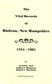

Search results from Open Library.
Recent natural events nearby
Ground air-quality sensors
Recently spotted species
Nearest stream gauge
Events
Gallery
Sources
- • Wikipedia
- • US Census Bureau (ACS 5-year estimates)
- • NOAA National Weather Service
- • NCES via Urban Institute Education Data Portal
- • CDC PLACES
- • Open-Meteo / sunrise-sunset.org
- • Wikipedia Pageviews API
- • Open Library