Browse / United States / New Hampshire / Newmarket
Newmarket
New HampshireCDP

Newmarket
Total population
5,679
Median home value
$423,500
Bachelor's+
Median income
$87,196
Founded
1727
Demographic figures from US Census Bureau · ACS 5-year estimates. Overview below cites Wikipedia and may reference a different year.
City facts
Facts from Wikidata (CC0).
Overview
Newmarket is a town in Rockingham County, New Hampshire, United States. The population was 9,430 at the 2020 census. Some residents are students and employees at the nearby University of New Hampshire in Durham.
Read more on WikipediaHistory & geography
History
Incorporated in 1727, Newmarket is one of six towns granted by Massachusetts in the last year of the reign of King George I. It started as a parish of Exeter, and was granted full town privileges by the legislature in 1737. It was probably named for Newmarket in Suffolk, England. The Lamprey River, running through the town, was named for John Lamprey, an early settler. Newmarket was a center of the New England shipping trade with the West Indies. The town's main exports were timber, dried fish from the Squamscott River and salted alewives from the Lamprey River. The return cargo brought whale oil, molasses and rum back to Newmarket. Newmarket also had a robust shipbuilding presence. There were many ships built for the Royal Navy using trees from Newmarket and the surrounding towns. There is record of Newmarket building 21 ships in one year. The company dominated the mill town's waterfront and economy, with seven textile mills harnessing water power at the falls. The company had cotton shipped up from the Deep South, so its production was adversely affected by the Civil War. It built numerous support structures, including multi-family housing for workers. The company built dams far upriver to create Pawtuckaway Pond in Nottingham and Mendums Pond in Barrington—during drought, the company could release a regulated flow of water from the dams into the Lamprey to run the works. The company closed in 1929. Adapted for modern commercial and residential uses, the mill buildings are located within the Newmarket Industrial and Commercial Historic District, which in 1980 was added to the National Register of Historic Places. In the 1970s, the mill served as the headquarters of the Timberland Company, during the years when it grew from a small work-boot manufacturer to a leading…
Geography
Situated beside Great Bay in southeastern New Hampshire, Newmarket is drained by the Lamprey River and its tributary, the Piscassic River. The town's highest point is the summit of Bald Hill, at above sea level, near the town's southwestern corner. Great Hill, with an elevation of , rises just south of the town center. According to the United States Census Bureau, the town has a total area of , of which are land and are water, comprising 11.24% of the town. The town is crossed by New Hampshire Route 108 and is the eastern terminus of New Hampshire Route 152.
Excerpted from the corresponding Wikipedia article (CC BY-SA).
Demographics & economy
Race & ethnicity
Source: US Census Bureau — American Community Survey, 5-year estimates.
Geography
Coordinates & boundaries from the US Census TIGER/Line shapefiles.
Climate
Air quality
Industrial & pollution facilities
Natural hazard risk
Health (adults)
Age-adjusted prevalence estimates from CDC PLACES (latest release).
Walkability
Amenities nearby
Wildlife & biodiversity
Schools
Largest nearby schools
- Exeter High SchoolHigh · Exeter · 1,447 students · 13.9:1 ratio
- Portsmouth High SchoolHigh · Portsmouth · 1,032 students · 11.7:1 ratio
- Cooperative Middle SchoolMiddle · Stratham · 951 students · 10.5:1 ratio
- Stratham Memorial SchoolElementary · Stratham · 521 students · 11.8:1 ratio
- Nottingham Elementary SchoolElementary · Nottingham · 505 students · 15.8:1 ratio
- Portsmouth Middle SchoolMiddle · Portsmouth · 499 students · 10.6:1 ratio
- Newmarket Elementary SchoolElementary · Newmarket · 472 students · 12.1:1 ratio
- Epping Elementary SchoolElementary · Epping · 456 students · 10.6:1 ratio
Public K–12 schools within ~10 mi from Urban Institute Education Data Portal (NCES Common Core of Data, 2022).
Earthquake history
Photos
Sights & places nearby
Notable people from here
Nearby places in New Hampshire
- Newfields2.8 mi away
- Durham4.7 mi away
- Exeter6.8 mi away
- Portsmouth8.2 mi away · pop. 21,956
- Dover8.2 mi away · pop. 33,364
- Epping8.4 mi away
- Hampton10.8 mi away
- Raymond12.2 mi away · pop. 3,645
- Somersworth12.6 mi away · pop. 12,111
- Hampton Beach12.9 mi away
- Seabrook Beach14.7 mi away
- Rochester15.5 mi away · pop. 32,492
Geography & sun
Elevation, sunrise/sunset and daylight from Open-Meteo. Solar climatology from NASA POWER.
Nearby airports
Public attention
Pageview totals from the Wikimedia Pageviews API.
Books about Newmarket
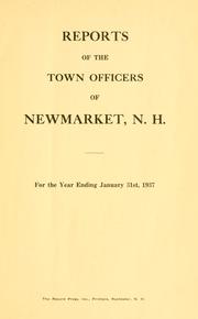


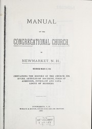
Search results from Open Library.
Recent natural events nearby
Ground air-quality sensors
Recently spotted species
Nearest stream gauge
Events
Gallery
Sources
- • Wikipedia
- • US Census Bureau (ACS 5-year estimates)
- • Wikidata
- • NCES via Urban Institute Education Data Portal
- • CDC PLACES
- • Open-Meteo / sunrise-sunset.org
- • Wikipedia Pageviews API
- • Open Library