Browse / United States / Oklahoma / Guthrie
Guthrie
Oklahomacity

Guthrie
Total population
11,243
Median home value
$186,600
Bachelor's+
Median income
$53,457
Founded
1889
Demographic figures from US Census Bureau · ACS 5-year estimates. Overview below cites Wikipedia and may reference a different year.
- Flood Watch · SevereFlood Watch issued October 13 at 12:26PM CDT until October 15 at 1:00PM CDT by NWS Norman OK
Source: NOAA National Weather Service.
City facts
Facts from Wikidata (CC0).
Overview
Guthrie is a city in and the county seat in Logan County, Oklahoma, United States, and a part of the Oklahoma City Metroplex. As of the 2020 census, Guthrie had a population of 10,749. First known as a railroad station stop, after the Land Run of 1889, Guthrie immediately gained 10,000 new residents, who began to develop the town. It was rapidly improved and was designated as the territorial capital, and in 1907 as the first state capital of Oklahoma. In 1910, state voters chose the larger Oklahoma City as the new capital in a special election.
Read more on WikipediaHistory & geography
History
Guthrie was established in 1887 as a railroad station called Deer Creek on the Southern Kansas Railway—later acquired by the Atchison, Topeka and Santa Fe Railway ("AT&SF")-- running from the Kansas–Oklahoma border to Purcell. The name was later changed to Guthrie, named for jurist John Guthrie of Topeka, Kansas. A post office was established on April 4, 1889. In 1889, some 50,000 potential settlers gathered at the edges of the Unassigned Lands in hopes of staking a claim to a plot. At noon on April 22, 1889, cannons resounded at a section of Indian Territory, launching president Benjamin Harrison's "Hoss Race" or Land Run of 1889. People ran for both farmlands and towns. During the next six hours, about 10,000 people settled in what became the capital of the new Territory of Oklahoma. Within months, Guthrie was developed as a modern brick-and-stone "Queen of the Prairie" with municipal water, electricity, a mass-transit system, and underground parking garages for horses and carriages. Guthrie's western heritage includes the fact that, on April 13, 1898, outlaw Richard "Little Dick" West, a former member of the Wild Bunch gang, was in town when approached by legendary lawmen Heck Thomas and Bill Tilghman. He refused to surrender, and was killed in the resulting gunfight. He is buried in the Summit View Cemetery in Guthrie near outlaw Bill Doolin. Guthrie’s early connection with rail travel was not completely defined by the AT&SF. Two other railroads indirectly served Guthrie, being the Guthrie and Kingfisher Railway and the Guthrie and Western Railway, which together connected the rails of the Chicago, Rock Island and Pacific Railroad (“Rock Island”) at Kingfisher with the AT&SF trackage serving Guthrie from a point near the town of Seward (just southwest of…
Excerpted from the corresponding Wikipedia article (CC BY-SA).
Demographics & economy
Race & ethnicity
Source: US Census Bureau — American Community Survey, 5-year estimates.
Geography
Coordinates & boundaries from the US Census TIGER/Line shapefiles.
Climate
Current forecast
Forecast for Guthrie, OK from NOAA NWS API.
Air quality
Industrial & pollution facilities
Natural hazard risk
Health (adults)
Age-adjusted prevalence estimates from CDC PLACES (latest release).
Walkability
Amenities nearby
Wildlife & biodiversity
Schools
Largest nearby schools
- GUTHRIE HSHigh · Guthrie · 1,025 students · 17.7:1 ratio
- GUTHRIE JHSMiddle · Guthrie · 496 students · 14.6:1 ratio
- GUTHRIE UPPER ESMiddle · Guthrie · 467 students · 15.6:1 ratio
- CHARTER OAK ESElementary · Guthrie · 467 students · 18:1 ratio
- FOGARTY ESElementary · Guthrie · 438 students · 18.3:1 ratio
- COTTERAL ESElementary · Guthrie · 294 students · 13.4:1 ratio
- CENTRAL ESElementary · Guthrie · 278 students · 14.6:1 ratio
- eSCHOOL VIRTUAL CHARTER HSHigh · Guthrie · 272 students · 34:1 ratio
Public K–12 schools within ~10 mi from Urban Institute Education Data Portal (NCES Common Core of Data, 2022).
Earthquake history
Photos
Sights & places nearby
Notable people from here
Nearby places in Oklahoma
- Langston8.2 mi away · pop. 1,692
- Coyle11 mi away · pop. 522
- Edmond14 mi away · pop. 99,036
- Fallis18.5 mi away · pop. 4
- Carney22.6 mi away · pop. 562
- The Village22.7 mi away
- Wellston23.5 mi away
- Lake Aluma23.9 mi away · pop. 105
- Tryon24.6 mi away · pop. 372
- Spencer25.4 mi away · pop. 3,928
- Stillwater25.7 mi away · pop. 49,269
- Warwick26 mi away · pop. 202
Geography & sun
Elevation, sunrise/sunset and daylight from Open-Meteo. Solar climatology from NASA POWER.
Nearby airports
Public attention
Pageview totals from the Wikimedia Pageviews API.
Books about Guthrie

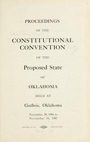
Search results from Open Library.
Recent natural events nearby
- Wildfire GRACEMONT, Caddo, OklahomaWildfires · 2026-09-13 · 60 mi
- Wildfire 2690, Caddo, OklahomaWildfires · 2026-08-21 · 66 mi
- Wildfire WRIGHT, Hughes, OklahomaWildfires · 2026-08-29 · 86 mi
- Wildfire B.B, Osage, OklahomaWildfires · 2026-08-06 · 89 mi
- Wildfire BISON, Osage, OklahomaWildfires · 2026-08-21 · 91 mi
- Wildfire MEERS, Comanche, OklahomaWildfires · 2026-09-08 · 101 mi
- Wildfire Calvary Creek, Washita, OklahomaWildfires · 2026-09-15 · 102 mi
- Wildfire PINTO, Stephens, OklahomaWildfires · 2026-09-08 · 102 mi
Wildfires, storms and other events from NASA EONET (last 12 months, within 250 mi).
Ground air-quality sensors
Recently spotted species
Nearest stream gauge
Events
Gallery
Sources
- • Wikipedia
- • US Census Bureau (ACS 5-year estimates)
- • NOAA National Weather Service
- • Wikidata
- • NCES via Urban Institute Education Data Portal
- • CDC PLACES
- • Open-Elevation
- • Open-Meteo / sunrise-sunset.org
- • Wikipedia Pageviews API
- • Open Library
- • NASA EONET