Browse / United Kingdom / England / Masham
Masham
Englandtown

Masham
Total population
1,112
Demographic figures from UK Office for National Statistics. Overview below cites Wikipedia and may reference a different year.
City facts
Overview
Masham is a market town and civil parish in North Yorkshire, England. It had a population of 1,205 at the 2011 census.
Read more on WikipediaHistory & geography
History
The Romans had a presence here, but the first permanent settlers were the Angles. Around 900 AD the Vikings invaded, burning and laying waste to the church. They also introduced sheep farming, for which the town is still known. Masham was historically a large parish in the North Riding of Yorkshire. As well as the town of Masham the parish included the townships of Burton-on-Yore, Ellingstring, Ellington High and Low, Fearby, Healey with Sutton, Ilton cum Pott and Swinton. In 1866 the townships became separate civil parishes. Masham Moor was an area of moorland to the west of the parish bordering the West Riding, common to the parishes of Masham and East Witton. It was divided between the parishes of Healey, Ilton cum Pott and Colsterdale in 1934. The area of the ancient parish, except Burton-on-Yore, was known as Mashamshire from the 12th century or earlier. St Mary's Church was most likely founded in the seventh century and stood somewhere near the present town hall on what used to be known as Cockpit Hill. The graveyard yielded 36 burials in a recent excavation. The present church – while having some Anglo-Saxon stonework and the stump of an eighth-century prayer cross – is mainly Norman with fifteenth-century additions. Masham was given to York Minster in the medieval period but, as the archbishop did not wish to make the long journey north to oversee the town's affairs, the parish was designated a peculiar. During the Middle Ages, Masham developed as a small town with milling, mining, cloth making and tanning industries. The town received its first market charter in 1251. Masham's importance as a major sheep market is the reason for the large market place and its Georgian houses. The market originally thrived because of its nearness to Jervaulx and…
Excerpted from the corresponding Wikipedia article (CC BY-SA).
Geography
Coordinates & boundaries from the US Census TIGER/Line shapefiles.
Climate
Air quality
Walkability
Amenities nearby
Wildlife & biodiversity
Most-observed species
- Common Wood-PigeonColumba palumbus Linnaeus, 1758 · Aves1,744
- Eurasian BlackbirdTurdus merula Linnaeus, 1758 · Aves1,533
- MallardAnas platyrhynchos Linnaeus, 1758 · Aves1,292
- Western JackdawColoeus monedula (Linnaeus, 1758) · Aves1,250
- European RobinErithacus rubecula (Linnaeus, 1758) · Aves1,241
- Eurasian Blue TitCyanistes caeruleus (Linnaeus, 1758) · Aves1,146
- Carrion CrowCorvus corone Linnaeus, 1758 · Aves1,145
- Graylag GooseAnser anser (Linnaeus, 1758) · Aves1,126
Citizen-science & research observations from the Global Biodiversity Information Facility (GBIF).
Earthquake history
Most recent
- M 3.4 — 2025-12-030 km ESE of Carnforth, United Kingdom
- M 2.8 — 2020-01-231 km NW of Stockton-on-Tees, United Kingdom
- M 3.6 — 2011-01-035 km S of Masham, United Kingdom
- M 3.5 — 2010-12-2112 km WSW of Ambleside, United Kingdom
- M 3.7 — 2009-04-283 km WSW of Flookburgh, United Kingdom
- M 2.5 — 2008-05-2812 km WNW of Penrith, United Kingdom
Events from the USGS Earthquake Catalog (global) (FDSN Event Web Service).
Photos
Sights & places nearby
Notable people from here


People born within ~10 km, from Wikidata (CC0). Click any name for their Wikipedia article.
Nearby places in England
Geography & sun
Elevation, sunrise/sunset and daylight from Open-Meteo. Solar climatology from NASA POWER.
Nearby airports
Public attention
Pageview totals from the Wikimedia Pageviews API.
Books about Masham


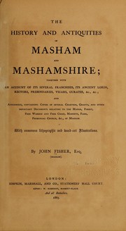
Search results from Open Library.
Recent natural events nearby
Ground air-quality sensors
Recently spotted species
Events
Gallery
Official Identifiers
ONS — UK Office for National Statistics
- ONS code
- osgb4000000074547760
- Local type
- Town
- Region
- Yorkshire and the Humber
api.postcodes.io / OS Open Names
Sources
- • Wikipedia
- • Wikidata
- • USGS Earthquake Catalog (global feed)
- • GBIF (Global Biodiversity Information Facility)
- • Open-Meteo / sunrise-sunset.org
- • Wikipedia Pageviews API
- • Open Library
- • ONS / OS Open Names — UK official place gazetteer, via api.postcodes.io (OS code, local type, county/unitary, district/borough, region)
- • ONS — UK Office for National Statistics — api.postcodes.io / OS Open Names