Browse / United Kingdom / England / Thirsk
Thirsk
Englandtown

Thirsk
Demographic figures from UK Office for National Statistics. Overview below cites Wikipedia and may reference a different year.
City facts
Facts from Wikidata (CC0).
Overview
Thirsk is a market town and civil parish in North Yorkshire, England; it is known for its racecourse and depiction as local author James Herriot's fictional Darrowby.
Read more on WikipediaHistory & geography
History
Archeological finds indicate there was a settlement in Thirsk around 500–600 BC. The town's name is derived from the Old Norse word , meaning 'fen' or 'lake'. Thirsk is mentioned twice in the 1086 Domesday Book as Tresche, in the Yarlestre wapentake, a village with ten households. At the time of the Norman invasion the manor was split between Orm and Thor, local Anglo-Saxon landowners. Afterwards, it was split between Hugh, son of Baldric, and the Crown. Most of Thirsk was granted to a Robert de Mowbray from Montbray in Normandy, for whose descendants the House of Mowbray and the Vale of Mowbray are named. By 1145, what is now Old Thirsk had gained a Market charter giving it town and borough status. The remaining land in the parish was under manorial rights. The Mowbray family built a castle on the north side of Castlegate. It is not mentioned in the Domesday Book and an exact date is not recorded for its construction, but it was completely destroyed by 1176 following an uprising against Henry II. William de Mowbray, 6th Baron of Thirsk, 4th Baron Mowbray, was one of the 25 executors of the Magna Carta in 1215. The Mowbrays built a manor house on the old castle site which was destroyed by the Scots in 1322. With no direct succession, the daughter of Thomas de Mowbray, 1st Duke of Norfolk, who had married into the Berkeley family, inherited the manor. Her son, William de Berkeley, 1st Marquess of Berkeley, inherited it on her death. For some years, the manor was held by Thomas Stanley Earl of Derby, whose successors held it after William's death, until 1723. In that year, it was sold by James, Earl of Derby to Ralph Bell of Sowerby, "whose descendants thereafter held the manor". It remained in the Bell family into the 20th century. Thirsk Hall in Kirkgate is…
Geography
{| class="wikitable mw-collapsible" !Place!!Distance!!Direction!!Relation |- |London | |South |Capital city |- |Middlesbrough | |North-east |Most populated place in the ceremonial county of North Yorkshire |- |York | |South-west |Historic county town |- |Northallerton | |North |County town |} Thirsk is in the Vale of Mowbray and situated around the Cod Beck. Within Thirsk, Norby lies to the north-west, and Old Thirsk to the north-east. The separate parish of Sowerby abuts to the south. Nearby villages with names of Danish origin, identified by the suffix by meaning village, include Thirlby, Boltby and Borrowby.
Excerpted from the corresponding Wikipedia article (CC BY-SA).
Geography
Coordinates & boundaries from the US Census TIGER/Line shapefiles.
Climate
Air quality
Walkability
Amenities nearby
Wildlife & biodiversity
Earthquake history
Photos
Sights & places nearby
Notable people from here


People born within ~10 km, from Wikidata (CC0). Click any name for their Wikipedia article.
Nearby places in England
Geography & sun
Elevation, sunrise/sunset and daylight from Open-Meteo. Solar climatology from NASA POWER.
Nearby airports
Public attention
Pageview totals from the Wikimedia Pageviews API.
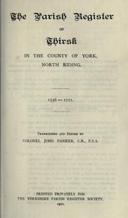
Books about Thirsk
![[Report 1969]](https://covers.openlibrary.org/b/id/8170618-M.jpg)
![[Report 1970]](https://covers.openlibrary.org/b/id/8170684-M.jpg)


Search results from Open Library.
Recent natural events nearby
Ground air-quality sensors
Recently spotted species
Events
Gallery
Official Identifiers
ONS — UK Office for National Statistics
- ONS code
- osgb4000000074547738
- Local type
- Town
- Region
- Yorkshire and the Humber
api.postcodes.io / OS Open Names
Sources
- • Wikipedia
- • Wikidata
- • Open-Meteo / sunrise-sunset.org
- • Wikipedia Pageviews API
- • Open Library
- • ONS / OS Open Names — UK official place gazetteer, via api.postcodes.io (OS code, local type, county/unitary, district/borough, region)
- • ONS — UK Office for National Statistics — api.postcodes.io / OS Open Names