Browse / United Kingdom / England / Ventnor
Ventnor
Englandtown

Ventnor
Total population
7,000
Demographic figures from UK Office for National Statistics. Overview below cites Wikipedia and may reference a different year.
City facts
Facts from Wikidata (CC0).
Overview
Ventnor is a seaside resort town and civil parish established in the Victorian era on the southeast coast of the Isle of Wight, England, 11 miles (18 km) from Newport. It is situated south of St Boniface Down, and built on steep slopes leading down to the sea. The higher part is referred to as Upper Ventnor ; the lower part, where most amenities are located, is known as Ventnor. Ventnor is sometimes taken to include the adjacent older settlements of St Lawrence and Bonchurch, which are covered by its town council. The population is 5,567 according to the 2021 Census.
Read more on WikipediaHistory & geography
History
While Bonchurch and St Lawrence both have churches dating back to the Norman era, the area in between that became Ventnor was unremarkable until the 19th century. There are indications of Bronze Age settlement, with burial mounds on the nearby downs, and excavations have evidenced small scale settlement in the area during both the Iron Age and the early Roman period. These include middens and palaeoenvironmental deposits at Binnel Bay, Woody Bay, St Catherine's Point and Rocken End. During the 13th century, the area was covered by the manors of Holloway and Steephill, both belonging to the Lisle family. A 1992 archaeological survey found evidence of a medieval settlement at Flowers Brook, which was referred to in a 1327 subsidy roll as Villata de steple. This area was subsequently incorporated into two farms, with some cottages on the site demolished in 1834. Ventnor watermill, on a site just north of the current cascade, is first mentioned in 1327, was destroyed by fire in 1848, rebuilt by 1853, and demolished in 1875. In the early nineteenth century, in addition to the mill, Ventnor consisted solely of a few fishermen's huts by the cove, a couple of inns, and a farm. In 1804, it was described by John Britton as a "hamlet...formed by a range of neat cottages chiefly inhabited by fishermen, open to the sea in front, and backed by woods and the high downs". at a time when consumption (now known as TB) was a common cause of death. Thereafter Ventnor developed very rapidly into a town, with numerous hotels and boarding houses targeting sick visitors, particularly during the winter, and a wider range of shops than would be expected for a town of its size (by 1891 it had four chemists). However, not everyone was enamoured with the fast-growing town: in 1845, after…
Geography
Ventnor is on the south-east coast of the Isle of Wight, an island in the English Channel about off the coast of Hampshire, at . It is by road south-south-east of the island's county town Newport, and about south-west of London. Its coastline is dominated by cliff scenery, with the town rising up the steep south-facing terraces between Ventnor Bay and St Boniface Down, which, at , is the highest point on the island. The town itself extends from the seashore up to the slopes of the downs, with its commercial centre being above sea-level; the urban area is contiguous with the neighbouring settlements of St Lawrence to the west and Bonchurch to the east. There are nearby Sites of Special Scientific Interest at Ventnor Downs, St Lawrence Bank, Rew Down, and the Bonchurch Landslips, as well as the coast west of the town that forms part of the island's largest SSSI between Steephill Cove and Compton Chine. The downs are part of the Isle of Wight Area of Outstanding Natural Beauty. Ventnor beach is one of the island's principal if smaller beaches; there are also small beaches at Bonchurch and Steephill. The Isle of Wight Coastal Path runs through Ventnor. The town has no river, although there are tufa-depositing springs along the downs feeding streams that flow the short distance to the sea, such as one through Cascade Gardens, and another through the park that becomes Flowers Brook. The tides along the coast are strong, with a tidal range of around . Three miles off the coast, there is a parallel ridge under the sea rising to within of the surface; tidal flows forced between it, and the island have carved out a deep channel known as 'St Catherine's Deep'. The coast here is also part of the South Wight Maritime Special Area of Conservation, with subtidal reefs…
Excerpted from the corresponding Wikipedia article (CC BY-SA).
Geography
Coordinates & boundaries from the US Census TIGER/Line shapefiles.
Climate
Air quality
Walkability
Amenities nearby
Wildlife & biodiversity
Earthquake history
Photos
Sights & places nearby
Notable people from here


People born within ~10 km, from Wikidata (CC0). Click any name for their Wikipedia article.
Nearby places in England
Geography & sun
Elevation, sunrise/sunset and daylight from Open-Meteo. Solar climatology from NASA POWER.
Nearby airports
Public attention
Pageview totals from the Wikimedia Pageviews API.
Books about Ventnor
![[Report 1946]](https://covers.openlibrary.org/b/id/11034003-M.jpg)

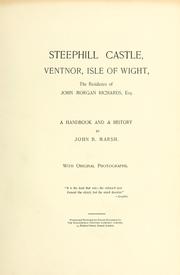


Search results from Open Library.
Recent natural events nearby
Ground air-quality sensors
Recently spotted species
Events
Gallery
Official Identifiers
ONS — UK Office for National Statistics
- ONS code
- osgb4000000074553925
- Local type
- Town
- Region
- South East
api.postcodes.io / OS Open Names
Sources
- • Wikipedia
- • Wikidata
- • Open-Meteo / sunrise-sunset.org
- • Wikipedia Pageviews API
- • Open Library
- • ONS / OS Open Names — UK official place gazetteer, via api.postcodes.io (OS code, local type, county/unitary, district/borough, region)
- • ONS — UK Office for National Statistics — api.postcodes.io / OS Open Names