Browse / United States / California / Half Moon Bay
Half Moon Bay
Californiacity

Half Moon Bay
Total population
11,391
Median home value
$1,549,500
Bachelor's+
Median income
$157,884
Demographic figures from US Census Bureau · ACS 5-year estimates. Overview below cites Wikipedia and may reference a different year.
- Beach Hazards Statement · ModerateBeach Hazards Statement issued June 15 at 5:01AM PDT until June 18 at 5:00AM PDT by NWS San Francisco CA
- Coastal Flood Advisory · MinorCoastal Flood Advisory issued June 15 at 5:01AM PDT until June 17 at 5:00AM PDT by NWS San Francisco CA
Source: NOAA National Weather Service.
City facts
Facts from Wikidata (CC0).
Overview
Half Moon Bay is a coastal city in San Mateo County, California, United States, approximately 25 miles south of San Francisco. Its population was 11,795 as of the 2020 census. Immediately north of Half Moon Bay is Pillar Point Harbor and the unincorporated community of Princeton-by-the-Sea. Half Moon Bay is known for Mavericks, a big-wave surf location. It is called Half Moon Bay because of its crescent shape.
Read more on WikipediaHistory & geography
History
Half Moon Bay began as a rural agricultural area, primarily used by Mission San Francisco de Asís (established in 1776) for grazing cattle, horses, and oxen. After the Mission's secularization, Tiburcio Vásquez received the Rancho Corral de Tierra Mexican land grant in 1839 and Candelario Miramontes was granted Rancho Miramontes (later known as Rancho San Benito) in 1841. The community began to develop in the 1840s as San Mateo County's first real town. Originally, San Benito, the town was renamed Spanishtown and attracted a thriving fishing industry in addition to its continued importance to coastal agriculture. Spanishtown became a racially diverse community, settled by Canadians, Chinese, English, Germans, Irish, Mexicans, Italians, Scots, Portuguese, and Pacific Islanders. Regular stagecoach service was established with San Mateo; coaches also served Purissima, Lobitos, and San Gregorio. Levy Brothers opened a department store downtown. Spanishtown was officially renamed Half Moon Bay in 1874. The area grew very slowly, even after the Ocean Shore Railroad began serving the community in 1907. The construction of Pedro Mountain Road in 1914 provided better access to San Francisco and probably contributed to the railroad's demise by 1920. The USS DeLong ran aground at Half Moon Bay on December 1, 1921. During Prohibition "rum runners" took advantage of dense fog and hidden coves in the area to serve several roadhouses and inns, some of which operate today as restaurants (e.g., Moss Beach Distillery). Real growth in the area came after World War II with the construction of numerous subdivisions, eventually leading to Half Moon Bay's incorporation in 1959. The city preserves a historic downtown district that has buildings dating as far back as 1869. In 2008,…
Geography
Half Moon Bay is approximately south of San Francisco, west of San Mateo, and north of Santa Cruz. Neighboring towns include El Granada, Princeton-by-the-Sea, Moss Beach, and Montara to the north and Purissima, San Gregorio, and Pescadero to the south. The city limits of Half Moon Bay run up the coast from the main part of the town to include the neighborhoods of Frenchman's Creek and Miramar Beach, with the northernmost extant overlooking Pillar Point Harbor. According to the United States Census Bureau, the city has a total area of , of which is land and (0.17%) is water. The study found at least 123 buildings, including the Ritz Carlton (a major employer for the town), Pigeon Point Lighthouse and the Pescadero Cal Fire Station would be seriously threatened by erosion if sea level were to rise by . Typical of Northern California, most of the rain falls from November to April. The normal annual precipitation is . |date=August 2010 }}
Excerpted from the corresponding Wikipedia article (CC BY-SA).
Demographics & economy
Race & ethnicity
Source: US Census Bureau — American Community Survey, 5-year estimates.
Geography
Coordinates & boundaries from the US Census TIGER/Line shapefiles.
Climate
Current forecast
Forecast for Half Moon Bay, CA from NOAA NWS API.
Air quality
Industrial & pollution facilities
Natural hazard risk
Health (adults)
Age-adjusted prevalence estimates from CDC PLACES (latest release).
Walkability
Amenities nearby
Wildlife & biodiversity
Most-observed species
- American CrowCorvus brachyrhynchos C.L.Brehm, 1822 · Aves34,443
- Anna's HummingbirdCalypte anna (R.Lesson, 1829) · Aves33,520
- House FinchHaemorhous mexicanus (P.L.Statius Müller, 1776) · Aves31,655
- Dark-eyed JuncoJunco hyemalis (Linnaeus, 1758) · Aves29,066
- Chestnut-backed ChickadeePoecile rufescens (J.K.Townsend, 1837) · Aves28,439
- Western GullLarus occidentalis Audubon, 1839 · Aves26,419
- Black PhoebeSayornis nigricans (Swainson, 1827) · Aves25,992
- Common RavenCorvus corax Linnaeus, 1758 · Aves24,152
Citizen-science & research observations from the Global Biodiversity Information Facility (GBIF).
Schools
Largest nearby schools
- Carlmont HighHigh · Belmont · 2,322 students · 20.4:1 ratio
- Aragon HighHigh · San Mateo · 1,740 students · 23.2:1 ratio
- Hillsdale HighHigh · San Mateo · 1,629 students · 17.7:1 ratio
- San Mateo HighHigh · San Mateo · 1,613 students · 19.2:1 ratio
- Burlingame HighHigh · Burlingame · 1,519 students · 21.1:1 ratio
- Mills HighHigh · Millbrae · 1,141 students · 21.5:1 ratio
- Ralston IntermediateMiddle · Belmont · 1,117 students · 21.5:1 ratio
- Half Moon Bay HighHigh · Half Moon Bay · 1,024 students · 21.3:1 ratio
Public K–12 schools within ~10 mi from Urban Institute Education Data Portal (NCES Common Core of Data, 2022).
Earthquake history
Most recent
- M 3.6 — 2026-06-073 km SW of Alamo, CA
- M 2.65 — 2026-06-047 km E of Fremont, CA
- M 2.72 — 2026-05-102 km ESE of Pinole, CA
- M 2.52 — 2026-05-0220 km SE of Livermore, CA
- M 2.77 — 2026-04-3014 km N of Morgan Hill, CA
- M 2.62 — 2026-04-2616 km E of Seven Trees, CA
Events from the USGS Earthquake Catalog (global) (FDSN Event Web Service).
Photos
Sights & places nearby
Notable people from here


People born within ~10 km, from Wikidata (CC0). Click any name for their Wikipedia article.
Nearby places in California
Geography & sun
Elevation, sunrise/sunset and daylight from Open-Meteo. Solar climatology from NASA POWER.
Nearby airports
Public attention
Pageview totals from the Wikimedia Pageviews API.
Books about Half Moon Bay

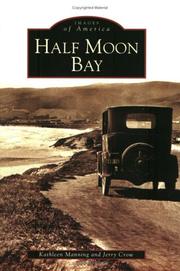
Search results from Open Library.
Recent natural events nearby
- PUTAH Wildfire, Yolo, CaliforniaWildfires · 2026-06-08 · 75 mi
- WALTZ Wildfire, Mariposa, CaliforniaWildfires · 2026-06-05 · 121 mi
- BRITE Wildfire, Kern, CaliforniaWildfires · 2026-05-09 · 220 mi
- Foothill Wildfire, Santa Barbara, CaliforniaWildfires · 2026-05-19 · 241 mi
- RIVER Wildfire, Kern, CaliforniaWildfires · 2026-05-18 · 246 mi
- TOWER Wildfire, Kern, CaliforniaWildfires · 2026-05-03 · 249 mi
Wildfires, storms and other events from NASA EONET (last 12 months, within 250 mi).
Ground air-quality sensors
Recently spotted species
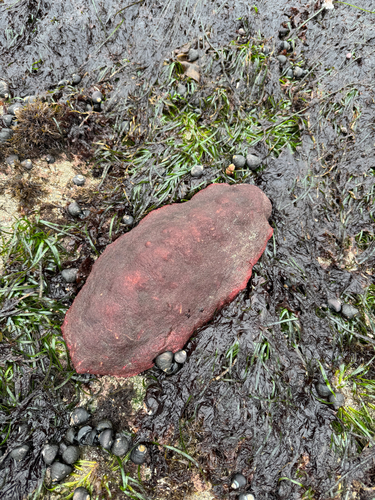
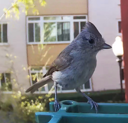
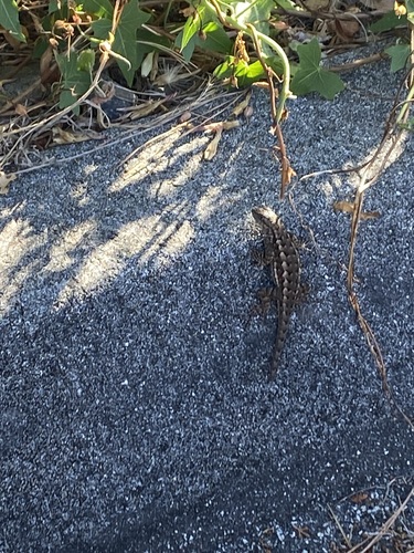
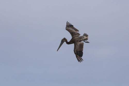
Research-grade observations from iNaturalist (within ~15 mi).
Nearest stream gauge
Live readings from USGS NWIS · measured 2026-06-15 09:00 UTC.
Events
Gallery
Geotagged photos within ~6 miles of Half Moon Bay, from Wikimedia Commons contributors.
 0.2 mi
 0.2 mi
 0.2 mi
 0.2 mi
 0.2 mi
 0.3 mi
 0.3 mi
.jpeg) 0.3 mi
0.3 mi 0.3 mi
 0.3 mi
 0.4 mi
 0.4 mi
 0.4 mi
 0.4 mi
.jpg) 0.4 mi
0.4 mi 0.4 mi
.jpg) 0.4 mi
0.4 mi.jpg) 0.4 mi
0.4 mi 0.4 mi
 0.4 mi
 0.4 mi
 0.4 mi
 0.4 mi
 0.4 mi
Photos via Wikimedia Commons — see each image page for license & attribution.
Sources
- • Wikipedia
- • US Census Bureau (ACS 5-year estimates)
- • NOAA National Weather Service
- • Wikimedia Commons
- • Wikidata
- • USGS Earthquake Catalog (global feed)
- • USGS NWIS (water data)
- • NCES via Urban Institute Education Data Portal
- • GBIF (Global Biodiversity Information Facility)
- • iNaturalist
- • CDC PLACES
- • Open-Meteo / sunrise-sunset.org
- • Wikipedia Pageviews API
- • Open Library
- • NASA EONET