Browse / United States / Massachusetts / Burlington
Burlington
MassachusettsCDP

Burlington
Total population
26,274
Median home value
$740,600
Bachelor's+
Median income
$146,436
Founded
1640
Demographic figures from US Census Bureau · ACS 5-year estimates. Overview below cites Wikipedia and may reference a different year.
- Wind Advisory · ModerateWind Advisory issued September 24 at 12:38PM EDT until September 27 at 2:00AM EDT by NWS Boston/Norton MA
Source: NOAA National Weather Service.
City facts
Facts from Wikidata (CC0).
Overview
Burlington is a town in Middlesex County, Massachusetts, United States. The population was 26,377 at the 2020 census.
Read more on WikipediaHistory & geography
History
It is believed that Burlington takes its name from the English town of Bridlington, Yorkshire, but this has never been confirmed. It was first settled in 1641, and was officially incorporated on February 28, 1799; several of the early homesteads are still standing, such as the Francis Wyman House, dating from 1666. The town is sited on the watersheds of the Ipswich, Mystic, and Shawsheen rivers. In colonial times up through the late 19th century, there was an industry in the mills along Vine Brook, which runs from Lexington to Bedford and then empties into the Shawsheen River. Burlington is now a suburban industrial town at the junction of the Boston-Merrimack corridor, but for most of its history, it was almost entirely agricultural, selling hops and rye to Boston and supplementing that income with small shoe-making shops. Early railroad expansion passed the town by (although the town was serviced by the Middlesex Turnpike), limiting its early development, and Burlington continued to cure hams for the Boston market and produce milk, fruit, and vegetables. This picture changed drastically, however, as soon as Route 128 was built. The highway kicked off an enormous expansion, and between 1955 and 1965 Burlington was the fastest growing town in the state. In one five-year period, its population tripled as residential and commercial retail development exploded creating the town's present character. It is currently a residential and professional hub.
Geography
Located in the Greater Boston Area of eastern Massachusetts, Burlington is bordered by Bedford on the west, Billerica on the north, Wilmington on the northeast, Woburn on the southeast, and Lexington on the south. Burlington is south of Lowell, northwest of Boston, southeast of Fitchburg, and from New York City. Its highest point is Greenleaf Mountain ( above sea level), and its lowest point is the Great Meadow above sea level. The elevation at Town Hall is above sea level. The largest body of water is the Mill Pond Reservoir in the eastern part of the town. According to the United States Census Bureau, the town has a total area of , of which is land and , or 0.59%, is water. There are different area codes in Burlington: 781, 617, and 339.
Excerpted from the corresponding Wikipedia article (CC BY-SA).
Demographics & economy
Race & ethnicity
Source: US Census Bureau — American Community Survey, 5-year estimates.
Geography
Coordinates & boundaries from the US Census TIGER/Line shapefiles.
Climate
Current forecast
Forecast for Burlington, MA from NOAA NWS API.
Air quality
Industrial & pollution facilities
Natural hazard risk
Health (adults)
Age-adjusted prevalence estimates from CDC PLACES (latest release).
Walkability
Amenities nearby
Wildlife & biodiversity
Schools
Largest nearby schools
- Lexington HighHigh · Lexington · 2,303 students · 12.3:1 ratio
- Malden HighHigh · Malden · 1,856 students · 16:1 ratio
- Waltham Sr HighHigh · Waltham · 1,751 students · 10.9:1 ratio
- Billerica Memorial High SchoolHigh · Billerica · 1,726 students · 13.5:1 ratio
- Mystic Valley Regional Charter SchoolOther · Malden · 1,608 students · 16.8:1 ratio
- Arlington HighHigh · Arlington · 1,527 students · 13.3:1 ratio
- Winchester High SchoolHigh · Winchester · 1,383 students · 14.6:1 ratio
- Winthrop L Chenery MiddleMiddle · Belmont · 1,371 students · 15.8:1 ratio
Public K–12 schools within ~10 mi from Urban Institute Education Data Portal (NCES Common Core of Data, 2022).
Earthquake history
Most recent
- M 3.8 — 2025-01-279 km SE of York Harbor, Maine
- M 2.7 — 2023-12-235 km SW of Chichester, New Hampshire
- M 2.7 — 2018-02-150 km SE of East Kingston, New Hampshire
- M 2.8 — 2016-03-214 km ESE of Warner, New Hampshire
- M 2.61 — 2013-10-11New Hampshire
- M 3.15 — 2010-09-262 km SW of Canterbury, New Hampshire
Events from the USGS Earthquake Catalog (global) (FDSN Event Web Service).
Photos
Sights & places nearby
Notable people from here


People born within ~10 km, from Wikidata (CC0). Click any name for their Wikipedia article.
Nearby places in Massachusetts
- West Concord10.9 mi away · pop. 6,320
- Peabody12 mi away · pop. 54,695
- Cochituate14.4 mi away
- Boxford15.7 mi away · pop. 2,284
- Methuen Town16.6 mi away
- Cordaville22.9 mi away
- Amesbury Town27.1 mi away
- Duxbury41.5 mi away · pop. 1,994
- Spencer44.1 mi away · pop. 11,992
- Ocean Grove53.5 mi away · pop. 3,453
- Bourne61.2 mi away · pop. 1,806
- Forestdale66.8 mi away
Geography & sun
Elevation, sunrise/sunset and daylight from Open-Meteo. Solar climatology from NASA POWER.
Nearby airports
Public attention
Pageview totals from the Wikimedia Pageviews API.
Books about Burlington
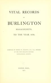

Search results from Open Library.
Recent natural events nearby
Ground air-quality sensors
Recently spotted species
Nearest stream gauge
Events
Gallery
Sources
- • Wikipedia
- • US Census Bureau (ACS 5-year estimates)
- • NOAA National Weather Service
- • Wikidata
- • USGS Earthquake Catalog (global feed)
- • NCES via Urban Institute Education Data Portal
- • CDC PLACES
- • Open-Meteo / sunrise-sunset.org
- • Wikipedia Pageviews API
- • Open Library
- • Wikidata SPARQL (CC0) — population, area, elevation, inception, head of government, Commons image
Notes: Climate data unavailable; Nearby POIs unavailable; Photos unavailable; Notable people unavailable; Air quality unavailable; Walkability unavailable; Wildlife observations unavailable; EPA pollution data unavailable; Livability counts unavailable; FEMA NRI data unavailable