Browse / United Kingdom / England / Newton Aycliffe
Newton Aycliffe
Englandtown

Newton Aycliffe
Demographic figures from UK Office for National Statistics. Overview below cites Wikipedia and may reference a different year.
City facts
Facts from Wikidata (CC0).
Overview
Newton Aycliffe is a town in County Durham, England. Founded in 1947 under the New Towns Act of 1946, the town is 5 miles (8.0 km) to the north of Darlington and 10 miles (16 km) to the south of Durham. It is the oldest new town in the north of England. Together with the bordering Aycliffe Village and the north part of School Aycliffe, it forms the civil parish of Great Aycliffe. The population of the town at the time of the 2021 census was 26,415.
Read more on WikipediaHistory & geography
History
Prior to the Newtown development, Aycliffe (originally 'Acley') was the site of an Anglo-Saxon settlement. The name Acley came from the Old English words: 'Ac', meaning oak, and 'ley', meaning 'a clearing'. Aycliffe was the location of a church synods in AD 782 and AD 789. Another old name was 'Yacley'. The town's motto is Latin for "Not the Least, but the Greatest we seek". On the edge of the town is the Bishop Auckland to Darlington railway branch line which is part of the 1825 Stockton and Darlington Railway. George Stephenson's steam locomotive Locomotion No 1 was placed on the rails close to Newton Aycliffe near to where Heighington station is. The Great North Road (A1) passed through the town until 1969. During World War II, Aycliffe was the site of ammunitions manufacturing. Huge grass-covered munitions factories were built and served by the nearby railway lines. The factories were largely staffed by thousands of women, dubbed the "Aycliffe Angels", who bravely took up the dangerous work. The government asked William Beveridge to produce a report on what he wanted Britain to be like after the war. In 1942 he produced his report. Five giants, he said, oppressed mankind – Poverty, Disease, Homelessness, Ignorance and Unemployment. To end this once and for all, Beveridge proposed a state system of Social Security benefits, a National Health Service, council housing, free education and full employment. He called it the Welfare State. The Welfare State was introduced across Britain in 1948. Beveridge selected an area of moorland which lay between Aycliffe and Middridge to be developed into what would become his flagship "new-town". Newton Aycliffe was intended to be the very embodiment of his vision for postwar Britain. Beveridge, committed as he was to his…
Geography
At the 2001 census, Great Aycliffe had a population of 26,385, although in 2007 Great Aycliffe Town Council reported this had risen to 29,000. It is the largest town within the Sedgefield constituency. Within a radius of are several towns and villages including Darlington, Bishop Auckland, Shildon and Heighington. To the south of the town is the village of Aycliffe. Newton comes from 'New Town'. Aycliffe Village is near to the A1(M) [https://www.geograph.org.uk/photo/214439 junction] with the A167 (former A1). The original Woodham was a medieval village, although apart from a few low mound earthworks (on private land) there is no trace of this original village. It was located on the northern side of the Woodham Burn stream and to the East of the A167 that cuts through the site in a north–south direction. The village itself was said to have been 'burned by the Scots' during the English – Scottish wars of the late 13th and early 14th centuries, and appears not to have been rebuilt, although several buildings did appear in the 18th and 19th centuries, some of which still remain on both east and west sides of the A167. There appears to have been a small 18th-century stone quarry on the eastern side of this site with associated buildings, which can be seen on the original 1860 Ordnance Survey maps, however most of these buildings were demolished towards the end of the 19th century. Afterwards the hamlet of Woodham remained relatively unchanged until the late 1970s – early 1980s, when some of its farms, such as Woodham North, Woodham South and the original Woodham Farm itself, were all demolished and their land used for new housing developments, as nearby Newton Aycliffe expanded and began to encroach on the original Woodham area. Newton Aycliffe, in common with many…
Excerpted from the corresponding Wikipedia article (CC BY-SA).
Geography
Coordinates & boundaries from the US Census TIGER/Line shapefiles.
Climate
Air quality
Walkability
Amenities nearby
Wildlife & biodiversity
Earthquake history
Photos
Sights & places nearby
Notable people from here


People born within ~10 km, from Wikidata (CC0). Click any name for their Wikipedia article.
Nearby places in England
Geography & sun
Elevation, sunrise/sunset and daylight from Open-Meteo. Solar climatology from NASA POWER.
Nearby airports
Public attention
Pageview totals from the Wikimedia Pageviews API.
Books about Newton Aycliffe

Search results from Open Library.
Recent natural events nearby
Ground air-quality sensors
Recently spotted species


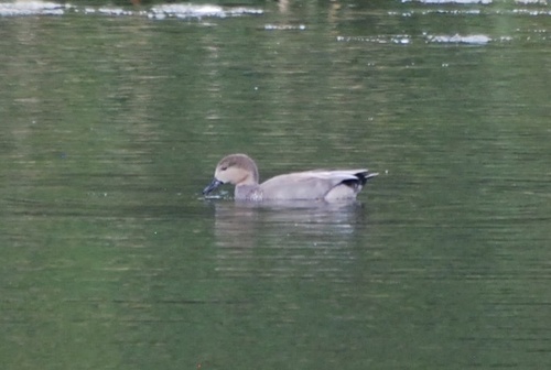




Research-grade observations from iNaturalist (within ~15 mi).
Events
Gallery
Sources
- • Wikipedia
- • Wikidata
- • iNaturalist
- • Open-Meteo / sunrise-sunset.org
- • Wikipedia Pageviews API
- • Open Library