Browse / United Kingdom / England / Reigate
Reigate
Englandtown

Reigate
Total population
22,123
Demographic figures from UK Office for National Statistics. Overview below cites Wikipedia and may reference a different year.
City facts
Overview
Reigate is a town in Surrey, England, around 19 miles (30 km) south of central London. The settlement is recorded in Domesday Book of 1086 as Cherchefelle and first appears with its modern name in the 1190s. The earliest archaeological evidence for human activity is from the Paleolithic and Neolithic, and during the Roman period, tile-making took place to the north-east of the modern centre.
Read more on WikipediaHistory & geography
History
The earliest evidence of human activity in the Reigate area is a triangular stone axe from the Paleolithic, which was found in Woodhatch in 1936. Worked flints from the later Neolithic have been found on Colley Hill. Finds from the Bronze Age include a gold penannular ring, dated to BCE, and a barbed spearhead from Priory Park. The eight barrows on Reigate Heath are thought to date from the same period, when the surrounding area may have been marshland. During the Roman period, the Doods Road area was a centre for tile-making. An excavation in 2014 uncovered the remains of a 2nd- or 3rd-century kiln with several types of tile, identified as tegulae, imbrices and pedales.|group=note}} Artefacts discovered to the south west of the town centre in 2011 suggest that there was a high-status villa nearby. Coins from the reigns of Vespasian (69–79), Hadrian (117–138), Severus Alexander (222–235) and Arcadius (383–408), indicate that there was Roman activity in the local area throughout the occupation of Britain. The former name Cherchefelle suggests that the most recent period of permanent settlement in Reigate began in Anglo-Saxon times. Excavations in Church Street in the late 1970s uncovered a Saxon glass jar and remains of a skeleton of uncertain age, but archaeological evidence from this period elsewhere in the town is sparse.|group=note}} woodland and herbage for 140 swine, pasture for 43 pigs and of meadow. The manor rendered £40 per year in 1086 and the residents included 67 villagers and 11 smallholders. The Domesday Book also records that the town was part of the larger Hundred of Cherchefelle. In 1868, Reigate borough was disenfranchised for corruption, but representation in the House of Commons was restored to the town in the Redistribution of Seats Act 1885…
Geography
Reigate is in central Surrey, around south of central London and north of Gatwick Airport. The town is in the Vale of Holmesdale, below the North Downs escarpment. The average elevation in the centre is above ordnance datum (OD) and the area is drained by the Wallace Brook and its tributaries, which feed the River Mole. Woodhatch lies on the Weald Clay, a sedimentary rock primarily consisting of mudstone that was deposited in the early Cretaceous. Much of Reigate is on the strata of the Lower Greensand Group. This group is multi-layered and includes the sandy Hythe Beds overlain by the clayey Sandgate Beds, which together form the high ground of Priory Park. Reigate Heath and the town centre are on quartz-rich Folkestone Beds and the water-filled part of the castle moat is dug into narrow band of clay present in the sandstone. To the north of the railway line is the Gault Formation, a stiff, blue-black, shaly clay, deposited in a deep-water marine environment. At the base of the North Downs is a thin outcrop of Upper Greensand, above which lies the Chalk Group. Weald clay was dug for brickmaking at Brown's Brickyard in Woodhatch. Building sand was excavated from Barnards Pit, to the west of the town, and at Wray Common Road to the east. Seams of silver sand which occur in the Folkestone Beds were quarried for glass making and the caves beneath the castle may originally have been excavated for this purpose, before being used as cellars. There is also evidence of ironstone extraction in the town, although this practice is thought to have ceased by 1650. Reigate Stone was mined from the Upper Greensand from medieval times until the mid-20th century and was used in the construction of several local buildings, including the castle, Reigate Priory and St Mary's Church.…
Excerpted from the corresponding Wikipedia article (CC BY-SA).
Geography
Coordinates & boundaries from the US Census TIGER/Line shapefiles.
Climate
Air quality
Walkability
Amenities nearby
Wildlife & biodiversity
Earthquake history
Photos
Sights & places nearby
Notable people from here
Nearby places in England
Geography & sun
Elevation, sunrise/sunset and daylight from Open-Meteo. Solar climatology from NASA POWER.
Nearby airports
Public attention
Pageview totals from the Wikimedia Pageviews API.
Books about Reigate
![[Report 1964]](https://covers.openlibrary.org/b/id/8142268-M.jpg)
![[Report 1944]](https://covers.openlibrary.org/b/id/8142548-M.jpg)
![[Report 1965]](https://covers.openlibrary.org/b/id/8140346-M.jpg)
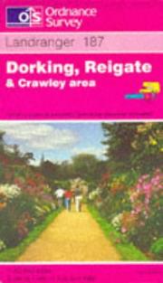
Search results from Open Library.
Recent natural events nearby
Ground air-quality sensors
Recently spotted species
Events
Gallery
Official Identifiers
ONS — UK Office for National Statistics
- ONS code
- osgb4000000074567244
- Local type
- Town
- Region
- South East
api.postcodes.io / OS Open Names
Sources
- • Wikipedia
- • Open-Meteo / sunrise-sunset.org
- • Wikipedia Pageviews API
- • Open Library
- • Wikidata SPARQL (CC0) — population, area, elevation, inception, head of government, Commons image
- • ONS / OS Open Names — UK official place gazetteer, via api.postcodes.io (OS code, local type, county/unitary, district/borough, region)
- • ONS — UK Office for National Statistics — api.postcodes.io / OS Open Names